MyTopo
Blackwater Falls West Virginia US Topo Map
Couldn't load pickup availability
Also explore the Blackwater Falls Forest Service Topo of this same quad for updated USFS data
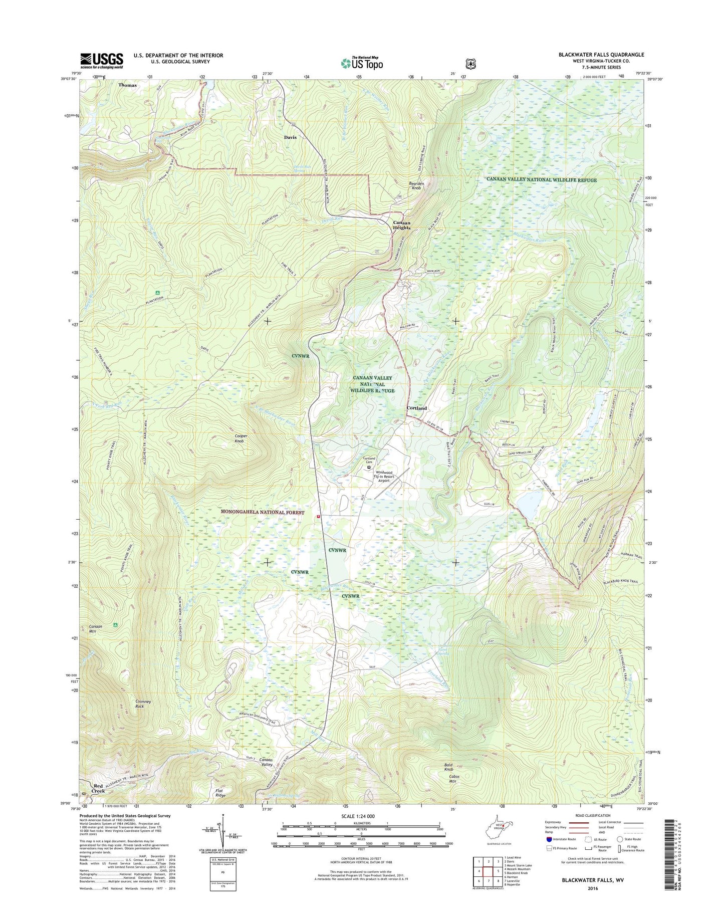
2023 topographic map quadrangle Blackwater Falls in the state of West Virginia. Scale: 1:24000. Based on the newly updated USGS 7.5' US Topo map series, this map is in the following counties: Tucker. The map contains contour data, water features, and other items you are used to seeing on USGS maps, but also has updated roads and other features. This is the next generation of topographic maps. Printed on high-quality waterproof paper with UV fade-resistant inks.
Quads adjacent to this one:
West: Mozark Mountain
Northwest: Lead Mine
North: Davis
Northeast: Mount Storm Lake
East: Blackbird Knob
Southeast: Hopeville
South: Laneville
Southwest: Harman
This map covers the same area as the classic USGS quad with code o39079a4.
Contains the following named places: Bald Knob, Bearden Knob, Blackwater Falls, Blackwater Falls State Park, Blackwater Lodge, Buena, Cabin Mountain, Canaan Heights, Canaan Mountain, Canaan Valley National Wildlife Refuge, Canaan Valley Resort State Park, Canaan Valley Resorts Golf Course, Canaan Valley Volunteer Fire Department, Chimney Rock, Club Run, Cooper Knob, Cortland, Cortland Cemetery, Cortland Grade School, Cosner School, Devils Run Spring, Dry Fork District, Dunkenbarger Trail, East Branch Weimer Run, Engine Run, Flanagan Hill Church, Flat Ridge, Flat Run, Flat Run Lake Dam, Freeland Run, Graham Farm Spring, Harmon School, Harr School, Lee Huffman Spring, Maple Grove School, Mill Run, North Branch Blackwater River, Pendleton Run Watershed Dam, Pointy Knob, Red Creek, Red Creek Post Office, Sand Run, Shays Run, Spruce Island Lake, Spruce Island Lake Dam, Stone Camp Mountain, Stonecoal Trail, Tucker County Emergency Medical Services Substation, West Branch Weimer Run, Windwood Fly-In Resort Airport, Yoakum Run, ZIP Code: 26260