MyTopo
Bowden West Virginia US Topo Map
Couldn't load pickup availability
Also explore the Bowden Forest Service Topo of this same quad for updated USFS data
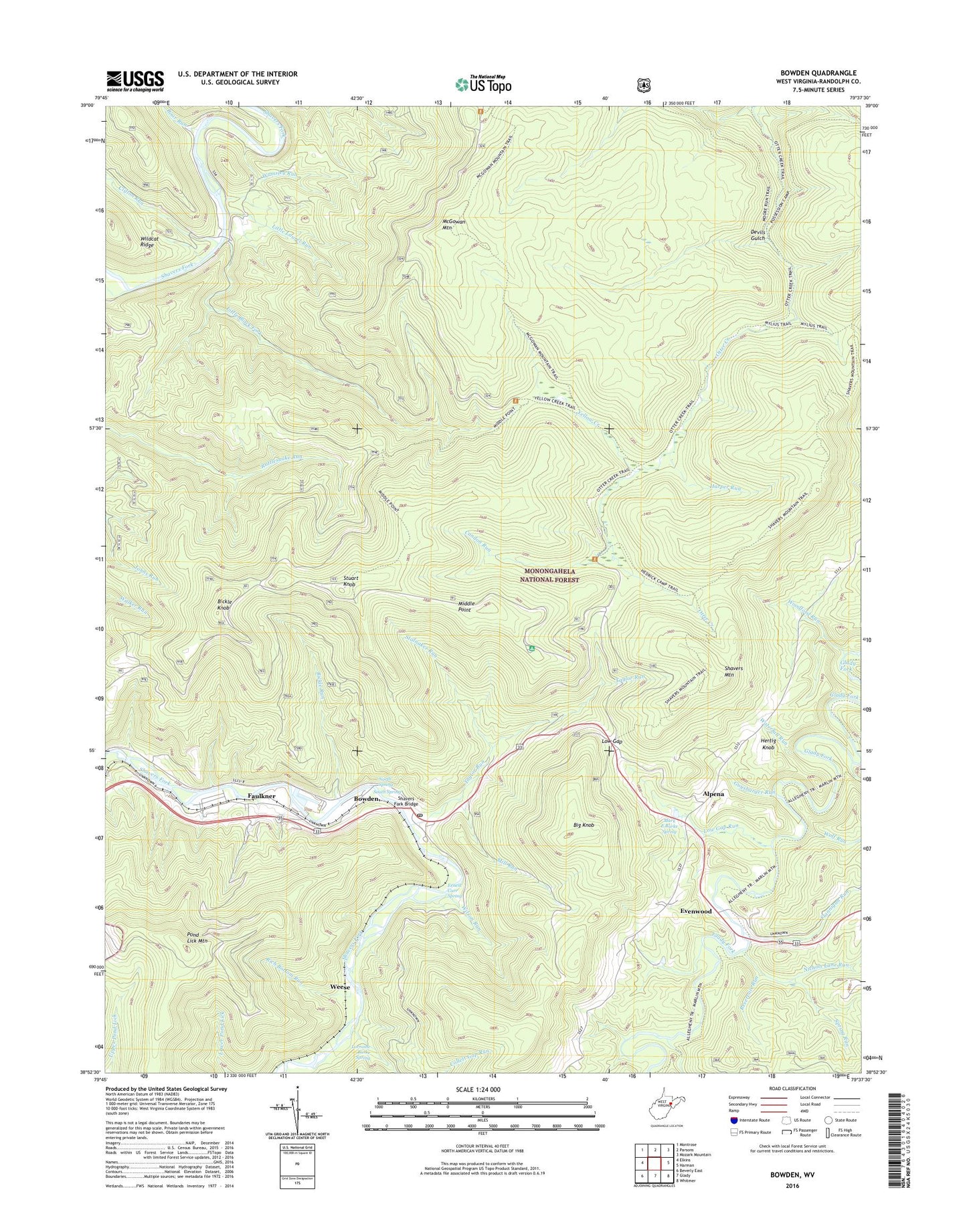
2023 topographic map quadrangle Bowden in the state of West Virginia. Scale: 1:24000. Based on the newly updated USGS 7.5' US Topo map series, this map is in the following counties: Randolph. The map contains contour data, water features, and other items you are used to seeing on USGS maps, but also has updated roads and other features. This is the next generation of topographic maps. Printed on high-quality waterproof paper with UV fade-resistant inks.
Quads adjacent to this one:
West: Elkins
Northwest: Montrose
North: Parsons
Northeast: Mozark Mountain
East: Harman
Southeast: Whitmer
South: Glady
Southwest: Beverly East
This map covers the same area as the classic USGS quad with code o38079h6.
Contains the following named places: Alpena, Alpena Gap Recreation Site, Baker Camp Run, Baker Sods, Bear Heaven Recreation Area, Bickle Knob, Bickle Knob Lookout Tower, Bickle Knob Picnic Area, Bickle Run, Big Knob, Boar Run, Bowden, Bowden Census Designated Place, Bowden National Fish Hatchery, Bowden Post Office, Chestnut Grove School, Chestnut School, Clifton Run, Collett Gap Run, Condon Run, Devils Gulch, Ernest Carr Spring, Evenwood, Faulkner, Faulkner Census Designated Place, Flannigan Run, Guysbarger Run, Harper Run, Hertig Knob, Laurel Lick Run, Little Black Fork, Little Black Fork Trail, Little Laurel Run, Long Trail, Lorraine Burke Spring, Low Gap, Low Gap Run, Mark E Burke Spring, McGowan Mountain, McGowan Mountain Trail, Meadows, Middle Mountain Trail, Middle Point, Mill Run, Moore Run, Nichols Lane Run, North Spring, Otter Creek Trail, Otter Creek Wilderness, Otter Creek Wildlife Management Area, Pond Lick Mountain, Possession Camp Run, Reservoir Run, Rich Bottom Run, Shavers Fork Bridge, Shavers Mountain Trail, South Spring, Spring Run, Stalnaker Run, Stuart Knob, Taylor Run, Wamsley Run, Waterfall Run, Weese, Wilson Run, Wolf Run, Woodford Run, Yellow Creek, Yellow Creek Trail, ZIP Code: 26254