MyTopo
Ivydale West Virginia US Topo Map
Couldn't load pickup availability
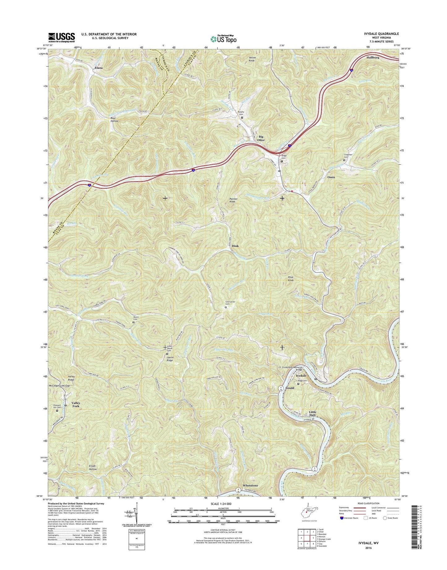
2023 topographic map quadrangle Ivydale in the state of West Virginia. Scale: 1:24000. Based on the newly updated USGS 7.5' US Topo map series, this map is in the following counties: Clay, Roane, Calhoun. The map contains contour data, water features, and other items you are used to seeing on USGS maps, but also has updated roads and other features. This is the next generation of topographic maps. Printed on high-quality waterproof paper with UV fade-resistant inks.
Quads adjacent to this one:
West: Newton
Northwest: Tariff
North: Chloe
Northeast: Rosedale
East: Strange Creek
Southeast: Swandale
South: Clay
Southwest: Elkhurst
This map covers the same area as the classic USGS quad with code o38081e1.
Contains the following named places: Big Otter, Big Otter Creek, Big Otter Elementary School, Big Otter Mountain, Big Otter Post Office, Big Otter Volunteer Fire Department, Bogg Fork, Boggs Cemetery, Boggs Fork, Cherrytree Cemetery, Cherrytree Run, Collins Fork, Deadfall Run, Dink, District A, Elana, Elijah Hollow, Gould, Granishee Creek, Grasslick Run, Greenbriar Run, Grimm Fork, Horse Run, Ivydale, Ivydale Baptist Church, Ivydale Elementary School, Ivydale Post Office, J C Cruikshank Memorial Bridge, Joes Run, Katy Run, Kidtown, Laurel Ridge, Laurel Run, Lick Run, Liontrace Run, Little Italy, Little Laurel Baptist Church, Little Laurel Missionary Baptist Church Cemetery, Little Laurel Run, McColgan Low Gap, Mill Run, Moore Cemetery, Moore Fork, Moore Fork Cemetery, Mountain Home, Murphy Cemetery, Murphy Fork, Ossia, Otterlick Community Church, Otterlick Run, Otterville Church, Painter Knob, Pilot Knob, Pleasant Hill Cemetery, Redhouse Run, Redhouse Siding, Rockcamp Run, Ross Hollow, Rush Fork, Simons Fork, Sinnett Run, Spread Run, Standingrock, Standingrock Run, Stinsonlick Fork, Swimminghole Run, Two Run, Upper Two Run, Valley Fork, Valley Fork Elementary School, Valley Fork Post Office, Valley Ridge United Methodist Church, Velvet Knob, Waters Defeat, Whetstone, Whetstone Run, White Pilgrim Church, Wilson Fork, Zion Hill Church, ZIP Codes: 25113, 25285


