MyTopo
Rosedale West Virginia US Topo Map
Couldn't load pickup availability
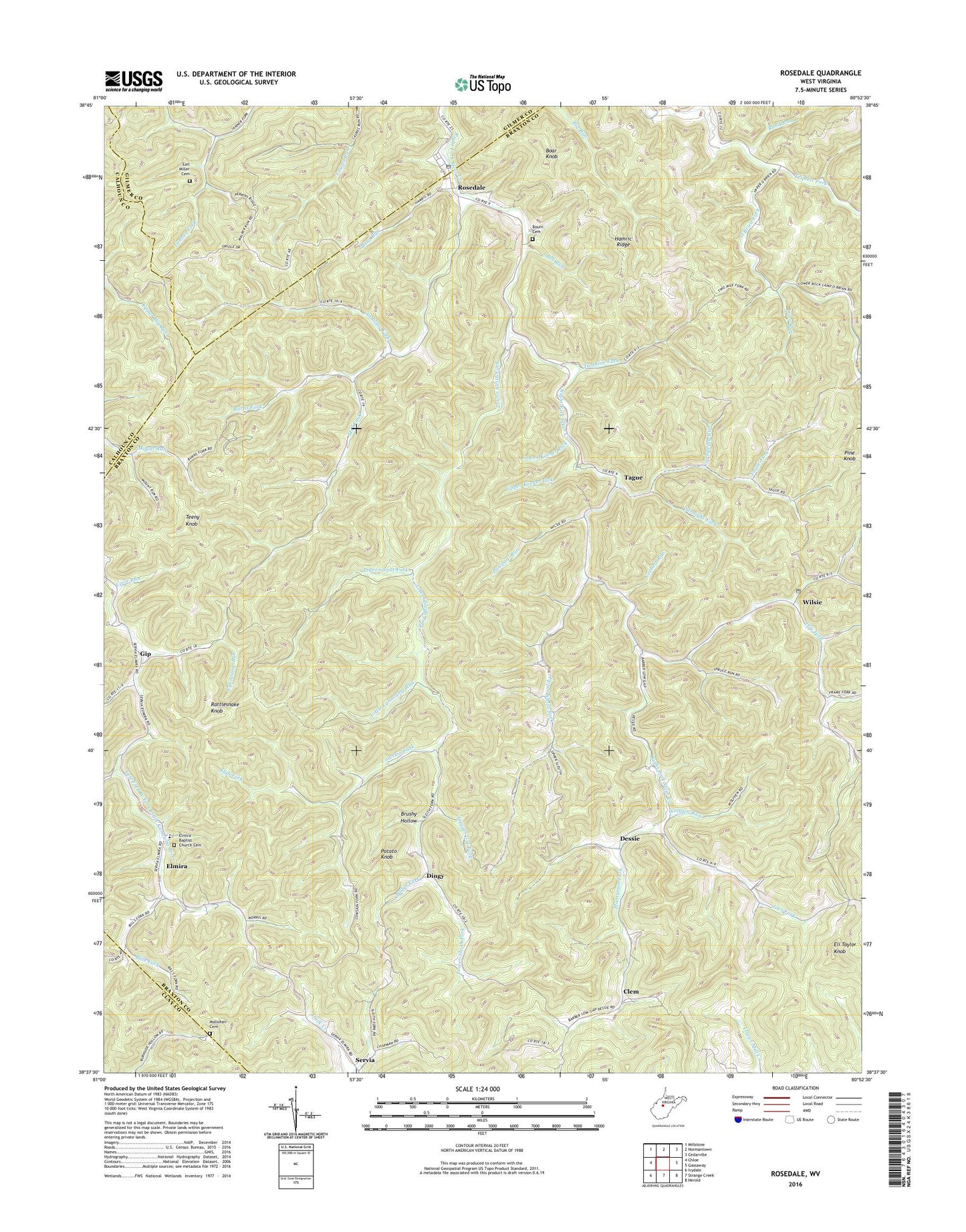
2023 topographic map quadrangle Rosedale in the state of West Virginia. Scale: 1:24000. Based on the newly updated USGS 7.5' US Topo map series, this map is in the following counties: Braxton, Gilmer, Calhoun, Clay. The map contains contour data, water features, and other items you are used to seeing on USGS maps, but also has updated roads and other features. This is the next generation of topographic maps. Printed on high-quality waterproof paper with UV fade-resistant inks.
Quads adjacent to this one:
West: Chloe
Northwest: Millstone
North: Normantown
Northeast: Cedarville
East: Gassaway
Southeast: Herold
South: Strange Creek
Southwest: Ivydale
This map covers the same area as the classic USGS quad with code o38080f8.
Contains the following named places: Anthony Fork, Barn Run, Bee Run, Bills Fork, Boar Knob, Boggs Fork, Bourn Cemetery, Brushy Hollow, Burns Fork, Charity Church, Clem, Coolspring Run, Coon Run, Corbett Run, Cowskin Fork, Dessie, Dingy, Dry Fork, Earl Miller Cemetery, Eli Taylor Knob, Elmira, Elmira Baptist Church Cemetery, Frame Fork, Frozen Chapel, Gip, Hamric Ridge, Joes Fork, Little Lynncamp Run, Long Run, Lower Keener Lick, Lower Sleith Fork, Lower Sleith School, Lynncamp Run, Mark, Mill Fork, Mollohan Cemetery, Mudlick Fork, Pawpaw Run, Pigeonroost Fork, Pine Knob, Plantation Fork, Potato Knob, Rattlesnake Knob, Road Run, Rosedale, Rosedale Post Office, Slab Fork, Sleith, Straight Fork, Tague, Tague Fork, Teeny Knob, Trigger Gut Fork, Triplett Fork, Twomile Fork, Unity Church, Upper Keener Lick, Upper Sleith Church, Upper Sleith Fork, Wilsie, Wilsie Post Office, Wolfpen Run, ZIP Code: 26636