MyTopo
Laneville West Virginia US Topo Map
Couldn't load pickup availability
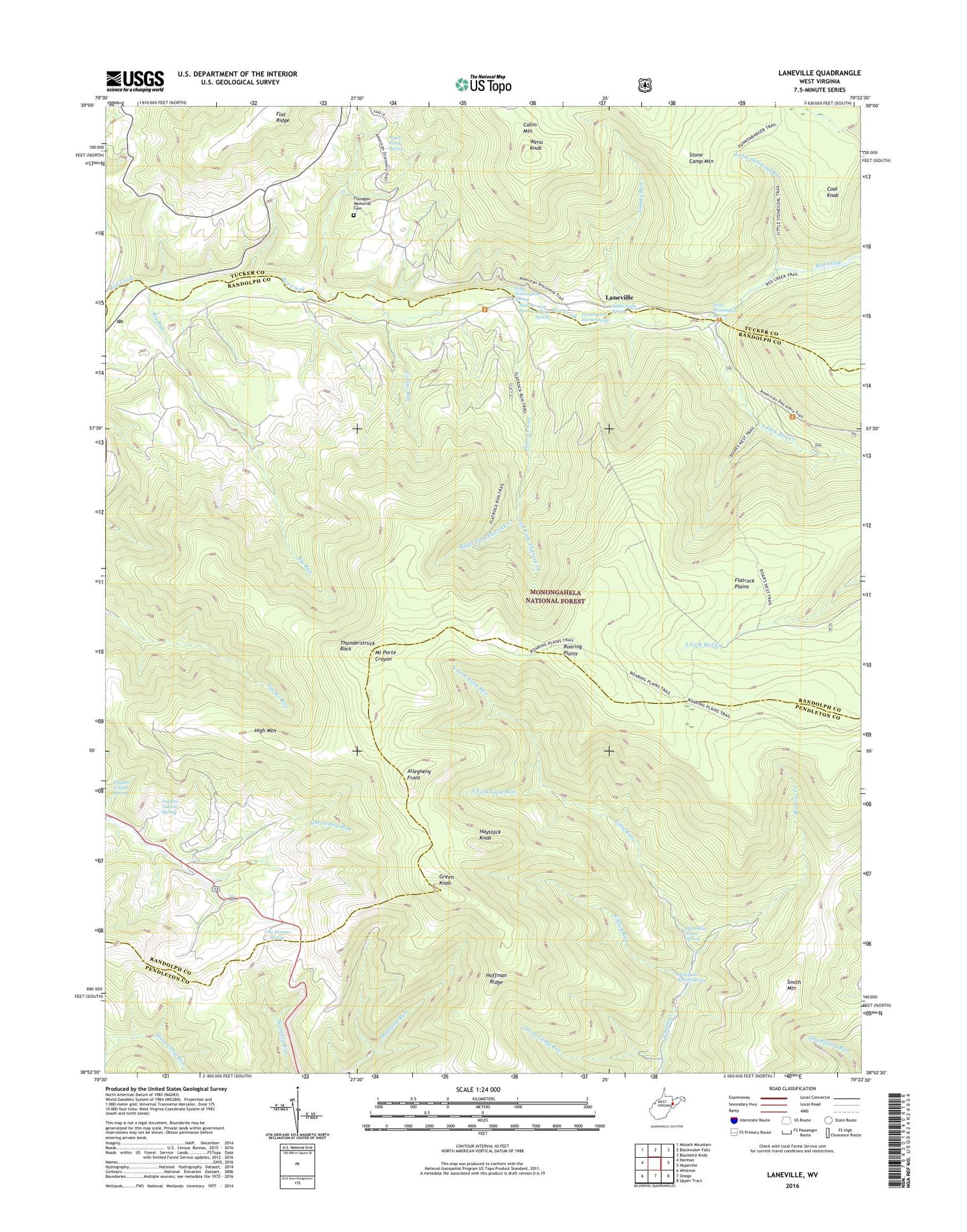
2019 topographic map quadrangle Laneville in the state of West Virginia. Scale: 1:24000. Based on the newly updated USGS 7.5' US Topo map series, this map is in the following counties: Randolph, Pendleton, Tucker. The map contains contour data, water features, and other items you are used to seeing on USGS maps, but also has updated roads and other features. This is the next generation of topographic maps. Printed on high-quality waterproof paper with UV fade-resistant inks.
Quads adjacent to this one:
West: Harman
Northwest: Mozark Mountain
North: Blackwater Falls
Northeast: Blackbird Knob
East: Hopeville
Southeast: Upper Tract
South: Onego
Southwest: Whitmer
Contains the following named places: Addie Judy Spring, Arbogast Farm Spring, Bethel Church, Big Run, Boars Nest Trail, Bonner Mountain School, Canaan Crossing, Coal Knob, Collins Run, Days Mill, Dolly Run, Dryfork Post Office, Elklick Run, Flanagan Memorial Cemetery, Flat Top School, Flatrock Plains, Flatrock Run, Gandy Run, Green Knob, Guy Harper Spring, Harperton, Hartman Farm Spring, Haystack Knob, High Mountain, Hoffman Ridge, Hoyt Pennington Spring, Laneville, Laneville Mennonite Church, Lee Ullery Spring, Left Fork Flatrock Creek, Little Stonecoal Run, Long Run, Mount Porte Crayon, Mount Porte Crayon Point of Interest, Nelson Spring, North Fork Long Run, Pennington Farm Spring, Right Fork Flatrock Creek, Roaring Plains, Roaring Plains West Wilderness, Roaring School, Smith Mountain, Snoden Yokum Spring, South Fork Long Run, South Fork Red Creek, Stone Camp Run, Stringtown, Thunderstruck Rock, Weiss Knob, Wolford Church, Wolford School, Wyatt Farm Spring, Wyoming, ZIP Codes: 26263, 26884