MyTopo
Levels West Virginia US Topo Map
Couldn't load pickup availability
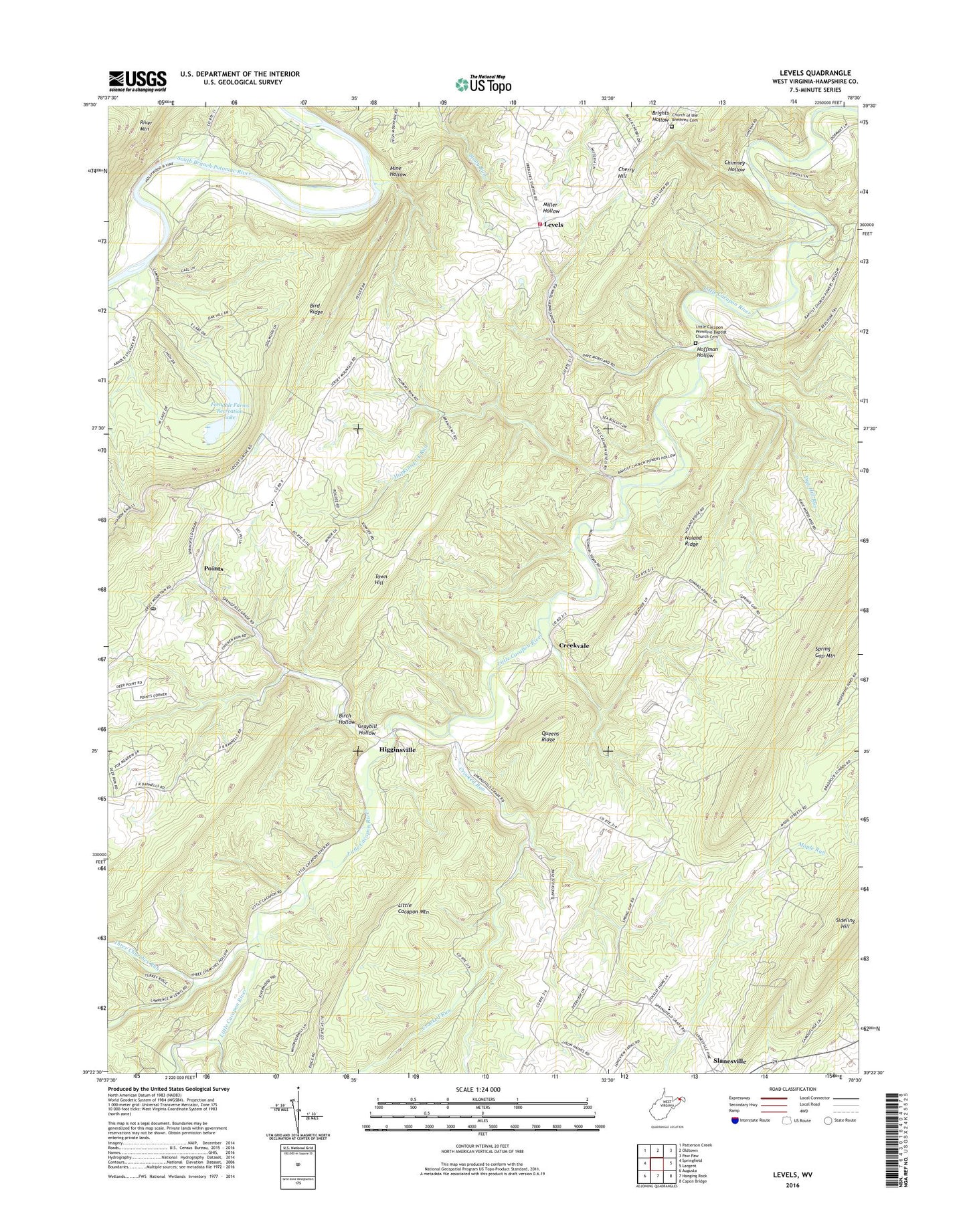
2023 topographic map quadrangle Levels in the state of West Virginia. Scale: 1:24000. Based on the newly updated USGS 7.5' US Topo map series, this map is in the following counties: Hampshire. The map contains contour data, water features, and other items you are used to seeing on USGS maps, but also has updated roads and other features. This is the next generation of topographic maps. Printed on high-quality waterproof paper with UV fade-resistant inks.
Quads adjacent to this one:
West: Springfield
Northwest: Patterson Creek
North: Oldtown
Northeast: Paw Paw
East: Largent
Southeast: Capon Bridge
South: Hanging Rock
Southwest: Augusta
This map covers the same area as the classic USGS quad with code o39078d5.
Contains the following named places: Birch Hollow, Bird Ridge, Blue Ford, Braddock School, Capon Chapel Church of the Brethren, Cherry Hill, Chimney Hollow, Church of the Brethren Cemetery, Cleveland School, Cornwell School, Creekvale, Crooked Run, Dug Hill Run, Dug Hill School, Dutch Lick School, Emboden School, Ferndale Farms Recreation Lake, Ferndale Farms Recreation Lake Dam, Gore District, Graybill Hollow, Higginsville, Hoffman Hollow, Hopkins Lick Run, Hopkins Lick School, John J Cornwell Elementary School, Levels, Levels Elementary School, Levels Volunteer Fire Company, Little Cacapon Primitive Baptist Church Cemetery, Mine Hollow, Noland Ridge, Points, Points Post Office, Queen of Gore School, Queens Ridge, Salem Church, Shiloh School, Slanesville Christian School, Spring Gap, Spring Gap Church, Three Churches Run, Victory School, Vinita School, ZIP Codes: 25431, 25437, 25444