MyTopo
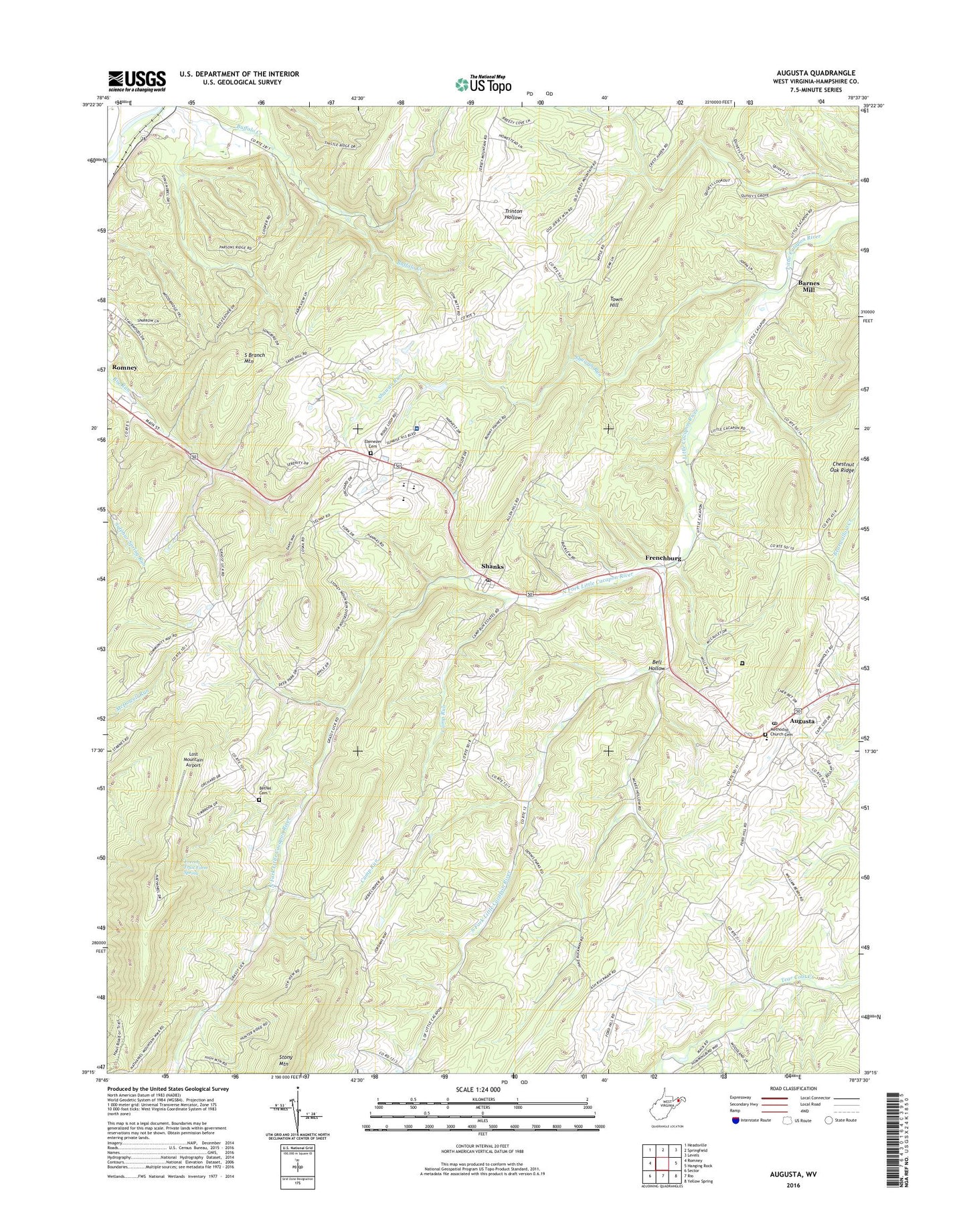
Augusta West Virginia US Topo Map
Couldn't load pickup availability
2023 topographic map quadrangle Augusta in the state of West Virginia. Scale: 1:24000. Based on the newly updated USGS 7.5' US Topo map series, this map is in the following counties: Hampshire. The map contains contour data, water features, and other items you are used to seeing on USGS maps, but also has updated roads and other features. This is the next generation of topographic maps. Printed on high-quality waterproof paper with UV fade-resistant inks.
Quads adjacent to this one:
West: Romney
Northwest: Headsville
North: Springfield
Northeast: Levels
East: Hanging Rock
Southeast: Yellow Spring
South: Rio
Southwest: Sector
This map covers the same area as the classic USGS quad with code o39078c6.
Contains the following named places: Augusta, Augusta Cemetery, Augusta Elementary School, Augusta Post Office, Augusta Volunteer Rescue Squad Company 13, Barnes Mill, Bell Hollow, Bethel Church, Boone Farms Lake Dam, Bryn School, Camp Run, Chestnut Grove School, Cleveland School, Davey School, Ebenezer Cemetery, Ebenezer Church, Everett Fruit Farm Spring, Fairview Church, Frenchburg, Hampshire County Career Training Center, Hampshire High School, Hampshire Memorial Hospital, Highview School, Holiness Church, J M Chick Buckbee Juvenile Detention Center, JM Chick Buckbee Juvenile Center, Little Cacapon Church, Little Capon School, Lost Mountain Airport, North Fork Little Cacapon River, Old Bethel Church Cemetery, Potomac Highlands Regional Jail, Ridgedale School, Romney Middle School, Shady Grove School, Shanks, Shanks Post Office, Shanks Roadside Park, Shawan Run, South Fork Little Cacapon River, Stonewall School, Stony Mountain, Town Hill, Victory School, Walnut Grove School, Willow Tree School, WJJB-FM (Romney), ZIP Codes: 26757, 26761