MyTopo
Prichard West Virginia US Topo Map
Couldn't load pickup availability
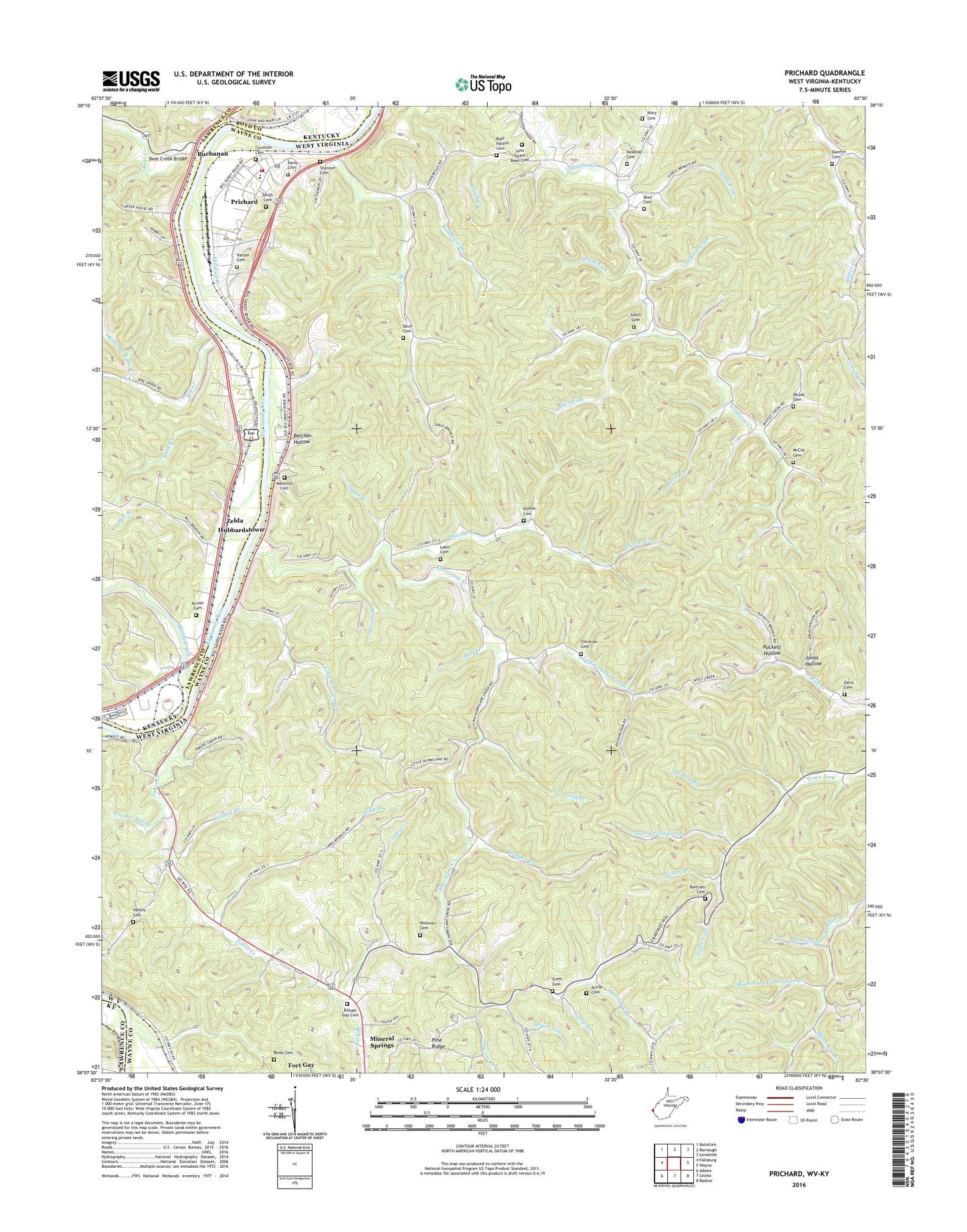
2019 topographic map quadrangle Prichard in the states of West Virginia, Kentucky. Scale: 1:24000. Based on the newly updated USGS 7.5' US Topo map series, this map is in the following counties: Wayne, Lawrence, Boyd. The map contains contour data, water features, and other items you are used to seeing on USGS maps, but also has updated roads and other features. This is the next generation of topographic maps. Printed on high-quality waterproof paper with UV fade-resistant inks.
Quads adjacent to this one:
West: Fallsburg
Northwest: Boltsfork
Northeast: Lavalette
East: Wayne
Southeast: Radnor
South: Louisa
Southwest: Adams
Contains the following named places: Alley Cemetery, Artrip Branch, Artrip Cemetery, Bartram Cemetery, Bear Creek, Bear Creek Bridge, Bear Creek Methodist Church, Bee Gum Branch, Belcher Hollow, Bellomy Chapel, Big 'G' Heliport, Big Sandy Plant of the Kentucky Power Company, Billups Gap Cemetery, Birch Branch, Black Fork, Black Log Branch, Blaine Creek, Blair Cemetery, Blair-Hatton Cemetery, Bloomer Branch, Brick Church, Brush Fork, Buchanan, Buchanan Chapel, Buchanan School, Bull Branch, Burk Branch, Butler District, Canterbury Post Office, Catalpa, Catalpa Post Office, Christian Cemetery, Community Chapel, Damron Cemetery, Davis Branch, Davis Cemetery, Dawson Branch, Durney Post Office, Elijah Creek, Forks of Hurricane, Foster Branch, Gilkerson Branch, Gragston Church, Greenwood, Hanley Cemetery, Hatton Cemetery, Hattons Branch, Henry Ferguson Branch, Hodge Memorial Church, Hubbardstown, Hurricane Creek, John Tucker Bean Cemetery, Jonas Hollow, Kinner Cemetery, Lakin Cemetery, Left Fork Greenbrier Creek, Left Fork Hurricane Creek, Left Fork Roe Creek, Little Hurricane Creek, Long Branch, Matovich Cemetery, Mayo Chapel, McCoy Cemetery, Mill Branch, Mill Fall Branch, Mouth of Bear, Mouth of Blaine Post Office, Newman Cemetery, Odell Fork, Orchard Branch, Plymal Cemetery, Powder Mill Branch, Prichard, Prichard Census Designated Place, Prichard Elementary School, Prichard Post Office, Prichard Volunteer Fire Department Station 200, Puckett Hollow, Queens Creek, Right Fork Greenbrier Creek, Right Fork Roe Creek, Rockville, Rockville Railroad Station, Roe Creek, Rowe Cemetery, Rush Creek, Shannon Cemetery, Shiloh Church, Smith Branch, Smith Cemetery, Smith Chapel, Smith School, Spruce Lick, Spruce Lick Church, Sugar Branch, Sulphur Fork, Tabor Creek, Trent Cemetery, Upper Greenbrier Church, Wellman Cemetery, WFGH-FM (Fort Gay), Wildcat Branch, Wolfpen Branch, Wronk Cemetery, Zelda, Zelda Post Office, Zelda Railroad Station, Zelda School, ZIP Code: 25555