MyTopo
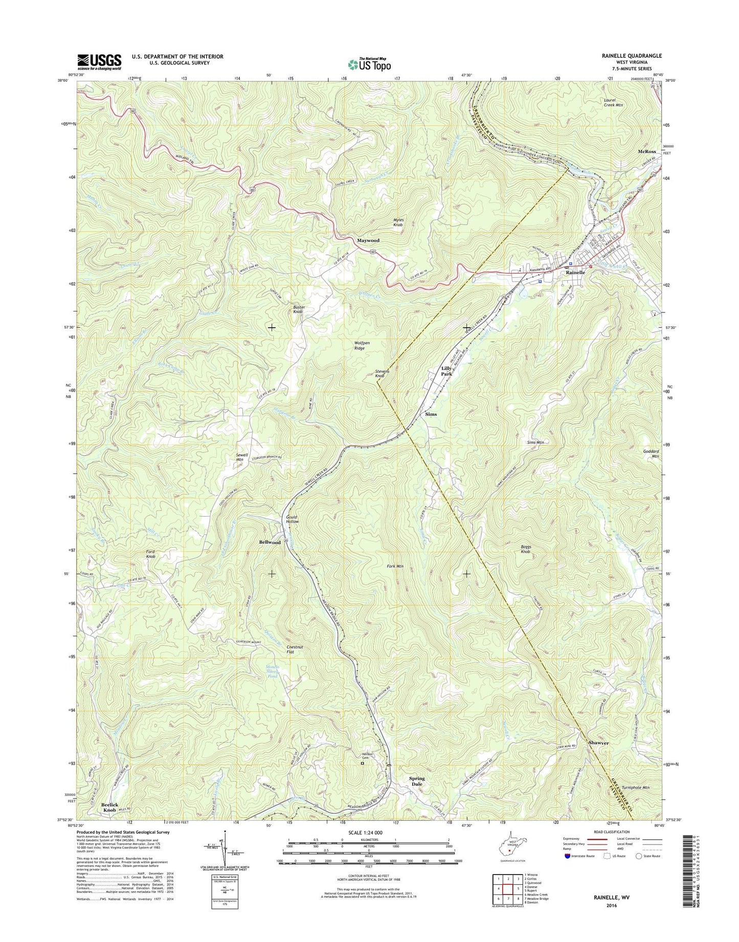
Rainelle West Virginia US Topo Map
Couldn't load pickup availability
2019 topographic map quadrangle Rainelle in the state of West Virginia. Scale: 1:24000. Based on the newly updated USGS 7.5' US Topo map series, this map is in the following counties: Fayette, Greenbrier. The map contains contour data, water features, and other items you are used to seeing on USGS maps, but also has updated roads and other features. This is the next generation of topographic maps. Printed on high-quality waterproof paper with UV fade-resistant inks.
Quads adjacent to this one:
West: Danese
Northwest: Winona
North: Corliss
Northeast: Quinwood
East: Rupert
Southeast: Dawson
South: Meadow Bridge
Southwest: Meadow Creek
Contains the following named places: Aldrich Camp, Arthurs Siding, Bellwood, Big Sewell Baptist Church, Boggs Creek, Boggs Knob, Buster Knob, Chestnut Flat, Coal Hollow School, Crookshanks Branch, Eureka School, Ford Knob, Fork Mountain, Gould Hollow, Greenbrier Hills Golf Club, Henson Cemetery, Laurel Branch Church, Lilly Park, Little Creek, Little Creek Church, Little Sewell Church, Little Sewell Creek, Maywood, Mill Creek, Monclo Slurry Dam, Monclo Slurry Pond, Mountain School, Myles Knob, Old Schoolhouse Branch, Quinton Branch, Quinton School, Quinwood Emergency Ambulance Service Rainelle, Rainelle, Rainelle Christian Academy, Rainelle Elementary School, Rainelle Elementary-Junior High School, Rainelle Police Department, Rainelle Post Office, Rainelle Public Library, Rainelle Volunteer Fire Department, Rock Camp Branch, Sewell Creek, Sewell Mountain, Shawver, Sievy Bridge, Sims, Sims Mountain, Sims School, Spring Dale, Spring Dale Post Office, Stevens Knob, Sturgeon Branch, Sturgeon Branch Church, Town of Rainelle, Turniphole Mountain, West Virginia State Police Troop 6 - Rainelle Detachment, Wolfpen Creek, Wolfpen Ridge, WRRL-AM (Rainelle), ZIP Code: 25962