MyTopo
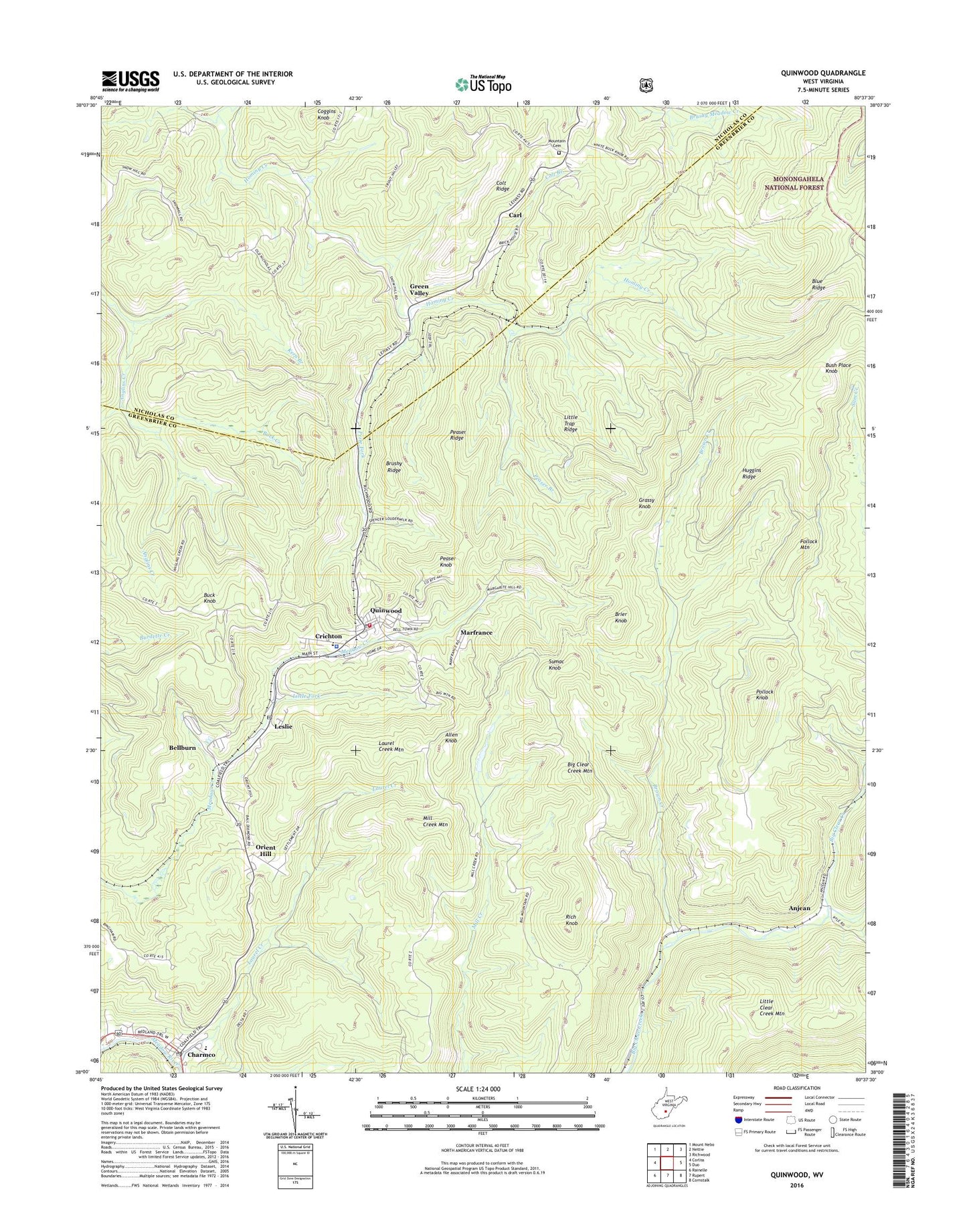
Quinwood West Virginia US Topo Map
Couldn't load pickup availability
Also explore the Quinwood Forest Service Topo of this same quad for updated USFS data
2023 topographic map quadrangle Quinwood in the state of West Virginia. Scale: 1:24000. Based on the newly updated USGS 7.5' US Topo map series, this map is in the following counties: Greenbrier, Nicholas. The map contains contour data, water features, and other items you are used to seeing on USGS maps, but also has updated roads and other features. This is the next generation of topographic maps. Printed on high-quality waterproof paper with UV fade-resistant inks.
Quads adjacent to this one:
West: Corliss
Northwest: Mount Nebo
North: Nettie
Northeast: Richwood
East: Duo
Southeast: Cornstalk
South: Rupert
Southwest: Rainelle
This map covers the same area as the classic USGS quad with code o38080a6.
Contains the following named places: Advent Church, Allen Knob, Anjean, Back Creek, Bamboo School, Bellburn, Big Clear Creek Mountain, Blue Ridge, Bridge Church, Brier Knob, Brown Creek, Brushy Ridge, Bryant, Buck Knob, Bush Place Knob, Carl, Charmco, Charmco Post Office, Chestnut Grove Church, Coggins Knob, Colt Branch, Colt Ridge, Crichton, Crichton Elementary School, Crichton Elementary-Junior High School, Grassy Knob, Green Valley, Greenbrier West High School, Hellem School, Hill Top United Methodist Church, Huggins Ridge, Kern Branch, Laurel Creek, Laurel Creek Mountain, Leslie, Leslie Post Office, Liberty Church, Little Fork, Little Trap Ridge, Marfrance, McClung, Mill Creek Mountain, Mill Creek School, Mountain Cemetery, Mountain Church, Orient Hill, Peaser Branch, Peaser Knob, Peaser Ridge, Pollock Knob, Pollock Mountain, Price Fork, Quinwood, Quinwood Emergency Ambulance, Quinwood Police Department, Quinwood Post Office, Quinwood Volunteer Fire Department, Rich Knob, Rich Knob Lookout Tower, Rome Church, Snow Hill School, South Fork Big Clear Creek, Sumac Knob, Town of Quinwood, Walker Hill, ZIP Codes: 25972, 25981