MyTopo
Spruce Knob West Virginia US Topo Map
Couldn't load pickup availability
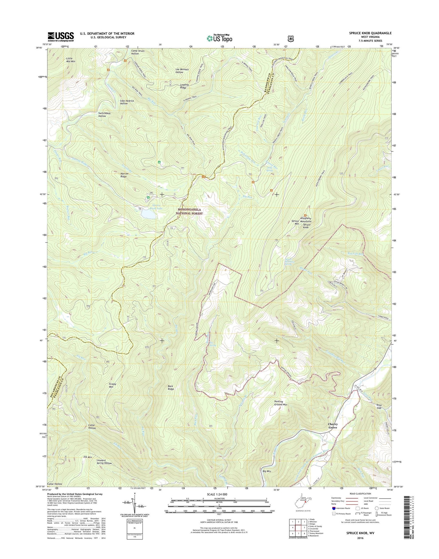
2019 topographic map quadrangle Spruce Knob in the state of West Virginia. Scale: 1:24000. Based on the newly updated USGS 7.5' US Topo map series, this map is in the following counties: Pendleton, Randolph, Pocahontas. The map contains contour data, water features, and other items you are used to seeing on USGS maps, but also has updated roads and other features. This is the next generation of topographic maps. Printed on high-quality waterproof paper with UV fade-resistant inks.
Quads adjacent to this one:
West: Sinks of Gandy
Northwest: Glady
North: Whitmer
Northeast: Onego
East: Circleville
Southeast: Moatstown
South: Snowy Mountain
Southwest: Thornwood
Contains the following named places: Allegheny Mountains, Back Ridge, Back Ridge Trail, Back Run, Beech Run, Big Run, Big Run Chapel, Big Run Trail, Big Spring, Camp Seven Hollow, Cherry Grove, Collar Hollow, Devers Run, Elk Mountain, Elk Run, Gatewood Group Campground, Gatewood Lookout Tower, Gatewood Nature Trail, Grants Branch, Grassy Mountain, Horton Riverton Trail, Huckleberry Trail, Hunting Ground Mountain, Judy Spring, Lafe Hedrick Hollow, Leading Ridge, Mick Run, Nans Branch, Narrow Ridge, North Fork Big Run Trail, Pounding Mill Run, Slab Camp Run, Spruce Knob, Spruce Knob Lake, Spruce Knob Lake Campground, Spruce Knob Lake Dam, Spruce Knob Picnic Area, Spruce Mountain, Spruce Mountain Spring, Switchback Hollow, Teter Gap, Teter Run, Tom Lick Run, Trussel Run