MyTopo
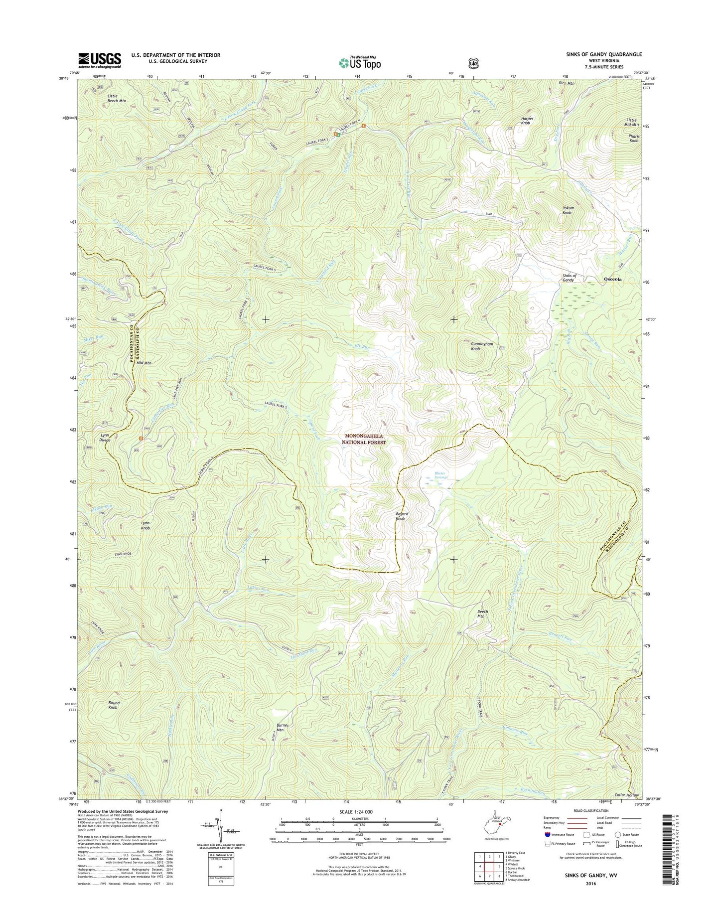
Sinks of Gandy West Virginia US Topo Map
Couldn't load pickup availability
Also explore the Sinks of Gandy Forest Service Topo of this same quad for updated USFS data
2023 topographic map quadrangle Sinks of Gandy in the state of West Virginia. Scale: 1:24000. Based on the newly updated USGS 7.5' US Topo map series, this map is in the following counties: Randolph, Pocahontas, Pendleton. The map contains contour data, water features, and other items you are used to seeing on USGS maps, but also has updated roads and other features. This is the next generation of topographic maps. Printed on high-quality waterproof paper with UV fade-resistant inks.
Quads adjacent to this one:
West: Wildell
Northwest: Beverly East
North: Glady
Northeast: Whitmer
East: Spruce Knob
Southeast: Snowy Mountain
South: Thornwood
Southwest: Durbin
This map covers the same area as the classic USGS quad with code o38079f6.
Contains the following named places: Bayard Knob, Beech Mountain, Bennett Run, Beulah Trail, Big Run, Blister Swamp, Burning Run, Camp Five Run, Camp Five Trail, Chaffey Trail, County Line Trail, Crawford Run, Cunningham Knob, Elk Run, Elklick Run, Five Lick Run, Forks Trail, Hansford Run, Harper Knob, Hinkle Run, Hinkle Run Trail, Laurel Fork Campground, Laurel Fork South Wilderness, Little Middle Mountain, Little River Campground, Lukins Run, Lynn Divide, Lynn Knob, Lynn Knob Trail, Middle Mountain, Middle Mountain Cubins, Osceola, Pharis Knob, Round Knob, Simmons Run, Sinks of Gandy, Sinks of Gandy Point of Interest, Stark School, Stillhouse Run, Stoney Run, The Pigs Ear, Tingler Run, Tingler Trail, Warner Run, Waybright Run, Yokum Knob, ZIP Code: 26268