MyTopo
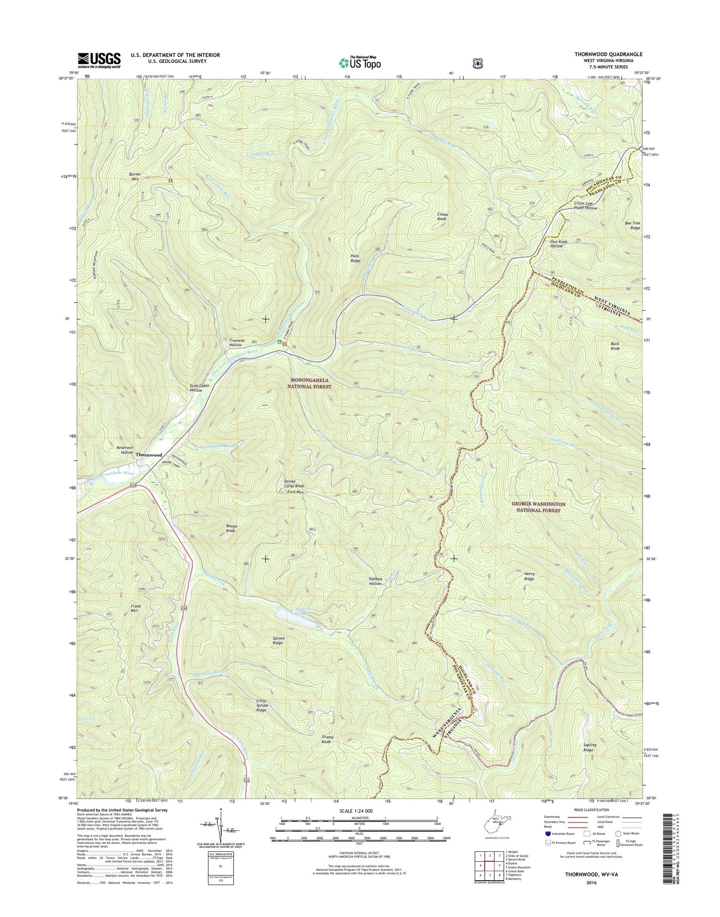
Thornwood West Virginia US Topo Map
Couldn't load pickup availability
Also explore the Thornwood Forest Service Topo of this same quad for updated USFS data
2023 topographic map quadrangle Thornwood in the states of West Virginia, Virginia. Scale: 1:24000. Based on the newly updated USGS 7.5' US Topo map series, this map is in the following counties: Pocahontas, Highland, Pendleton. The map contains contour data, water features, and other items you are used to seeing on USGS maps, but also has updated roads and other features. This is the next generation of topographic maps. Printed on high-quality waterproof paper with UV fade-resistant inks.
Quads adjacent to this one:
West: Durbin
Northwest: Wildell
North: Sinks of Gandy
Northeast: Spruce Knob
East: Snowy Mountain
Southeast: Monterey
South: Hightown
Southwest: Green Bank
This map covers the same area as the classic USGS quad with code o38079e6.
Contains the following named places: Abes Run, Bearwallow Run, Big Run, Buck Knob, Buffalo Fork, Buffalo Fork Dam, Buffalo Lake, Burner Mountain Trail, Camp Pocahontas, Campbell Run, Colaw Knob, Dunlevie Methodist Church, East Fork Trail, Fivemile Hollow, Fork Mountain, Grassy Knob, Grassy Run, Gum Cabin Hollow, Henry Ridge, Island Campground, Lick Run, Little River, Little Spruce Ridge, Locust Spring Run Trail, Locust Springs Picnic Area, Locust Springs Recreation Site, Long Run, Lost Run, Max Roth Kugel Tree Plantation, Mullenax Run, Newman Run, Old House Run, Old House Run Picnic Area, Old House Run Recreation Area, Poca Ridge, Poca Run, Rambottom Run, Reservoir Hollow, Rough Knob, Slabcamp Run, Smoke Camp Knob, Spruce Ridge, Thornwood, Thornwood Community Church, Toolbox Hollow, Walderman Run, ZIP Code: 24920


