MyTopo
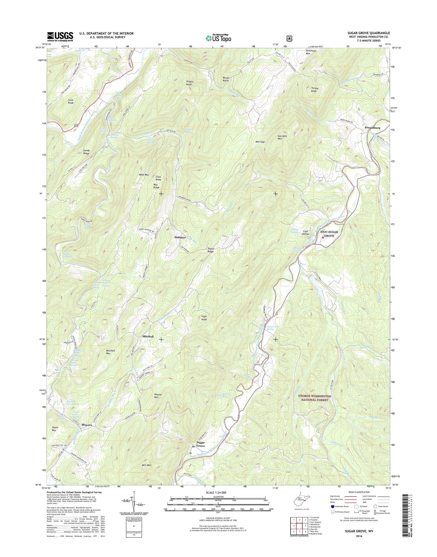
Sugar Grove West Virginia US Topo Map
Couldn't load pickup availability
2019 topographic map quadrangle Sugar Grove in the state of West Virginia. Scale: 1:24000. Based on the newly updated USGS 7.5' US Topo map series, this map is in the following counties: Pendleton. The map contains contour data, water features, and other items you are used to seeing on USGS maps, but also has updated roads and other features. This is the next generation of topographic maps. Printed on high-quality waterproof paper with UV fade-resistant inks.
Quads adjacent to this one:
West: Moatstown
Northwest: Circleville
North: Franklin
Northeast: Fort Seybert
East: Brandywine
Southeast: Reddish Knob
Southwest: Doe Hill
Contains the following named places: Beaver Dam Spring, Bill Run, Blackthorn Creek, Calvary Church, Cave Knob, Cave Spring, Cliff Run, Cool Hollow, Cress Spring, Dahmer, Dickinson Mountain, Dry Run, Dry Run Spring, Earl Kiser Spring, Eastern District, Eckhard Farm Spring, Falling Spring, Flint Knob, Franklin Spring, George Run, Harper Farm Spring, High Knob, Hiner Farm Spring, Hiveley Run, Hoover Mountain, Jamison Farm Spring, Kettle Run, Lick Run, Little Fork, Little Stony Run, Middle Ridge, Mill Gap, Mill Mountain, Mill Run, Miller Run, Mitchell, Mitchell Farm Spring, Mitchell Mountain, Moyers, Naval Information Operation Command Sugar Grove Fire Department Station 6, Naval Information Operations Command Sugar Grove, Neds Mountain, Pitzenbarger Spring, Powder Mill Spring, Propst Gap Church, Propst Knob, Propstburg, Raven Rocks, Rexrode Farm Spring, Rexrode Spring, Rocky Run, Saint Lukes Church, Sandy Ridge, Seng Run, Sharp Ridge, Smith Creek, Socrates Mountain, South Fork Structure Number 15 Dam, South Fork Structure Number 16 Dam, South Fork Structure Number 17 Dam, South Fork Volunteer Fire Department, Stauffles Run, Stony Run, Sugar Grove, Sugar Grove Post Office, Sugar Run, Thorn Church, Thorn Creek, Thorn Creek Spring, Thorn Creek Wildlife Management Area, Thorn Spring, Thorny Run, Turkey Knob, Whitehorn Creek, Whitethorn Creek, Wolf Run