MyTopo
Valley Point West Virginia US Topo Map
Couldn't load pickup availability
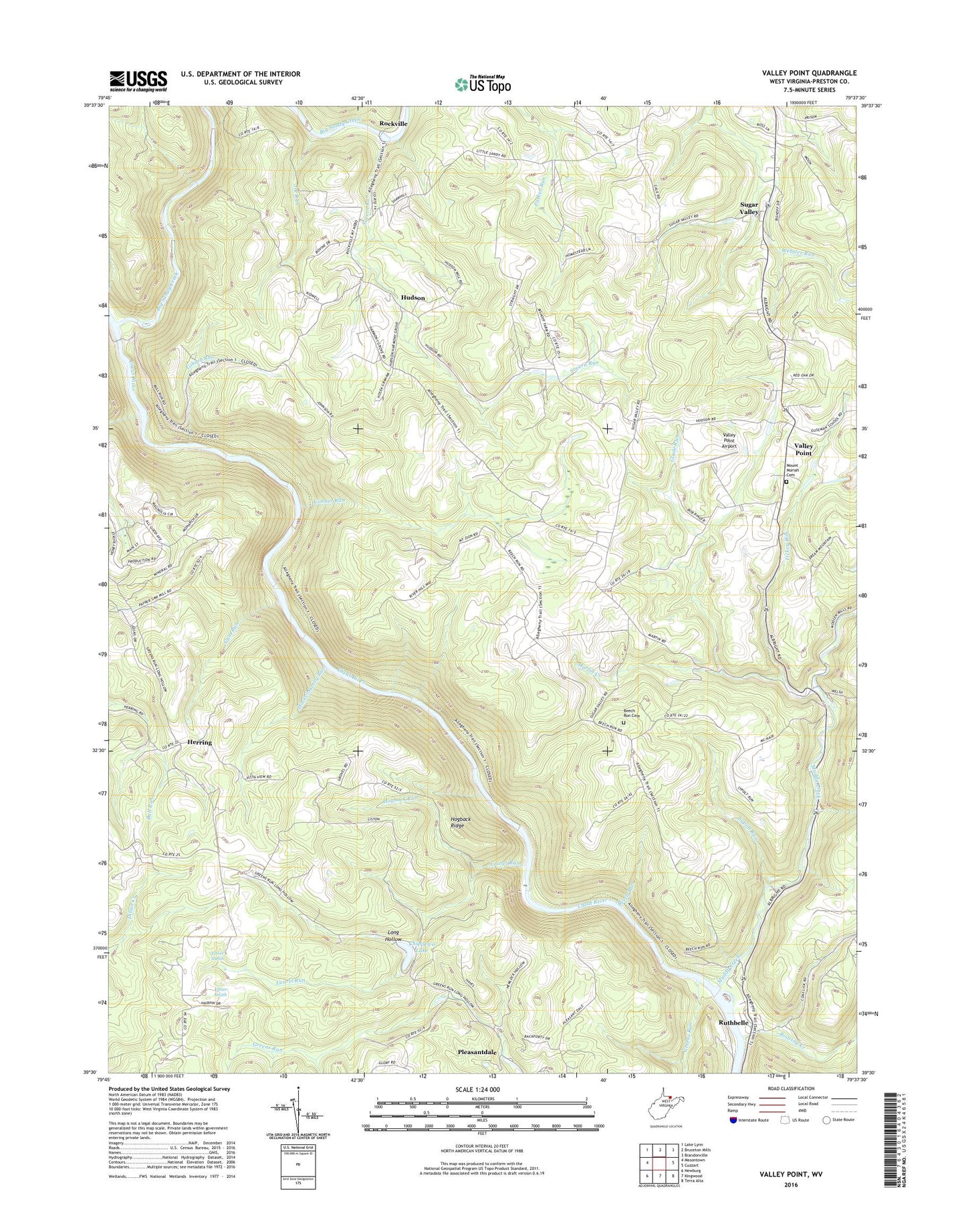
2019 topographic map quadrangle Valley Point in the state of West Virginia. Scale: 1:24000. Based on the newly updated USGS 7.5' US Topo map series, this map is in the following counties: Preston. The map contains contour data, water features, and other items you are used to seeing on USGS maps, but also has updated roads and other features. This is the next generation of topographic maps. Printed on high-quality waterproof paper with UV fade-resistant inks.
Quads adjacent to this one:
West: Masontown
North: Bruceton Mills
Northeast: Brandonville
East: Cuzzart
Southeast: Terra Alta
South: Kingwood
Southwest: Newburg
Contains the following named places: Beech Run, Beech Run Cemetery, Beech Run School, Beech Run United Methodist Church, Big Sandy Creek, Cale School, Chippewa Lake, Chippewa Lake Dam, Conner Run, Crab Orchard Run, Deep Hollow School, Elmer Smith, Fickey Run, First District, Gibson Run, Glade Meadows School, Glade Run, Greens Run, Gum Run, Hackelbarney Run, Harmony Grove United Methodist Church, Hayden, Herring, Hogback Ridge, Hogback Run, Hudson, Joe Run, Laurel Run, Long Hollow, Martin Creek, Mount Moriah Cemetery, Mount Moriah United Methodist Church, Mount Nebo, Mount Nebo Baptist Church, Mount Nebo School, Mount Union Church, Mount Zion Church, Mount Zion School, Muddy Creek, Old Virginia Furnace, Pleasant District, Pleasant Grove Baptist Church, Pleasant Valley School, Pleasantdale, Pleasantdale United Methodist Church, Roaring Creek, Rockville, Rockville Truss Bridge, Ruthbelle, Sovern Run, Sugar Valley, Sugar Valley School, Sugar Valley United Methodist Church, Sutherland, Sypolt Run, Valley Point, Valley Point Airport, Valley Point Pentecostal Church, Wesley Church, ZIP Code: 26519