MyTopo
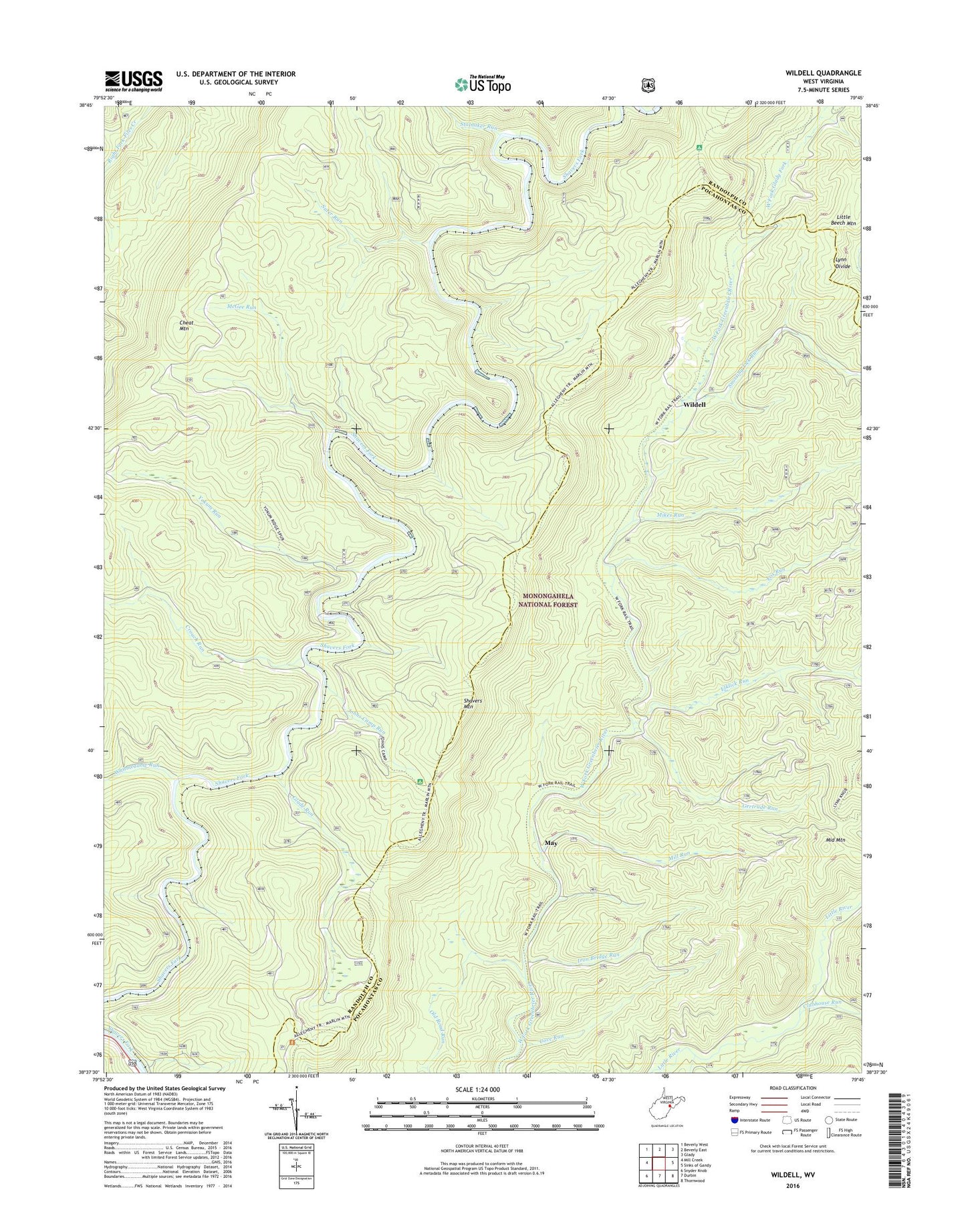
Wildell West Virginia US Topo Map
Couldn't load pickup availability
2019 topographic map quadrangle Wildell in the state of West Virginia. Scale: 1:24000. Based on the newly updated USGS 7.5' US Topo map series, this map is in the following counties: Randolph, Pocahontas. The map contains contour data, water features, and other items you are used to seeing on USGS maps, but also has updated roads and other features. This is the next generation of topographic maps. Printed on high-quality waterproof paper with UV fade-resistant inks.
Quads adjacent to this one:
West: Mill Creek
Northwest: Beverly West
North: Beverly East
Northeast: Glady
East: Sinks of Gandy
Southeast: Thornwood
South: Durbin
Southwest: Snyder Knob
Contains the following named places: Clubhouse Run, Cove Run, Crouch Hunter Access Trail, Crouch Ridge Trail, Crouch Run, Elklick Run, Enviro Energy Mine, Fox Run, Gaudineer Scenic Area, Gertrude, Gertrude Run, Glade Run, Iron Bridge Run, Johns Camp Run, Johns Camp Run Shelter, May, McGee Run, Mikes Run, Mill Run, North South Trail, Old Road Run, Shavers Mountain, Snorting Lick Run, Span Oak Run, Stalnaker Run, Suter Run, Turkey Hunter Access Trail, Whitmeadow Hunter Access Trail, Whitmeadow Run, Wildell, Wildell School, Wildell Shelter, Yokum Hunter Access Trail, Yokum Run