MyTopo
Williamsburg West Virginia US Topo Map
Couldn't load pickup availability
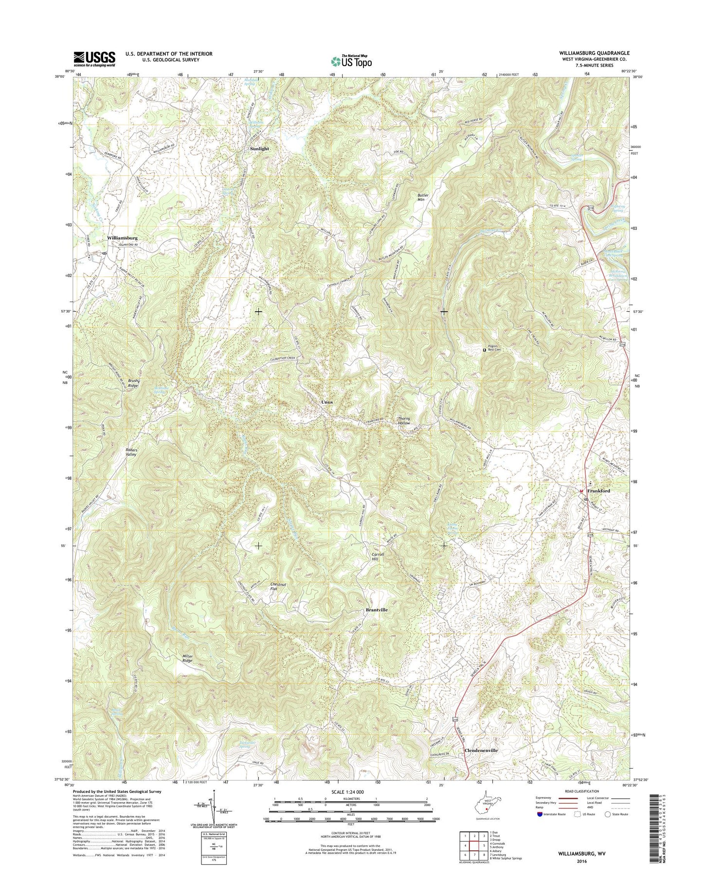
2023 topographic map quadrangle Williamsburg in the state of West Virginia. Scale: 1:24000. Based on the newly updated USGS 7.5' US Topo map series, this map is in the following counties: Greenbrier. The map contains contour data, water features, and other items you are used to seeing on USGS maps, but also has updated roads and other features. This is the next generation of topographic maps. Printed on high-quality waterproof paper with UV fade-resistant inks.
Quads adjacent to this one:
West: Cornstalk
Northwest: Duo
North: Trout
Northeast: Droop
East: Anthony
Southeast: White Sulphur Springs
South: Lewisburg
Southwest: Asbury
This map covers the same area as the classic USGS quad with code o37080h4.
Contains the following named places: Asbury Fishing Lake Dam, Bethel School, Brantville, Buckeye Creek, Burns Run, Butler Mountain, Carroll Hill, Carroll Hill School, Castret Spring, Chestnut Flat, Chestnut Flat School, Clendenenville, Culverson Creek, Dansie School, Fort Donnally, Frankford, Frankford Elementary School, Frankford Post Office, Frankford Volunteer Fire Department, Germany School, Gravelpoint School, Greenbrier County, Head Spring, Highway Spring, Indian Creek, Kathy Farms Spring, Locust Spring School, Marshall Spring, Mary Immaculate Church, Matts Black Cave Spring, McClintic Spring, McFerrin Breakdown Cave Spring, Miller Ridge, Mount Vernon School, Mountain View School, Northern Greenbrier Ambulance Service, Oak View School, Pilgrim Rest Cemetery, Pilgrim Rest Church, Rapp School, Savannah School, Sinking Creek, Spencer Spring, Spruce Run, Sunlight, Thorny Hollow, Tuckwiller Spring, Unus, Unus Church, Wesley Chapel, Williams Spring, Williamsburg, Williamsburg Elementary School, Williamsburg High School, Williamsburg Post Office, ZIP Codes: 24938, 24957