MyTopo
Trout West Virginia US Topo Map
Couldn't load pickup availability
Also explore the Trout Forest Service Topo of this same quad for updated USFS data
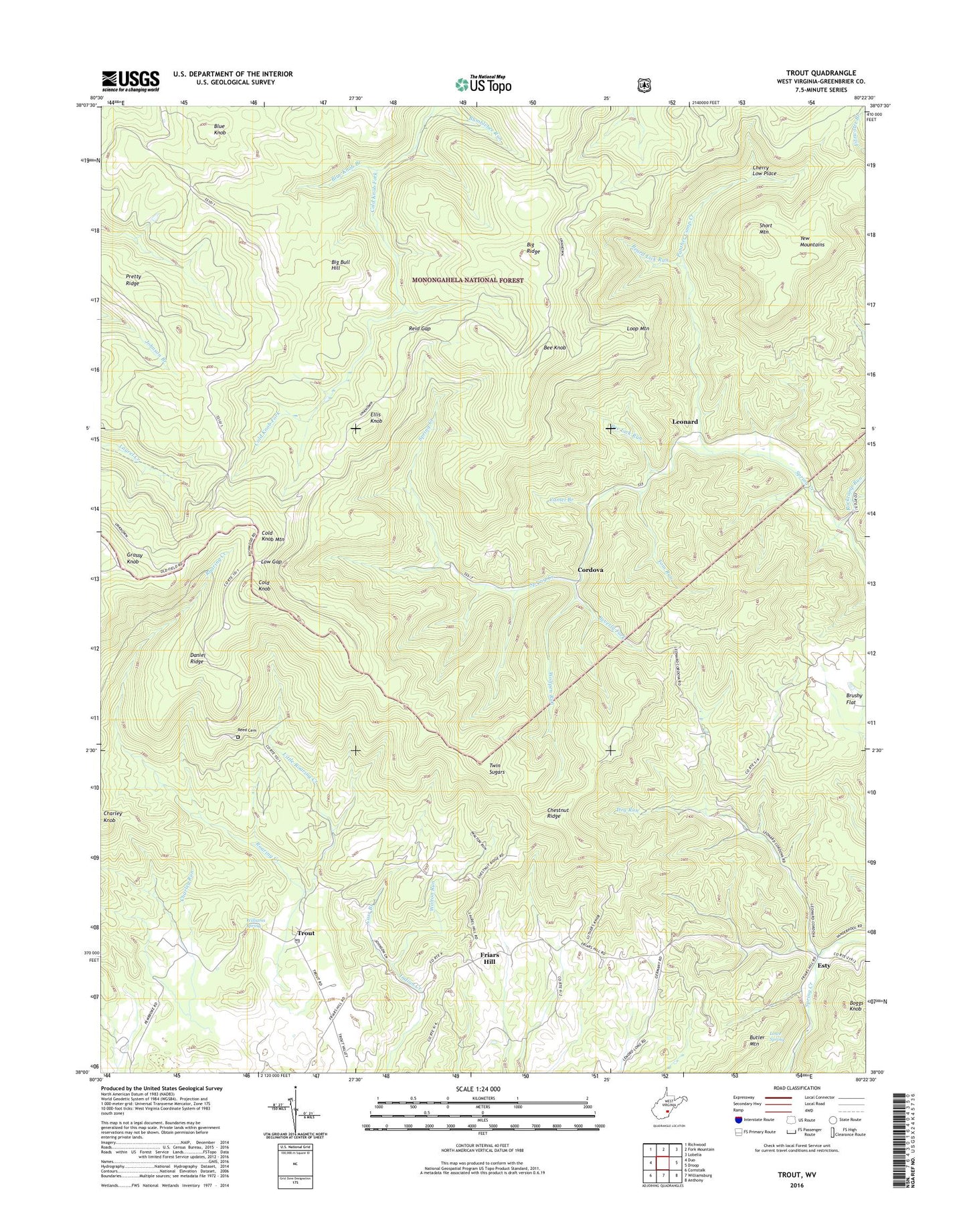
2023 topographic map quadrangle Trout in the state of West Virginia. Scale: 1:24000. Based on the newly updated USGS 7.5' US Topo map series, this map is in the following counties: Greenbrier. The map contains contour data, water features, and other items you are used to seeing on USGS maps, but also has updated roads and other features. This is the next generation of topographic maps. Printed on high-quality waterproof paper with UV fade-resistant inks.
Quads adjacent to this one:
West: Duo
Northwest: Richwood
North: Fork Mountain
Northeast: Lobelia
East: Droop
Southeast: Anthony
South: Williamsburg
Southwest: Cornstalk
This map covers the same area as the classic USGS quad with code o38080a4.
Contains the following named places: Baldwin School, Band of Hope Church, Beard Lick Run, Bee Knob, Bee Lick Run, Beverly Fork, Big Bull Hill, Big Ridge, Blue Knob, Blue Knob Branch, Boggs Knob, Brushy Flat School, Bull Run, Camel Branch, Carr Branch, Charley Knob, Charley Run, Cherry Low Place, Chestnut Ridge, Chestnut Ridge School, Cold Knob, Cold Knob Mountain, Cold Knob School, Cordova, Daniel Ridge, Dry Run, Ellis Knob, Esty, First Baptist Church of Trout, Friars Hill, Grassy Knob, Grassy Knob Lookout Tower, Leonard, Little Roaring Creek, Loop Mountain, Low Gap, Lowe Spring, McMillion Church, Mount Pleasant Church, Mount Vale School, New Ellis Chapel, New Piedmont School, Panther Camp Creek, Pretty Ridge, Reed Cemetery, Reid Gap, Roaring Creek, Rockcamp Church, Rockcamp Run, Short Mountain, Tom Run, Trout, Trout Post Office, Twin Sugars, Vires School, Walton Run, Williams Spring, Wolfpen Run, ZIP Code: 24991