MyTopo
Bean Lake Wisconsin US Topo Map
Couldn't load pickup availability
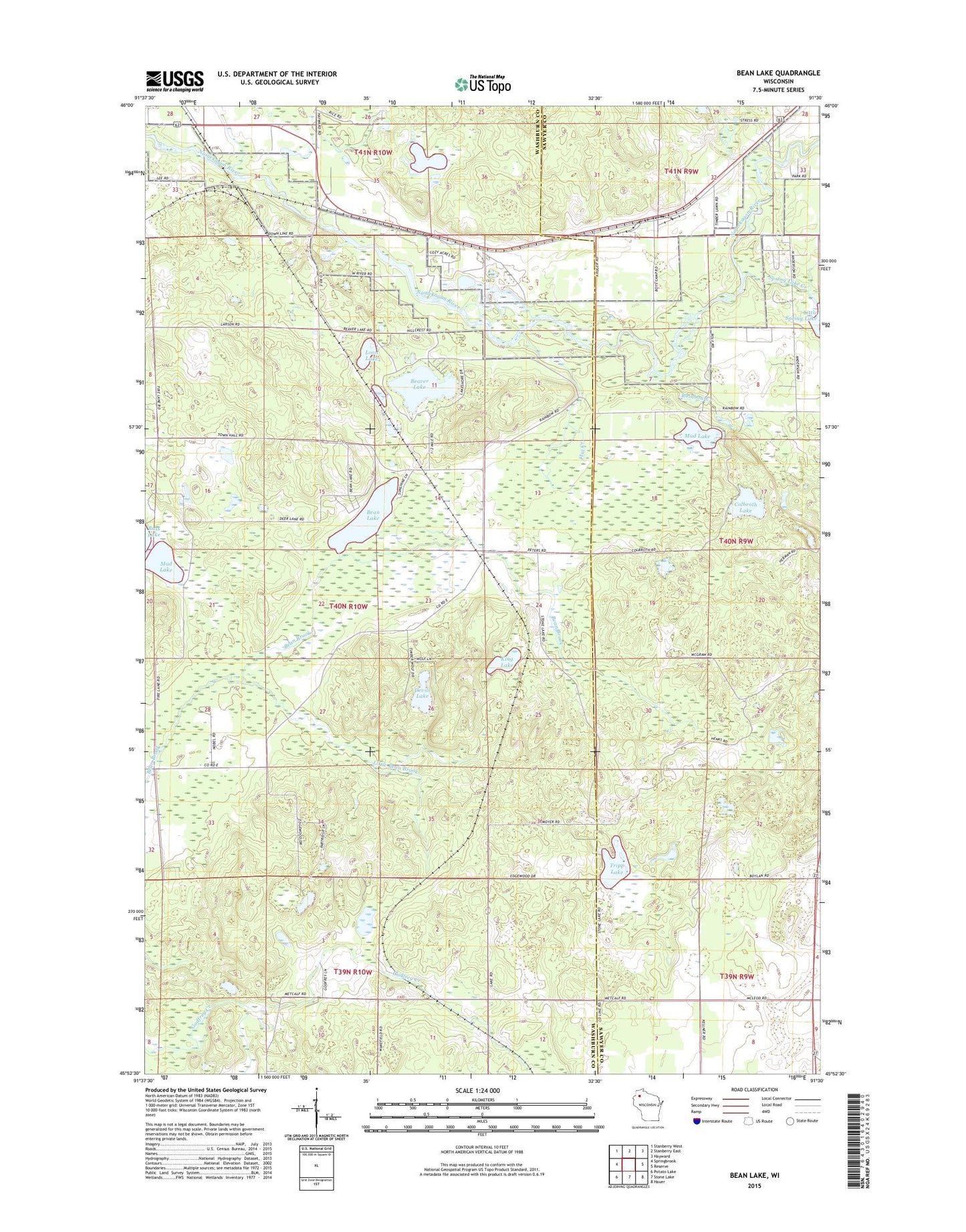
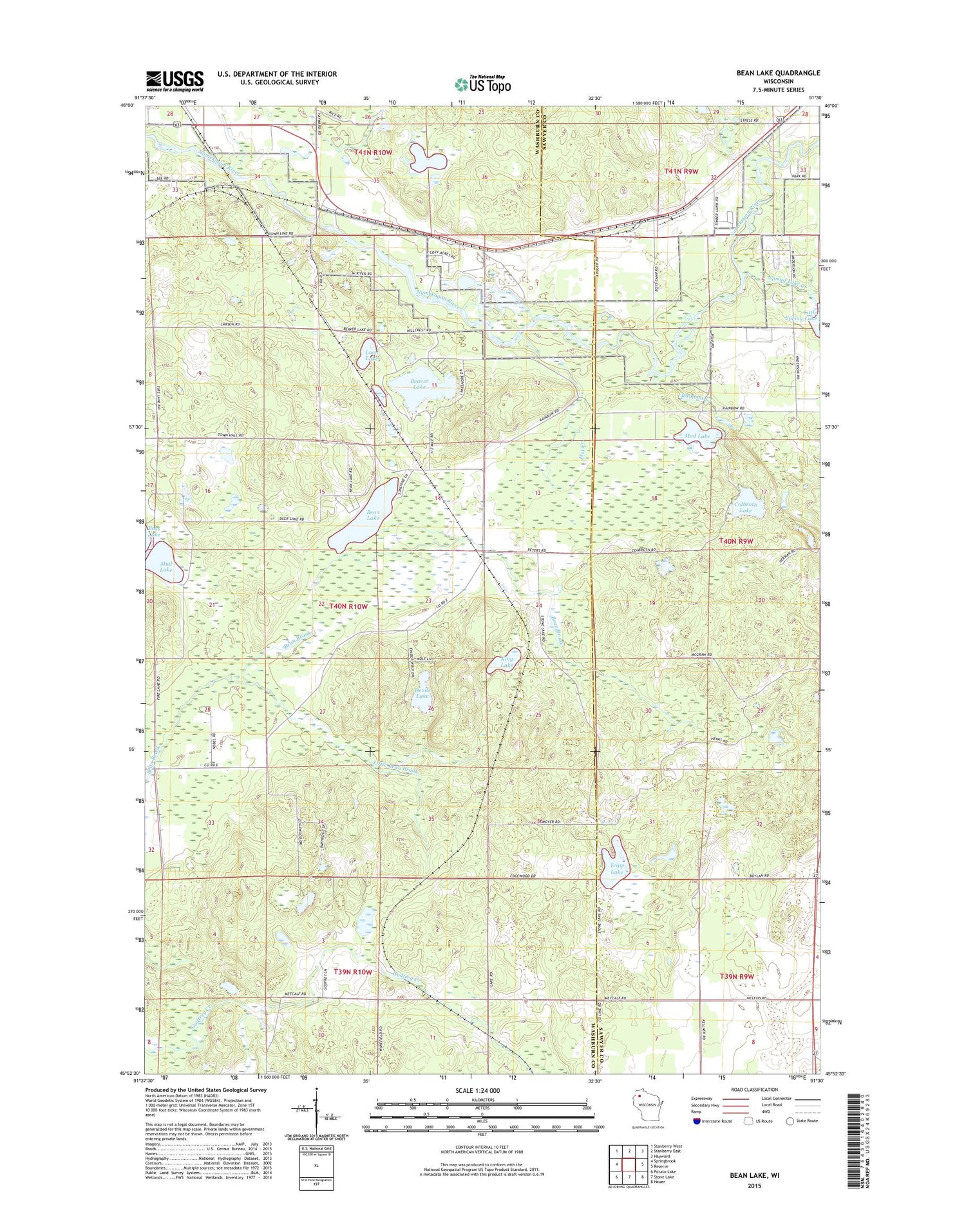
2019 topographic map quadrangle Bean Lake in the state of Wisconsin. Scale: 1:24000. Based on the newly updated USGS 7.5' US Topo map series, this map is in the following counties: Washburn, Sawyer. The map contains contour data, water features, and other items you are used to seeing on USGS maps, but also has updated roads and other features. This is the next generation of topographic maps. Printed on high-quality waterproof paper with UV fade-resistant inks.
Quads adjacent to this one:
West: Springbrook
Northwest: Stanberry West
North: Stanberry East
Northeast: Hayward
East: Reserve
Southeast: Hauer
South: Stone Lake
Southwest: Potato Lake
Contains the following named places: Bean Brook State Wildlife Management Area, Bean Lake, Beaver Lake, Brownlee School, Colbroth Lake, Devils Lake, Edgewood School, Flat Creek, Flat Creek State Wildlife Management Area, Jordon School, King Lake, Little Bean Brook, Little Spring Lake, Loon Lake, Mud Lake, Rainbow Creek, Saint Croix National Scenic Riverway, Spring Lake Creek, Stinnett School, Stress Pit, Town of Bass Lake, Tripp Lake, WHSM-AM (Hayward), WHSM-FM (Hayward)