MyTopo
Reserve Wisconsin US Topo Map
Couldn't load pickup availability
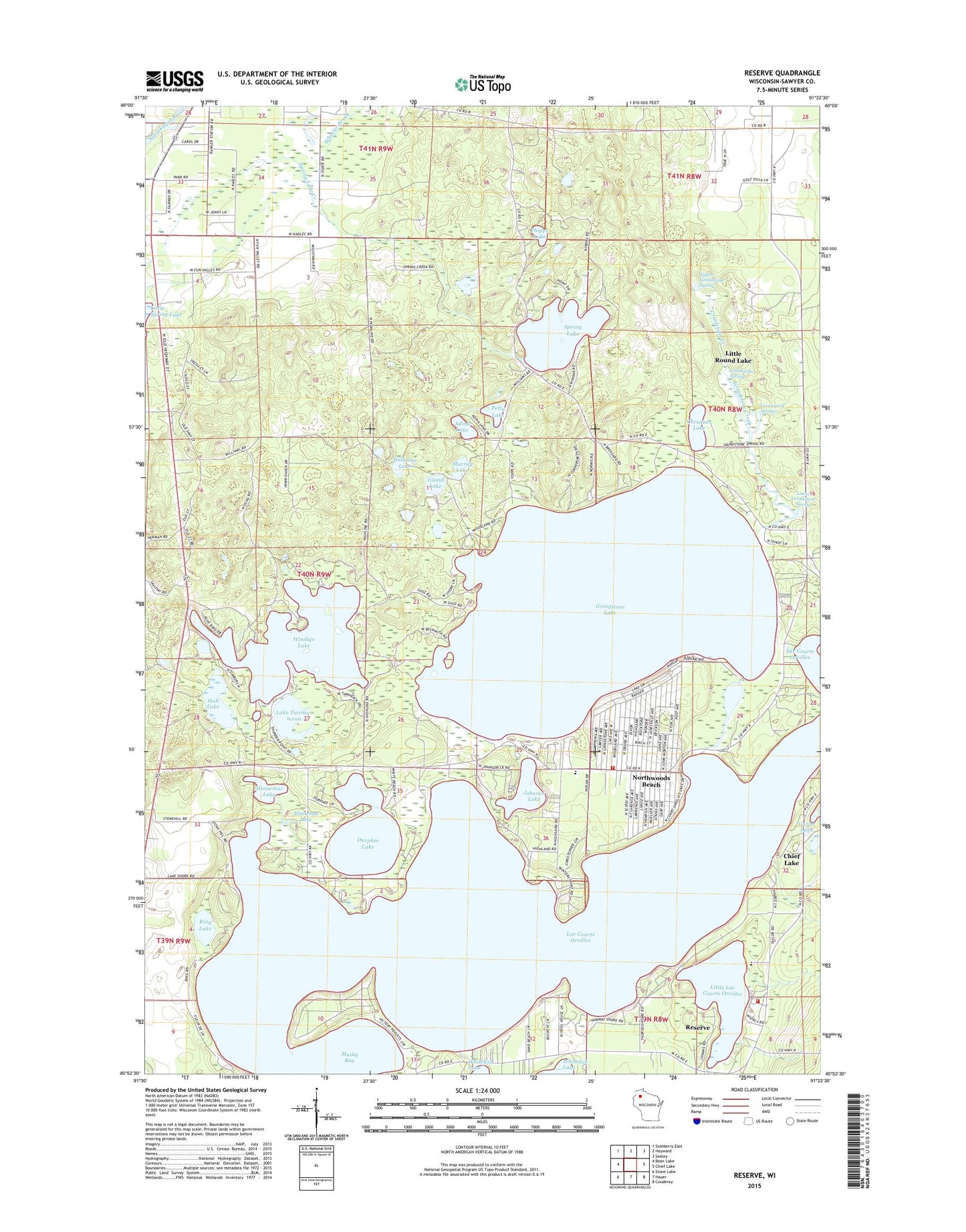
2022 topographic map quadrangle Reserve in the state of Wisconsin. Scale: 1:24000. Based on the newly updated USGS 7.5' US Topo map series, this map is in the following counties: Sawyer. The map contains contour data, water features, and other items you are used to seeing on USGS maps, but also has updated roads and other features. This is the next generation of topographic maps. Printed on high-quality waterproof paper with UV fade-resistant inks.
Quads adjacent to this one:
West: Bean Lake
Northwest: Stanberry East
North: Hayward
Northeast: Seeley
East: Chief Lake
Southeast: Couderay
South: Hauer
Southwest: Stone Lake
This map covers the same area as the classic USGS quad with code o45091h4.
Contains the following named places: Adina Lake, Bass Lake Volunteer Fire Department, Boylan School, Christner Lake, Durphee Lake, Graveyard Springs, Grindstone Creek, Grindstone Creek State Wildlife Management Area, Grindstone Lake, Grindstone Spring, Hub Lake, Island Lake, Johnson Lake, Jonjak Dam, Kinnamon School, Lac Courte Oreillas Tribal Police Department, Lac Courte Oreilles, Lac Courte Oreilles Volunteer Fire Department Station 2, Lake Twenty-seven, Little Lac Courte Oreilles, Lower Grindstone Spring, Minnemac Lake, Murray Lake, Musky Bay, Northwoods Beach, Northwoods Church, Northwoods Mennonite School, Petty Lake, Phipps Lake, Reserve, Ring Lake, Saint Francis Solanus Catholic School, Saint Francis Solanus Mission, Schoolhouse Lake, Spring Lake, Town of Bass Lake, Town of Hayward, Upper Grindstone Spring, Victory Heights Chapel, Wheeler Brook, Whitefish Church, Whitefish Creek, Whitefish School, Williams Lake, Windigo Lake