MyTopo
Potato Lake Wisconsin US Topo Map
Couldn't load pickup availability
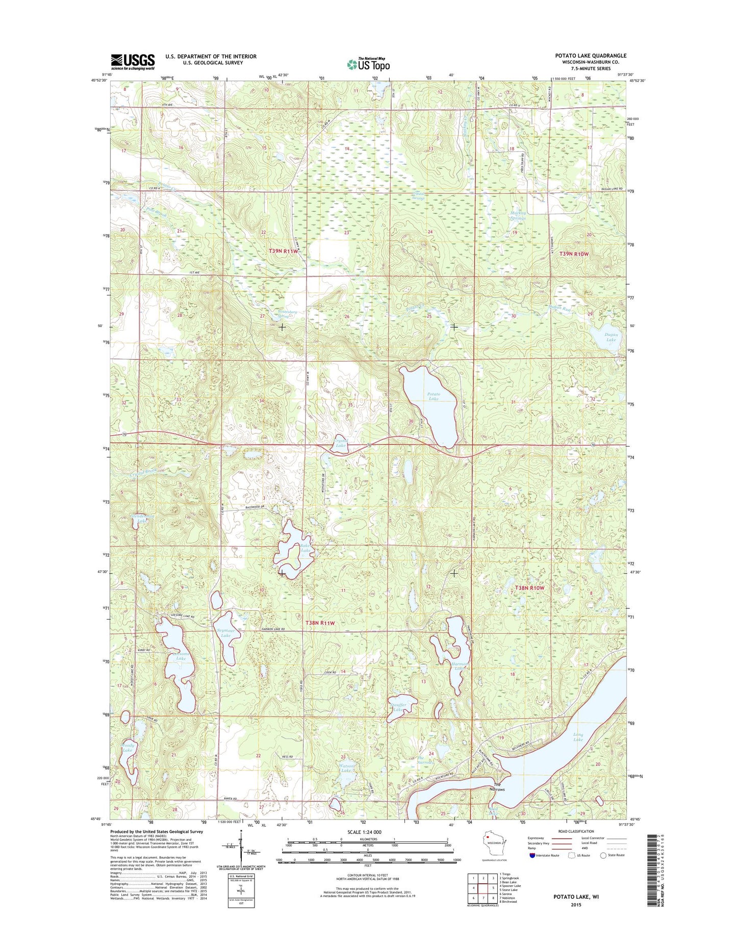
2022 topographic map quadrangle Potato Lake in the state of Wisconsin. Scale: 1:24000. Based on the newly updated USGS 7.5' US Topo map series, this map is in the following counties: Washburn. The map contains contour data, water features, and other items you are used to seeing on USGS maps, but also has updated roads and other features. This is the next generation of topographic maps. Printed on high-quality waterproof paper with UV fade-resistant inks.
Quads adjacent to this one:
West: Spooner Lake
Northwest: Trego
North: Springbrook
Northeast: Bean Lake
East: Stone Lake
Southeast: Birchwood
South: Nobleton
Southwest: Sarona
This map covers the same area as the classic USGS quad with code o45091g6.
Contains the following named places: Baker Lake, Crystal Lake, Crystal School, Crystal Swamp, Crystal Townhall, Dugan Lake, Dugan Run, Evergreen Church, Glendennon Lake, Harmon Lake, Leesome Lake, Mackay Springs, Madge Townhall, Moody Lake, Pine Brook, Potato Lake, Potato Lake Fire Tower, Seymour Lake, Stauffer Lake, The Narrows, Town of Crystal, Town of Madge, Watson Lake, Westenberg Spring