MyTopo
Stone Lake Wisconsin US Topo Map
Couldn't load pickup availability
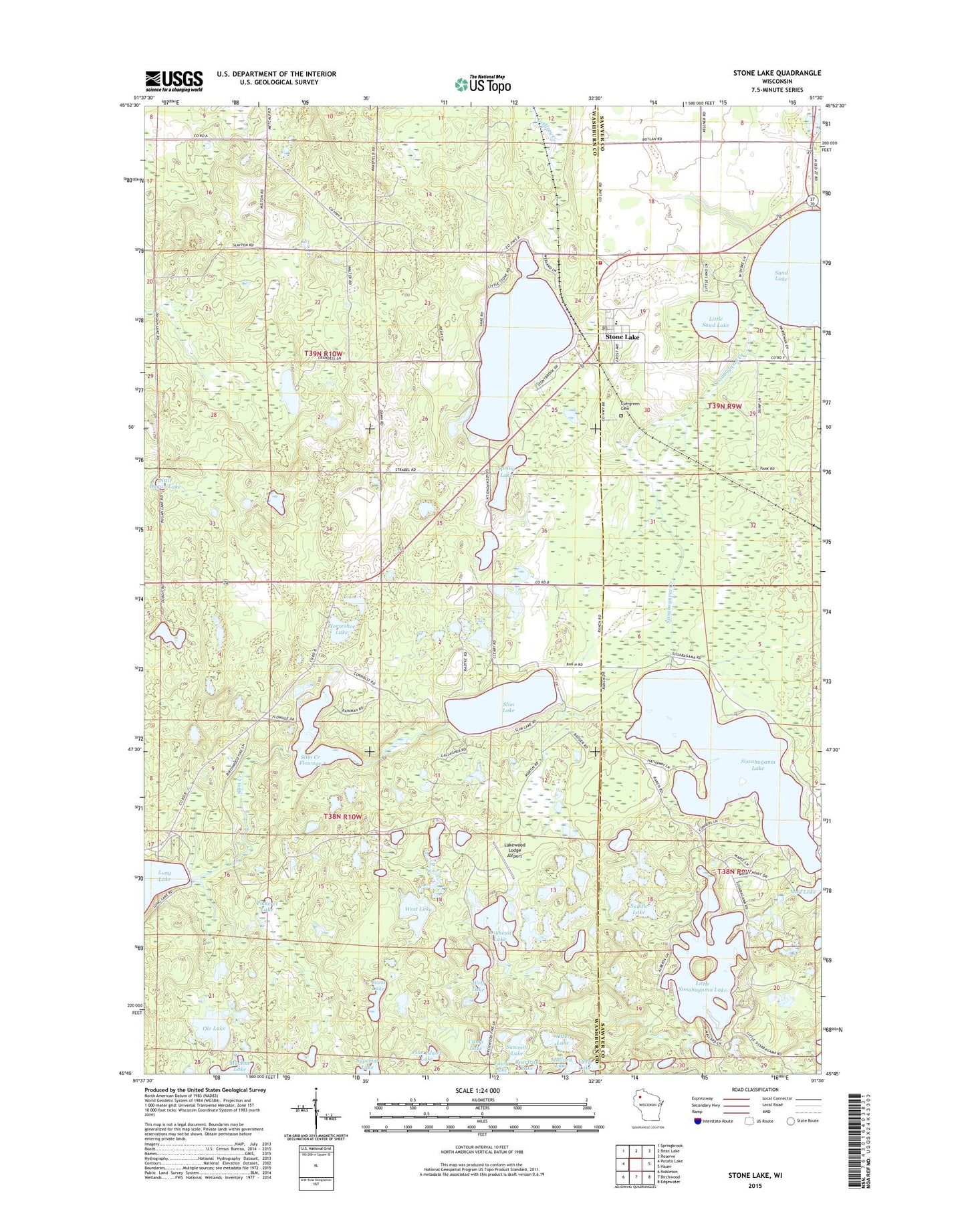
2022 topographic map quadrangle Stone Lake in the state of Wisconsin. Scale: 1:24000. Based on the newly updated USGS 7.5' US Topo map series, this map is in the following counties: Washburn, Sawyer. The map contains contour data, water features, and other items you are used to seeing on USGS maps, but also has updated roads and other features. This is the next generation of topographic maps. Printed on high-quality waterproof paper with UV fade-resistant inks.
Quads adjacent to this one:
West: Potato Lake
Northwest: Springbrook
North: Bean Lake
Northeast: Reserve
East: Hauer
Southeast: Edgewater
South: Birchwood
Southwest: Nobleton
This map covers the same area as the classic USGS quad with code o45091g5.
Contains the following named places: Camp Lake, Deep Lake, Evangelical Lutheran Church, Evergreen Cemetery, Horseshoe Lake, Lakewood Lodge Airport, Little Dugan Lake, Little Sand Lake, Little Sissabagama Lake, Little Stone Lake, Loyhead Lake, Mallard Lake, Mud Lake, Ole Lake, Osprey Lake, Otter Lake, Pickerel Lake, Pine Island Lake, Pine Knoll School, Reflection Lake, Saddle Lake, Sawmill Lake, Scoot Lake, Sissabagama Creek, Sissabagama Lake, Slim Creek, Slim Creek 2WP220 Dam, Slim Creek Dam, Slim Creek Flowage, Slim Creek Flowage 17, Slim Lake, Snag Lake, Spring Lake, Stone Lake, Stone Lake Census Designated Place, Stone Lake Elementary School, Stone Lake Post Office, Stone Lake Townhall, Stone Lake Volunteer Fire Department, Stone Lake Water Tower, Town of Stone Lake, West Lake, Wolf Lake