
MyTopo
Bennett Wisconsin US Topo Map
Couldn't load pickup availability
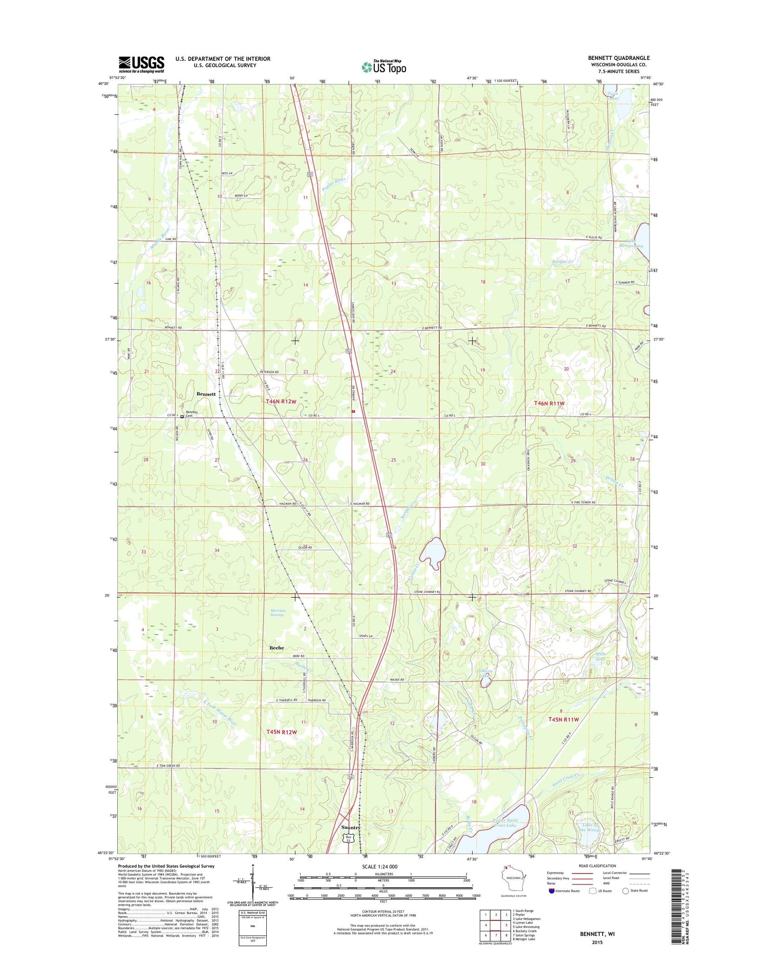
2018 topographic map quadrangle Bennett in the state of Wisconsin. Scale: 1:24000. Based on the newly updated USGS 7.5' US Topo map series, this map is in the following counties: Douglas. The map contains contour data, water features, and other items you are used to seeing on USGS maps, but also has updated roads and other features. This is the next generation of topographic maps. Printed on high-quality waterproof paper with UV fade-resistant inks.
Quads adjacent to this one:
West: Lyman Lake
Northwest: South Range
North: Poplar
Northeast: Lake Nebagamon
East: Lake Minnesuing
Southeast: Metzger Lake
South: Solon Springs
Southwest: Buckety Creek
Contains the following named places: Beebe, Beebe Creek, Bennett, Bennett Cemetery, Bennett Volunteer Fire Department, Catlin Creek, Douglas County Sheriff's Office Substation, East Fork Moose River, Emmanuel Church, Gilbert Lake, Hansen Creek, Kaspar Creek, Lake of the Woods, Merriam Swamp, Mills Lake, North Country National Scenic Trail, Porcupine Creek, Saint Croix Creek, Town of Bennett, Twin Lakes, Whispering Pines Church


