MyTopo
Metzger Lake Wisconsin US Topo Map
Couldn't load pickup availability
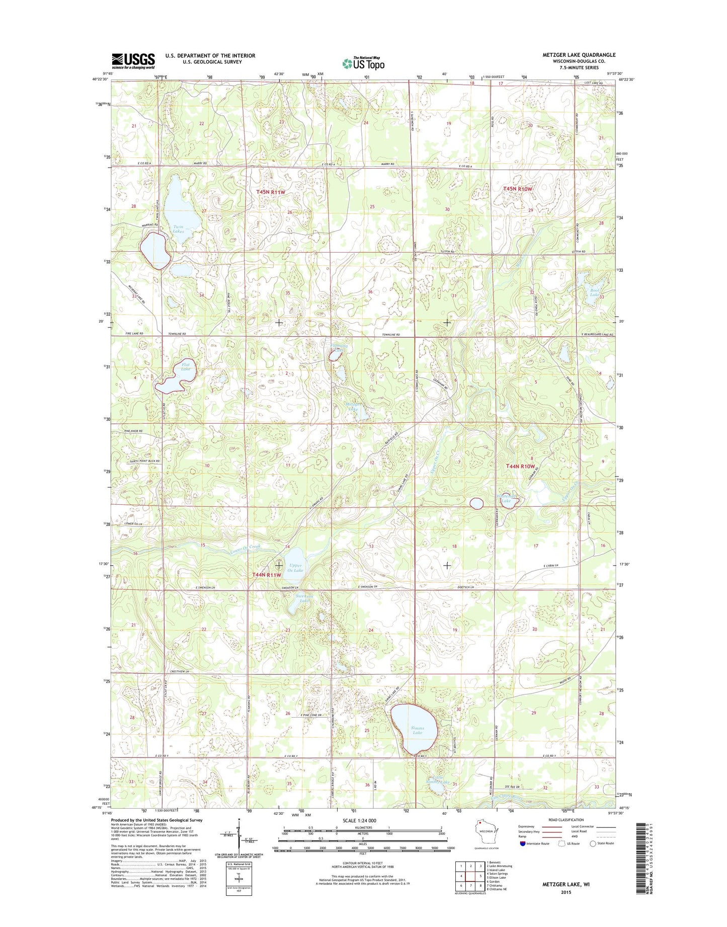
2022 topographic map quadrangle Metzger Lake in the state of Wisconsin. Scale: 1:24000. Based on the newly updated USGS 7.5' US Topo map series, this map is in the following counties: Douglas. The map contains contour data, water features, and other items you are used to seeing on USGS maps, but also has updated roads and other features. This is the next generation of topographic maps. Printed on high-quality waterproof paper with UV fade-resistant inks.
Quads adjacent to this one:
West: Solon Springs
Northwest: Bennett
North: Lake Minnesuing
Northeast: Island Lake
East: Ellison Lake
Southeast: Chittamo NE
South: Chittamo
Southwest: Gordon
This map covers the same area as the classic USGS quad with code o46091c6.
Contains the following named places: Boot Lake, Camp Bovey, Flamang Lake, Flat Lake, Little Simms Lake, Metzger Lake, Mud Creek, Simms Lake, Swenson Lake, Twin Lakes, Upper Ox Creek, Upper Ox Lake, Whiteside Lake, ZIP Code: 54873