MyTopo
Lake Minnesuing Wisconsin US Topo Map
Couldn't load pickup availability
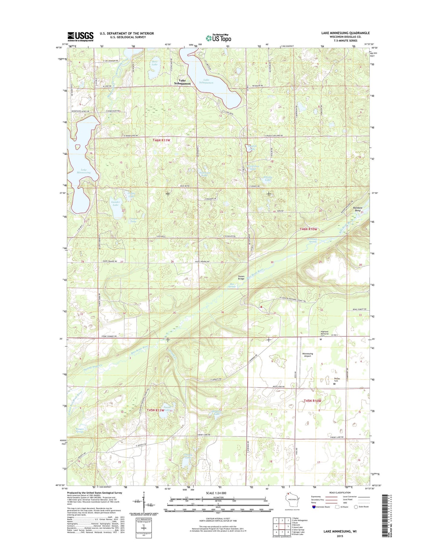
2022 topographic map quadrangle Lake Minnesuing in the state of Wisconsin. Scale: 1:24000. Based on the newly updated USGS 7.5' US Topo map series, this map is in the following counties: Douglas. The map contains contour data, water features, and other items you are used to seeing on USGS maps, but also has updated roads and other features. This is the next generation of topographic maps. Printed on high-quality waterproof paper with UV fade-resistant inks.
Quads adjacent to this one:
West: Bennett
Northwest: Poplar
North: Lake Nebagamon
Northeast: Brule
East: Island Lake
Southeast: Ellison Lake
South: Metzger Lake
Southwest: Solon Springs
This map covers the same area as the classic USGS quad with code o46091d6.
Contains the following named places: Anderson Lake, Barnes Cemetery, Beaupre Springs, Blue Springs, Brule River State Forest, Cheney Lake, Coffee Lake, Cream Lake, Deer Lake, East Fork Bois Brule River, Gander Lake, Highland Memorial Cemetery, Highland Townhall, Highland Township Volunteer Fire Department, Horseshoe Lake, Jerseth Creek, Lake Minnesuing, Lake Minnesuing County Park, McDougal Springs, Minnesuing Airport, Minnesuing Creek, Plate Lake, Priest Lake, Rainbow Bend, Shoberg Lake, Smith Lake, Spring Angel Creek, Stones Bridge, Stones Bridge Landing, Sunfish Lake, West Fork Bois Brule River, Whisky Lake, Wilson Creek, ZIP Code: 54849