MyTopo
Bevent Wisconsin US Topo Map
Couldn't load pickup availability
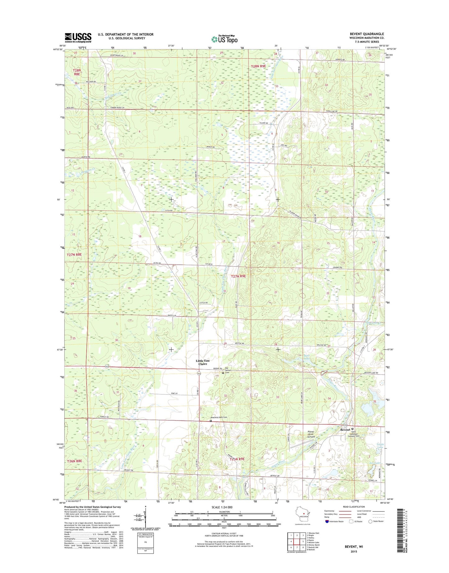
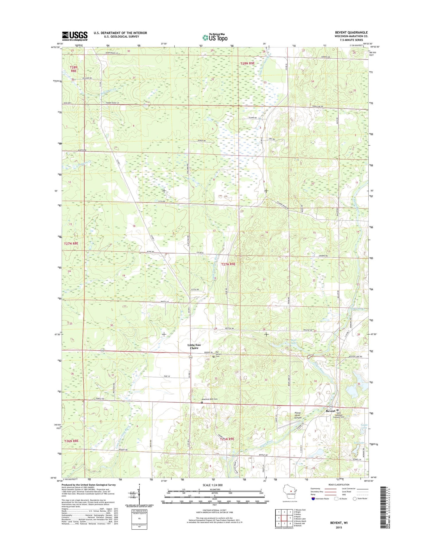
2018 topographic map quadrangle Bevent in the state of Wisconsin. Scale: 1:24000. Based on the newly updated USGS 7.5' US Topo map series, this map is in the following counties: Marathon. The map contains contour data, water features, and other items you are used to seeing on USGS maps, but also has updated roads and other features. This is the next generation of topographic maps. Printed on high-quality waterproof paper with UV fade-resistant inks.
Quads adjacent to this one:
West: Peplin
Northwest: Wausau East
North: Ringle
Northeast: Hatley
East: Mission Lake
Southeast: Rosholt
South: Rosholt NW
Southwest: Dewey Marsh
Contains the following named places: Bear Lake, Bevent, Dallman Dairy Farm, Fox Lake, Furmanek Farms, Little Bull Junior Creek, Little Eau Claire, Majestic Farms Greenhouse, Osowski Farm, Our Saviors Cemetery, Peacefull Rest Cemetery, Pike Lake Creek, Plover River Airfield, Przybylski Farm, Rosenberry School, Saint Ladislaus Catholic Cemetery, Saint Ladislaus School, Town of Reid, Turtle Lake, Tyler School, ZIP Code: 54440