MyTopo
Rosholt Wisconsin US Topo Map
Couldn't load pickup availability
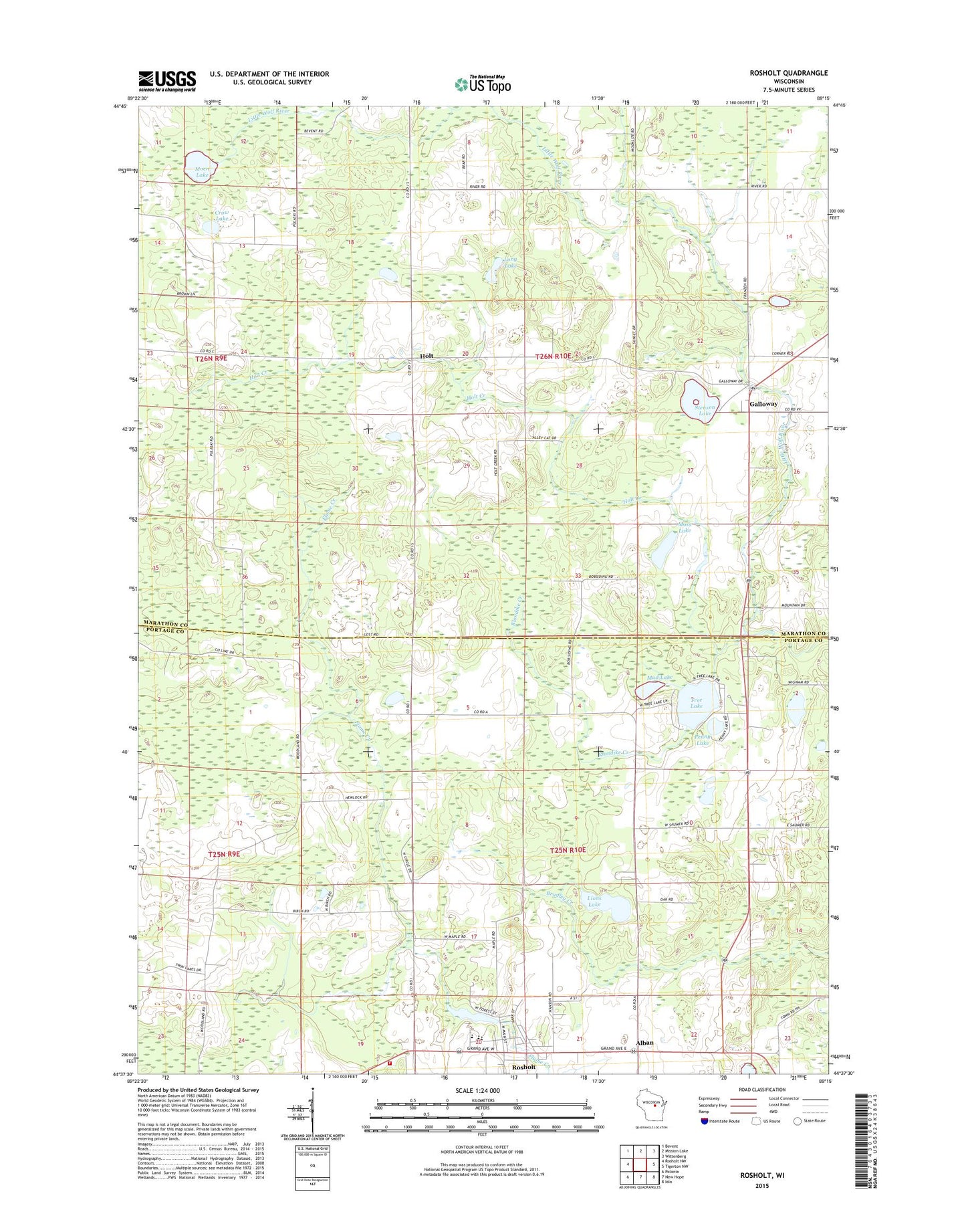
2022 topographic map quadrangle Rosholt in the state of Wisconsin. Scale: 1:24000. Based on the newly updated USGS 7.5' US Topo map series, this map is in the following counties: Marathon, Portage. The map contains contour data, water features, and other items you are used to seeing on USGS maps, but also has updated roads and other features. This is the next generation of topographic maps. Printed on high-quality waterproof paper with UV fade-resistant inks.
Quads adjacent to this one:
West: Rosholt NW
Northwest: Bevent
North: Mission Lake
Northeast: Wittenberg
East: Tigerton NW
Southeast: Iola
South: New Hope
Southwest: Polonia
This map covers the same area as the classic USGS quad with code o44089f3.
Contains the following named places: Alban, Camp F Creek, Crow Lake, Galloway, Galloway Census Designated Place, Green School, Holt, Holt Creek, Klondike Creek, Lions Lake, Long Lake, Moen Lake, Moss Lake, Mud Lake, Penny Lake, Peterson Park, Rosholt, Rosholt Elementary School, Rosholt Fire Department, Rosholt High School, Rosholt Middle School, Rosholt Post Office, Stenson Lake, Town of Alban, Town of Franzen, Tree Lake, Village of Rosholt, Washington School, ZIP Code: 54473