MyTopo
Big Spring Wisconsin US Topo Map
Couldn't load pickup availability
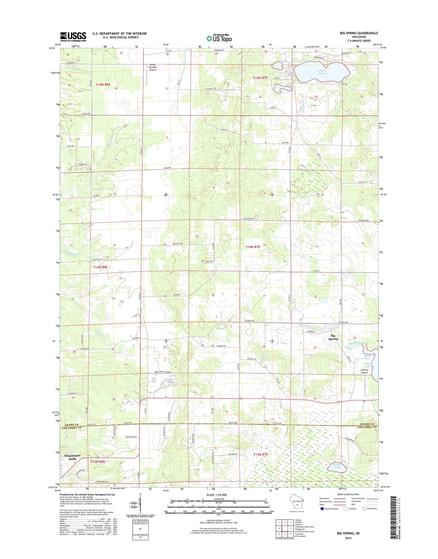
2018 topographic map quadrangle Big Spring in the state of Wisconsin. Scale: 1:24000. Based on the newly updated USGS 7.5' US Topo map series, this map is in the following counties: Adams, Columbia. The map contains contour data, water features, and other items you are used to seeing on USGS maps, but also has updated roads and other features. This is the next generation of topographic maps. Printed on high-quality waterproof paper with UV fade-resistant inks.
Quads adjacent to this one:
West: Wisconsin Dells North
Northwest: Easton
North: Brooks
Northeast: Oxford
East: Briggsville
Southeast: Pine Island
South: Lewiston
Southwest: Wisconsin Dells South
Contains the following named places: Badger Valley School, Big Spring, Big Spring Creek, Burns Cove, Davis Corners, Dell Prairie, Dell Prairie School, Gaffney Airport, Jordan Lake, Polish Paradise Airport, Town of New Haven, Ward School, Weeting Lake, WNNO-AM (Wisconsin Dells), WNNO-FM (Wisconsin Dells), World Wide Church, ZIP Code: 53965