MyTopo
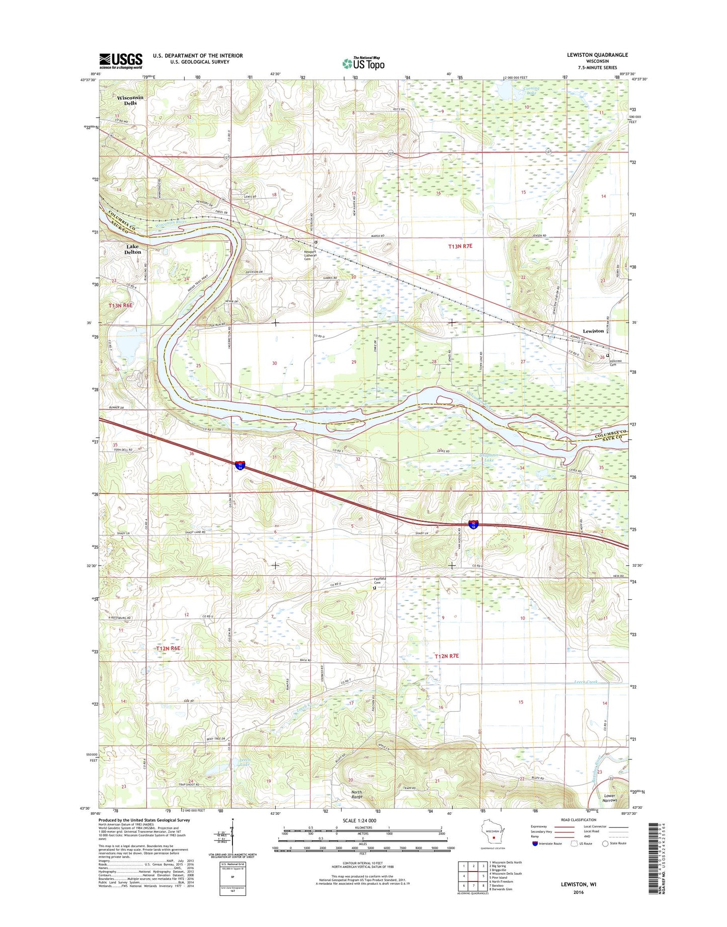
Lewiston Wisconsin US Topo Map
Couldn't load pickup availability
2022 topographic map quadrangle Lewiston in the state of Wisconsin. Scale: 1:24000. Based on the newly updated USGS 7.5' US Topo map series, this map is in the following counties: Sauk, Columbia. The map contains contour data, water features, and other items you are used to seeing on USGS maps, but also has updated roads and other features. This is the next generation of topographic maps. Printed on high-quality waterproof paper with UV fade-resistant inks.
Quads adjacent to this one:
West: Wisconsin Dells South
Northwest: Wisconsin Dells North
North: Big Spring
Northeast: Briggsville
East: Pine Island
Southeast: Durwards Glen
South: Baraboo
Southwest: North Freedom
This map covers the same area as the classic USGS quad with code o43089e6.
Contains the following named places: Best Ever School, Big Sky Twin Drive-In, Chapman Lake, Corning Lake, Fairfield Cemetery, Fairfield Center Elementary School, Greens Corners, Greens Corners School, Hillcrest Cemetery, Leech Lake, Lewiston, Lower Dells School, Moe Settlement, Newport Evangelical Lutheran Church, Newport Lutheran Cemetery, Pecks Corners, Stearns School, Tofson School, Town of Fairfield, Town of Newport, Yellow Thunder Park