MyTopo
Birch Island Lake Wisconsin US Topo Map
Couldn't load pickup availability
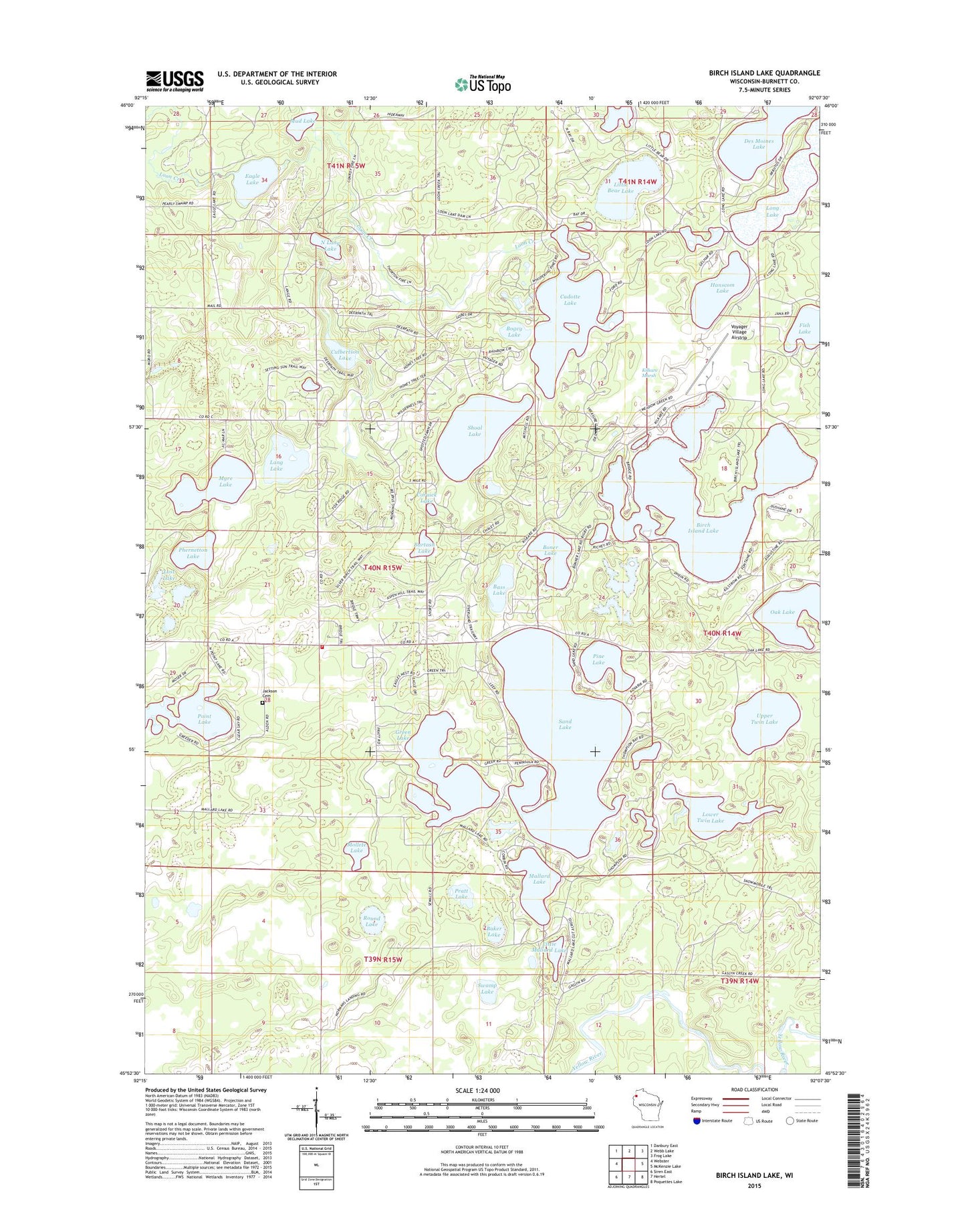
2018 topographic map quadrangle Birch Island Lake in the state of Wisconsin. Scale: 1:24000. Based on the newly updated USGS 7.5' US Topo map series, this map is in the following counties: Burnett. The map contains contour data, water features, and other items you are used to seeing on USGS maps, but also has updated roads and other features. This is the next generation of topographic maps. Printed on high-quality waterproof paper with UV fade-resistant inks.
Quads adjacent to this one:
West: Webster
Northwest: Danbury East
North: Webb Lake
Northeast: Frog Lake
East: McKenzie Lake
Southeast: Poquettes Lake
South: Hertel
Southwest: Siren East
Contains the following named places: Baker Lake, Bartash Lake, Bass Lake, Birch Island Lake, Bogey Lake, Boner Lake, Cadotte Lake, Coruick Lake, Culbertson Lake, Culbertson Springs State Fishery Area, Des Moines Lake, Eagle Lake, Green Lake, Hanscom Lake, Jackson Cemetery, Jackson Townhall, Jackson Township Fire Department, Kilkare Marsh, Lang Lake, Leaf Lake, Little Bear Lake, Little Mallard Lake, Long Lake, Loon Lake, Loon Lake 2WP344 Dam, Lost Lake, Lower Twin Lake, Mallard Lake, Mollete Lake, Moro School, Mud Lake, Myre Lake, North Lang Lake, Oak Lake, Phernetton Lake, Pine Lake, Point Lake, Pratt Lake, Radke Sand and Gravel Pit, Round Lake, Sand Lake, Sanks Lake, Shoal Lake, Swamp Lake, Town of Jackson, Truck Lake, Upper Twin Lake, Voyager Village Airstrip, Voyager Village Country Club