MyTopo
McKenzie Lake Wisconsin US Topo Map
Couldn't load pickup availability
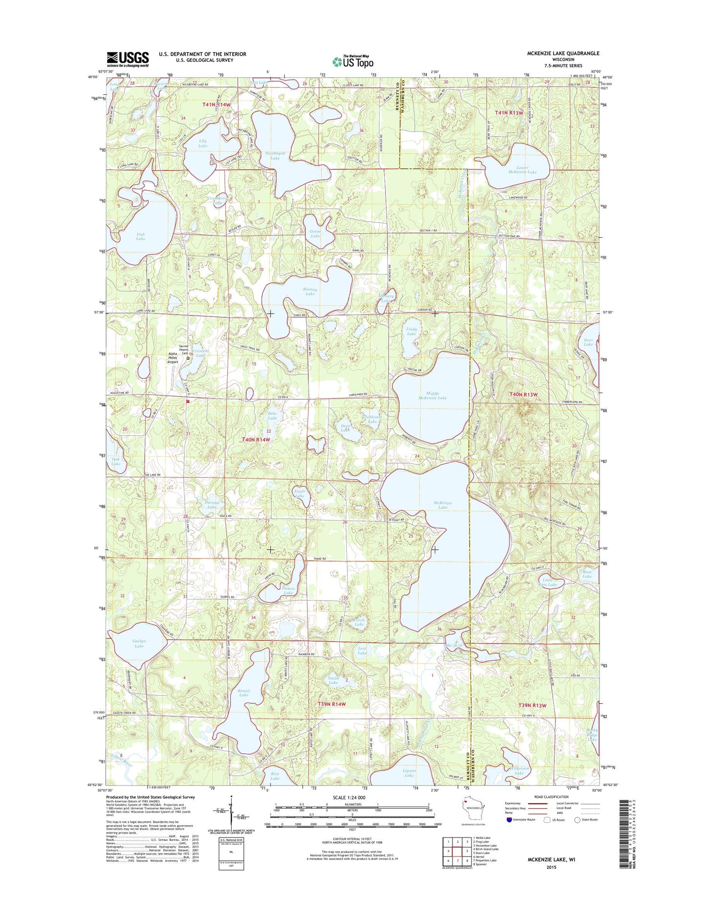
2022 topographic map quadrangle McKenzie Lake in the state of Wisconsin. Scale: 1:24000. Based on the newly updated USGS 7.5' US Topo map series, this map is in the following counties: Burnett, Washburn. The map contains contour data, water features, and other items you are used to seeing on USGS maps, but also has updated roads and other features. This is the next generation of topographic maps. Printed on high-quality waterproof paper with UV fade-resistant inks.
Quads adjacent to this one:
West: Birch Island Lake
Northwest: Webb Lake
North: Frog Lake
Northeast: Horseshoe Lake
East: Dunn Lake
Southeast: Spooner
South: Poquettes Lake
Southwest: Hertel
This map covers the same area as the classic USGS quad with code o45092h1.
Contains the following named places: Alpha Hotel Airport, Behr Lake, Benoit Lake, Clubhouse Lake, Cranberry Lake, Crescent Lake, Deep Lake, Deer Lake, Dubois Lake, Durand Lake, Eagle Lake, Fish Lake, Gaslyn Creek School, Gaslyn Lake, Goose Lake, Lily Lake, Lindy Lake, Little Bass Lake, Lost Lake, Lower McKenzie Lake, McKenzie Lake, McKenzie Lake Lookout Tower, Middle McKenzie Lake, Mystery Lake, Nicaboyne Lake, North Midwest Cranberry Company WP99 Dam, Perch Lake, Rooney Lake, Sacred Hearts Cemetery, Sacred Hearts Church, Scott School, Scott Townhall, Scott Township Volunteer Fire Department, Smith Lake, South Midwest Cranberry Company WP99 Dam, Town of Scott, Wilkerson Lake