MyTopo
Poquettes Lake Wisconsin US Topo Map
Couldn't load pickup availability
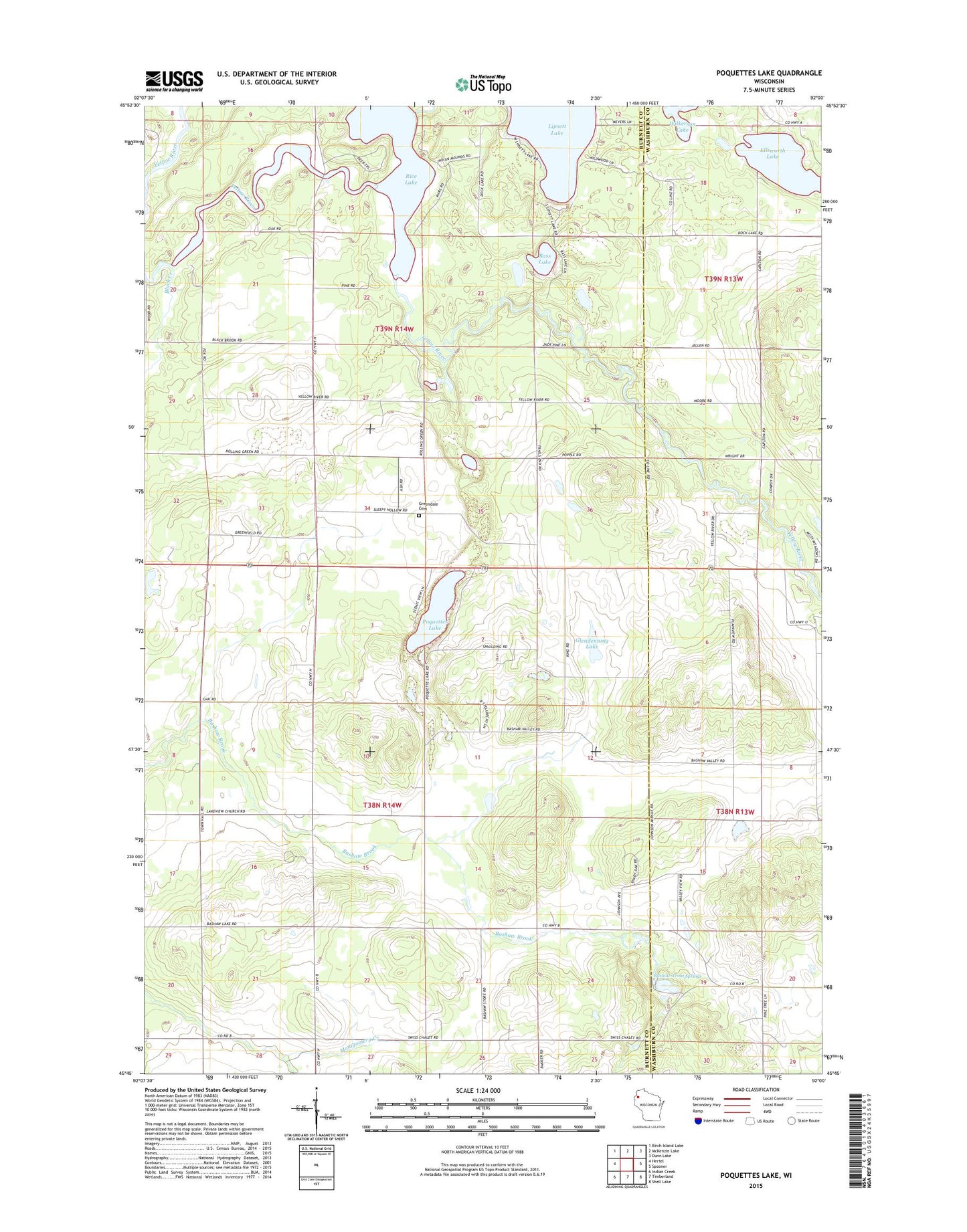
2022 topographic map quadrangle Poquettes Lake in the state of Wisconsin. Scale: 1:24000. Based on the newly updated USGS 7.5' US Topo map series, this map is in the following counties: Burnett, Washburn. The map contains contour data, water features, and other items you are used to seeing on USGS maps, but also has updated roads and other features. This is the next generation of topographic maps. Printed on high-quality waterproof paper with UV fade-resistant inks.
Quads adjacent to this one:
West: Hertel
Northwest: Birch Island Lake
North: McKenzie Lake
Northeast: Dunn Lake
East: Spooner
Southeast: Shell Lake
South: Timberland
Southwest: Indian Creek
This map covers the same area as the classic USGS quad with code o45092g1.
Contains the following named places: Bashaw, Bashaw Brook School, Bashaw Trout Springs, Bass Lake, Black Creek, Dewey Townhall, Ellsworth Lake, Glendenning Lake, Green Grove Alliance Church, Green Grove School, Greendale Cemetery, Lipsett Lake, McCarty School, Meads Lake, North Dewey School, Plainview School, Poquette Lake Orchard, Poquettes Lake, Rice Lake, Rusk Townhall, Stillrecht Pit, Town of Dewey, Town of Rusk