
MyTopo
Boyd Wisconsin US Topo Map
Couldn't load pickup availability
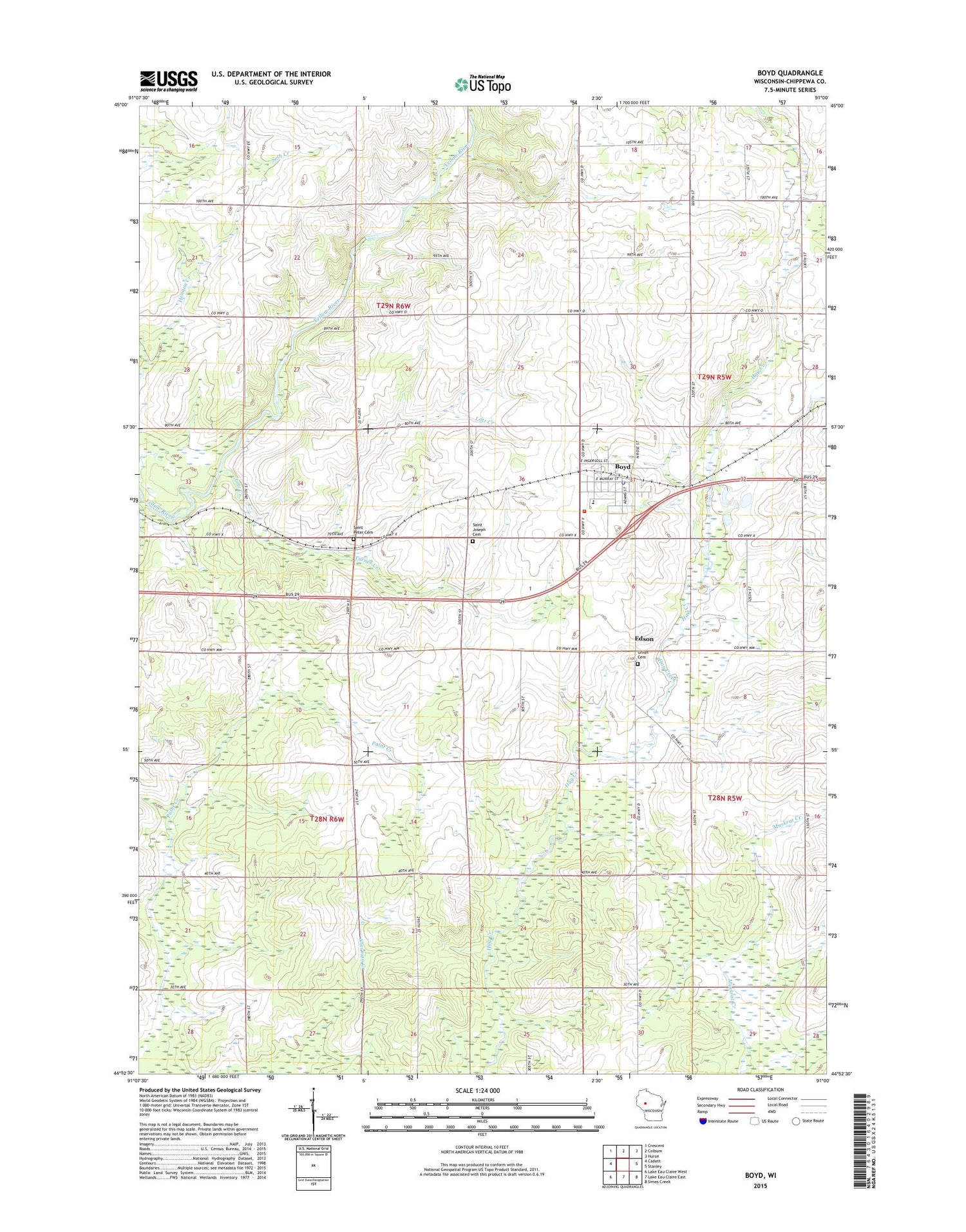
2018 topographic map quadrangle Boyd in the state of Wisconsin. Scale: 1:24000. Based on the newly updated USGS 7.5' US Topo map series, this map is in the following counties: Chippewa. The map contains contour data, water features, and other items you are used to seeing on USGS maps, but also has updated roads and other features. This is the next generation of topographic maps. Printed on high-quality waterproof paper with UV fade-resistant inks.
Quads adjacent to this one:
West: Cadott
Northwest: Crescent
North: Colburn
Northeast: Huron
East: Stanley
Southeast: Simes Creek
South: Lake Eau Claire East
Southwest: Lake Eau Claire West
Contains the following named places: Boyd, Boyd Early Learning Center, Boyd Edson Delmar Volunteer Fire Department Ambulance and Rescue, Boyd Police Department, Boyd Post Office, Boyd Wastewater Treatment Facility, Danielson School, Delmar Center School, Edson, Liberty Hill School, Lotz Creek, Lotz Park, McKinley School, Popple Grove School, Saint Joseph Cemetery, Saint Peter Cemetery, Saint Peters Lutheran Church, Sherman School, Slaughterhouse Creek, Town of Delmar, Town of Edson, Turner Creek, Union Cemetery, Victory School, Village of Boyd, ZIP Code: 54726


