MyTopo
Crescent Wisconsin US Topo Map
Couldn't load pickup availability
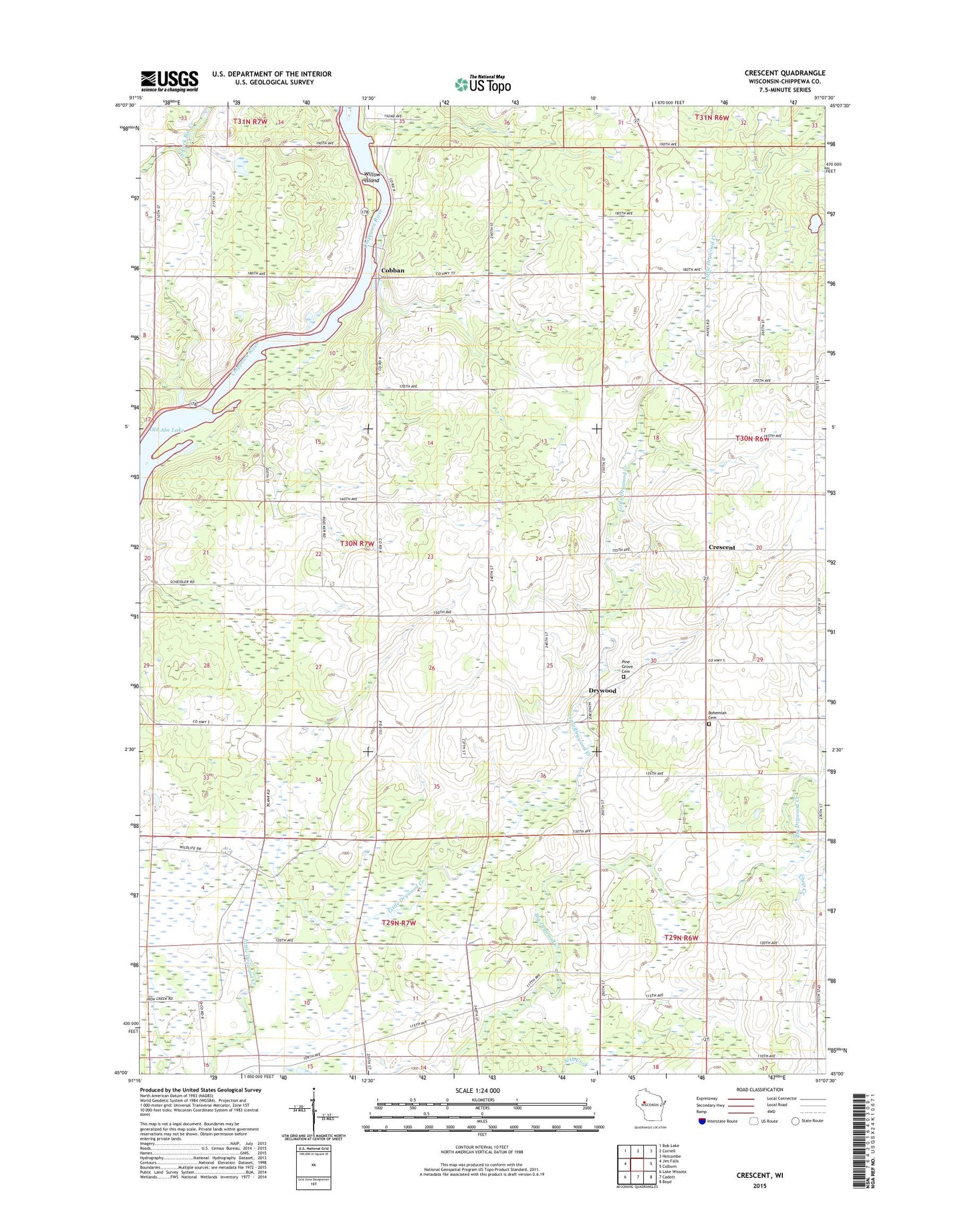
2022 topographic map quadrangle Crescent in the state of Wisconsin. Scale: 1:24000. Based on the newly updated USGS 7.5' US Topo map series, this map is in the following counties: Chippewa. The map contains contour data, water features, and other items you are used to seeing on USGS maps, but also has updated roads and other features. This is the next generation of topographic maps. Printed on high-quality waterproof paper with UV fade-resistant inks.
Quads adjacent to this one:
West: Jim Falls
Northwest: Bob Lake
North: Cornell
Northeast: Holcombe
East: Colburn
Southeast: Boyd
South: Cadott
Southwest: Lake Wissota
This map covers the same area as the classic USGS quad with code o45091a2.
Contains the following named places: Big Drywood Church, Bohemian Cemetery, Chap Creek, Cobban, Crescent, Drywood, Drywood Creek State Public Hunting Ground, Eleanor School, Golden Rule School, Matott School, Mitchell School, Pine Grove Cemetery, Saint Anthony Church, Seidlitz Dairy Farm, Town of Arthur, Willow Island, WWIB-FM (Ladysmith)