MyTopo
Pine Dells Wisconsin US Topo Map
Couldn't load pickup availability
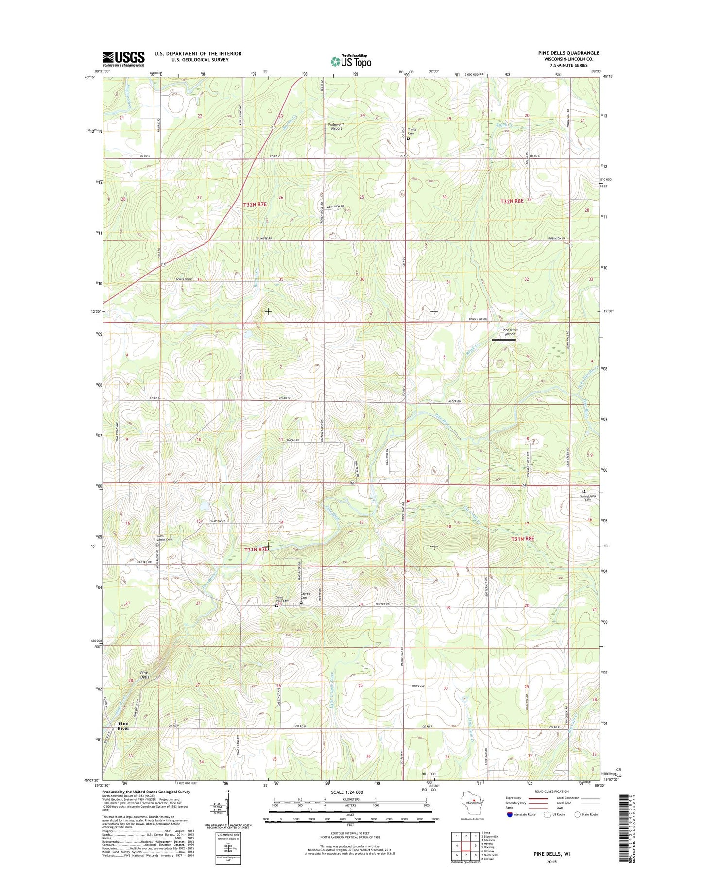
2022 topographic map quadrangle Pine Dells in the state of Wisconsin. Scale: 1:24000. Based on the newly updated USGS 7.5' US Topo map series, this map is in the following counties: Lincoln. The map contains contour data, water features, and other items you are used to seeing on USGS maps, but also has updated roads and other features. This is the next generation of topographic maps. Printed on high-quality waterproof paper with UV fade-resistant inks.
Quads adjacent to this one:
West: Merrill
Northwest: Irma
North: Bloomville
Northeast: Gleason
East: Doering
Southeast: Kalinke
South: Nutterville
Southwest: Brokaw
This map covers the same area as the classic USGS quad with code o45089b5.
Contains the following named places: Calvary Church, Calvary Lutheran Cemetery, Dutch Corners, Finn School, French Ridge School, Goettchel School, Hartwig School, Heller School, Miller School, North Branch Pine River, Pat Smith Creek, Pine Dells, Pine River, Pine River Airport, Pine River Volunteer Fire Department, Plamann School, Podeweltz Airport, Rajek Creek, Saint James Cemetery, Saint James Church, Saint Luke Church, Saint Paul Church, Saint Paul Lutheran Cemetery, Saint Paul School, Schley Townhall, Spring Creek, Springbrook Cemetery, Sunrise School, Town of Pine River, Trinity Lutheran Cemetery