
MyTopo
Brussels Wisconsin US Topo Map
Couldn't load pickup availability
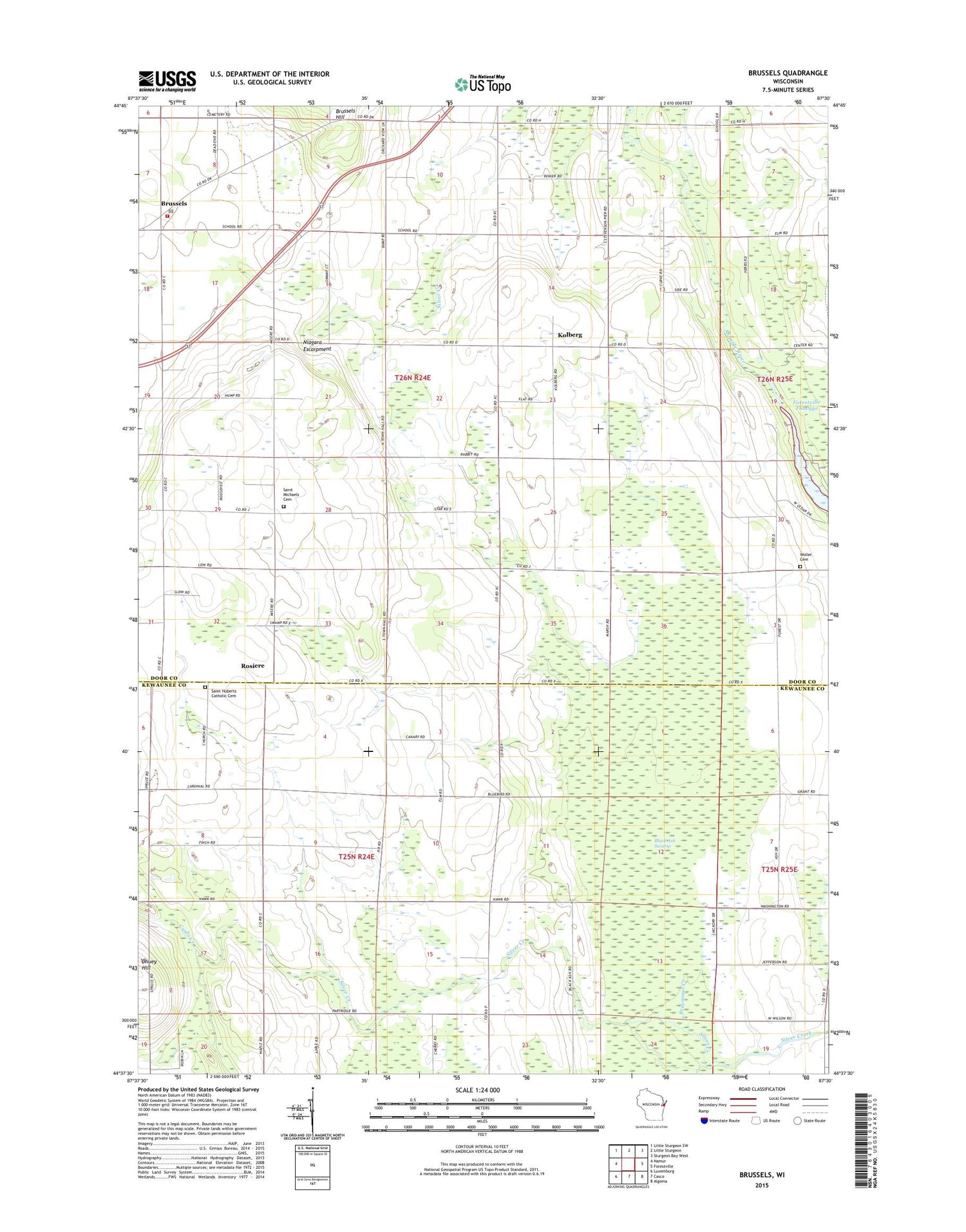
2018 topographic map quadrangle Brussels in the state of Wisconsin. Scale: 1:24000. Based on the newly updated USGS 7.5' US Topo map series, this map is in the following counties: Door, Kewaunee. The map contains contour data, water features, and other items you are used to seeing on USGS maps, but also has updated roads and other features. This is the next generation of topographic maps. Printed on high-quality waterproof paper with UV fade-resistant inks.
Quads adjacent to this one:
West: Namur
Northwest: Little Sturgeon SW
North: Little Sturgeon
Northeast: Sturgeon Bay West
East: Forestville
Southeast: Algoma
South: Casco
Southwest: Luxemburg
Contains the following named places: Ahnapee River Tree Farm, Ahnapee State Trail, Black Ash Swamp, Bruemmer Creek, Brussels, Brussels - Union - Gardner Fire Department Station 1, Brussels Post Office, C and M Farms, Dhuey Hill, Doorco Farms, Emergency Services of Door County, Emmanuel Lutheran Cemetery, Engebose Farms, Fair Land Dairy, Forestville Flowage, Forestville Flowage 40, Gregor School, Kolberg, Lincoln School, Marin Farms, Niagara Escarpment, Orchard View Game Farm, Rio Creek, Roosevelt School, Rosiere, Rosiere School, Saint Francis Cemetery, Saint Hubert Catholic Church, Saint Huberts Catholic Cemetery, Saint Michaels Cemetery, Saint Michaels Church, Springdale Dairy Farm, Town of Brussels, Town of Lincoln, WOMA-FM (Algoma), ZIP Code: 54213


