MyTopo
Buckhorn Corner Wisconsin US Topo Map
Couldn't load pickup availability
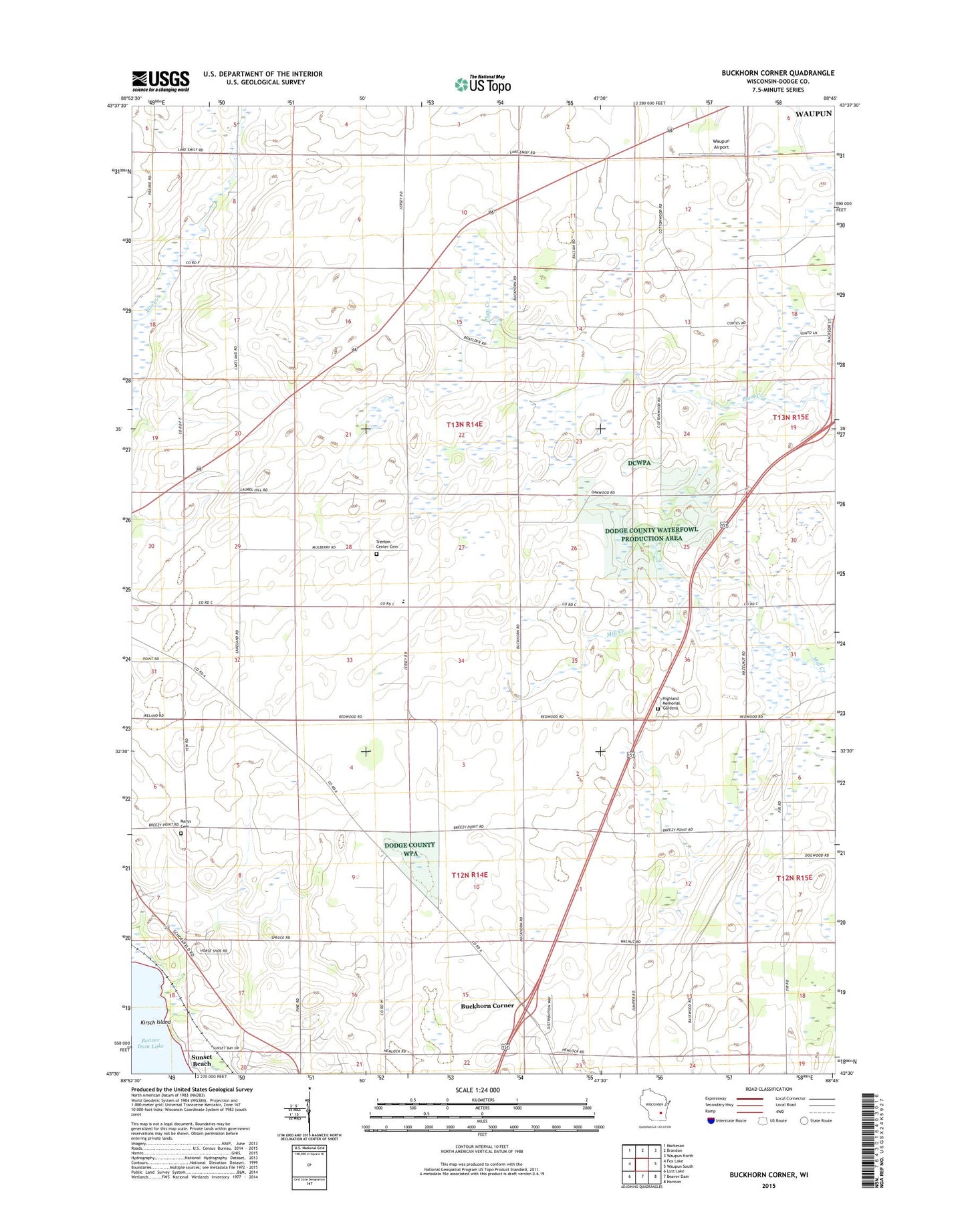
2022 topographic map quadrangle Buckhorn Corner in the state of Wisconsin. Scale: 1:24000. Based on the newly updated USGS 7.5' US Topo map series, this map is in the following counties: Dodge. The map contains contour data, water features, and other items you are used to seeing on USGS maps, but also has updated roads and other features. This is the next generation of topographic maps. Printed on high-quality waterproof paper with UV fade-resistant inks.
Quads adjacent to this one:
West: Fox Lake
Northwest: Markesan
North: Brandon
Northeast: Waupun North
East: Waupun South
Southeast: Horicon
South: Beaver Dam
Southwest: Lost Lake
This map covers the same area as the classic USGS quad with code o43088e7.
Contains the following named places: Annunciation Cemetery, Boomer School, Buckhorn Corner, Climax School, Dodge County Waterfowl Production Area, Excelsior School, Highland Memory Gardens, Kirsch Island, Lake View School, Oak Lawn School, Oakwood School, Prairie View School, Saint John Church, Sunset Beach, Town of Trenton, Trenton Cemetery, Trenton Elementary School, Waupun Airport, Willowbrook Farm