MyTopo
Lost Lake Wisconsin US Topo Map
Couldn't load pickup availability
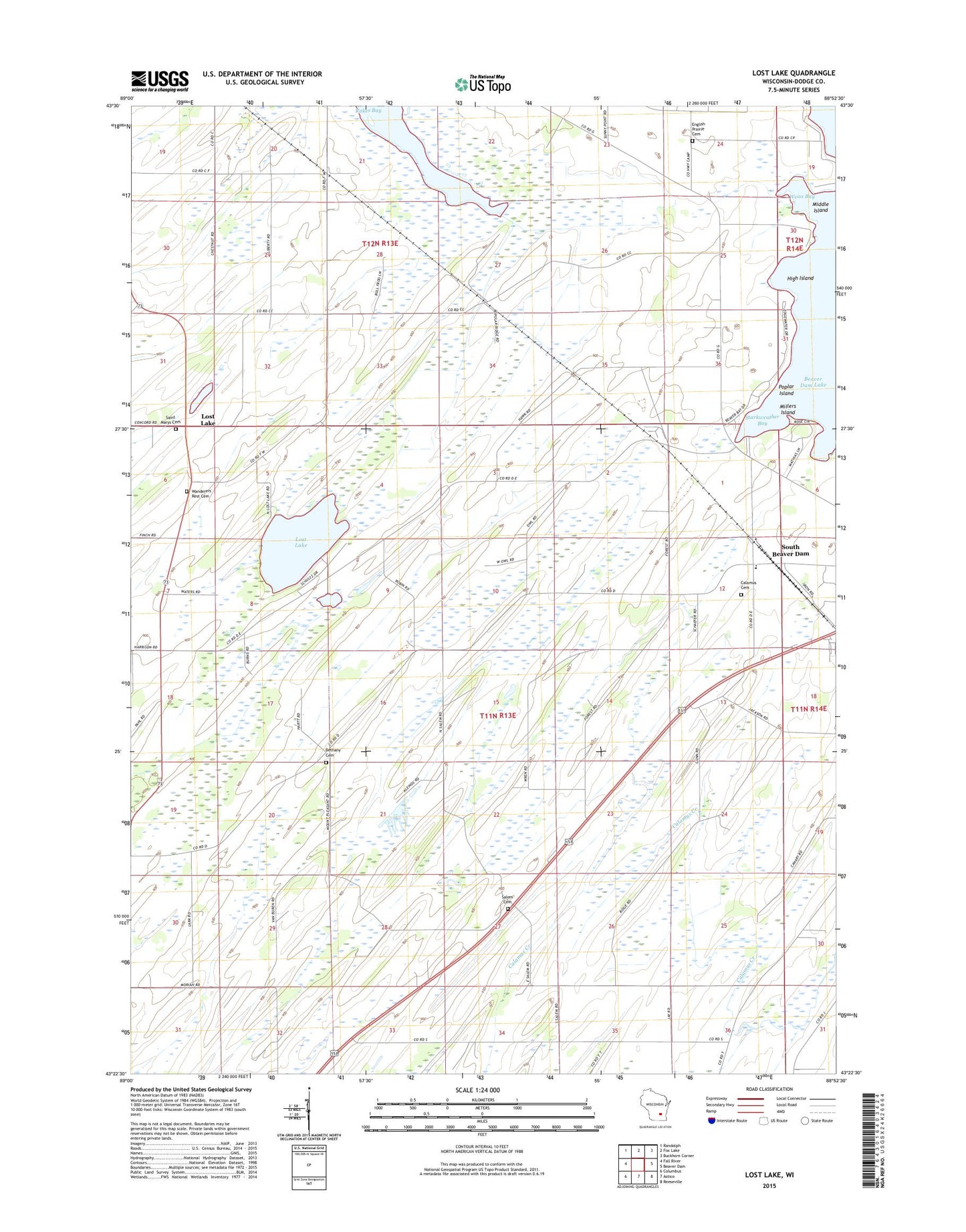
2022 topographic map quadrangle Lost Lake in the state of Wisconsin. Scale: 1:24000. Based on the newly updated USGS 7.5' US Topo map series, this map is in the following counties: Dodge. The map contains contour data, water features, and other items you are used to seeing on USGS maps, but also has updated roads and other features. This is the next generation of topographic maps. Printed on high-quality waterproof paper with UV fade-resistant inks.
Quads adjacent to this one:
West: Fall River
Northwest: Randolph
North: Fox Lake
Northeast: Buckhorn Corner
East: Beaver Dam
Southeast: Reeseville
South: Astico
Southwest: Columbus
This map covers the same area as the classic USGS quad with code o43088d8.
Contains the following named places: Annunciation Cemetery, Bethany Cemetery, Calamus Cemetery, Derge County Park, Elm Grove School, English Prairie Cemetery, English Prairie School, Harrison School, High Island, Jackson School, Lost Lake, Lost Lake School, Middle Island, Millers Island, Mount Pleasant School, Oak Hill School, Pleasant View School, Poplar Island, Salem Cemetery, South Beaver Dam, South Beaver Dam Elementary School, Starkweather Bay, Sunlit School, Town of Calamus, Town of Westford, Van Buren School, Wanderers Rest Cemetery, WBEV-AM (Beaver Dam), Weiss Bay