
MyTopo
Chetek Wisconsin US Topo Map
Couldn't load pickup availability
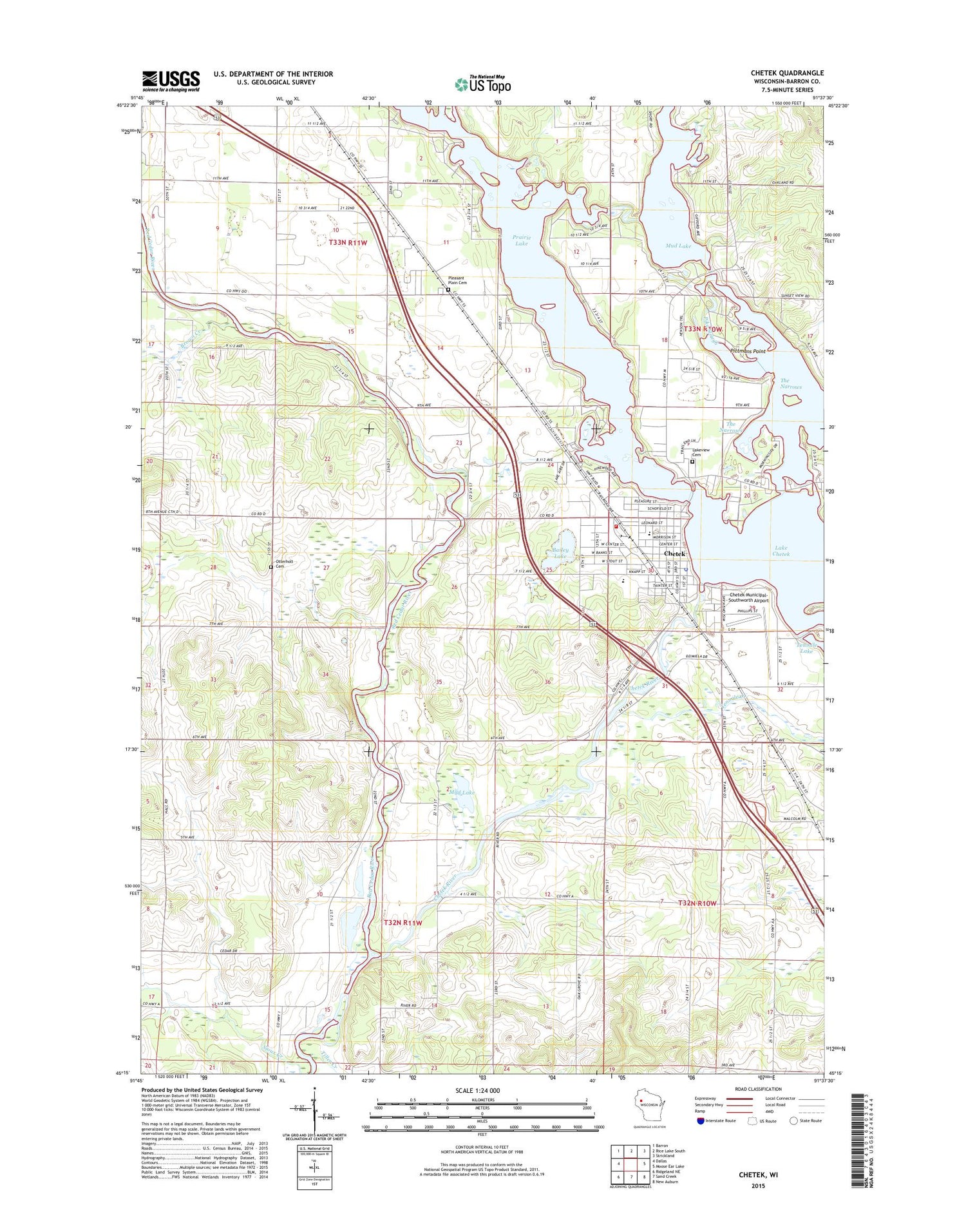
2018 topographic map quadrangle Chetek in the state of Wisconsin. Scale: 1:24000. Based on the newly updated USGS 7.5' US Topo map series, this map is in the following counties: Barron. The map contains contour data, water features, and other items you are used to seeing on USGS maps, but also has updated roads and other features. This is the next generation of topographic maps. Printed on high-quality waterproof paper with UV fade-resistant inks.
Quads adjacent to this one:
West: Dallas
Northwest: Barron
North: Rice Lake South
Northeast: Strickland
East: Moose Ear Lake
Southeast: New Auburn
South: Sand Creek
Southwest: Ridgeland NE
Contains the following named places: Advent Christian Church, Bailey Lake, Brown Creek, Chetek, Chetek Flowage 135, Chetek Full Gospel Tabernacle, Chetek Lutheran Church, Chetek Middle School, Chetek Municipal-Southworth Airport, Chetek Police Department, Chetek Post Office, Chetek River, Chetek United Methodist Church, Chetek Volunteer Fire Department, Chetek Wastewater Treatment Plant, Chetek Weyerhaeuser Middle - High School, Chetek WP277 Dam, City of Chetek, City View School, Dovre Townhall, Gregarson School, Hunt School, Lake Chetek, Lakeview Cemetery, Lakewood Park, Mud Lake, Oak Grove School, Otterholt Cemetery, Otterholt School, Pike Slough, Pittmans Point, Pleasant Hill School, Pleasant Plain Cemetery, Pleasant Plain School, Pokegama Lake, Prairie Lake, Prairie Lake Townhall, Riverview School, Roselawn Elementary School, Saint Boniface Catholic Church, Sioux Creek Townhall, Stardust Drive-In Theatre, Sunset View Country Club, Tenmile Creek, The Narrows, Tiller Creek, Town of Prairie Lake, Town of Sioux Creek, ZIP Code: 54728


