MyTopo
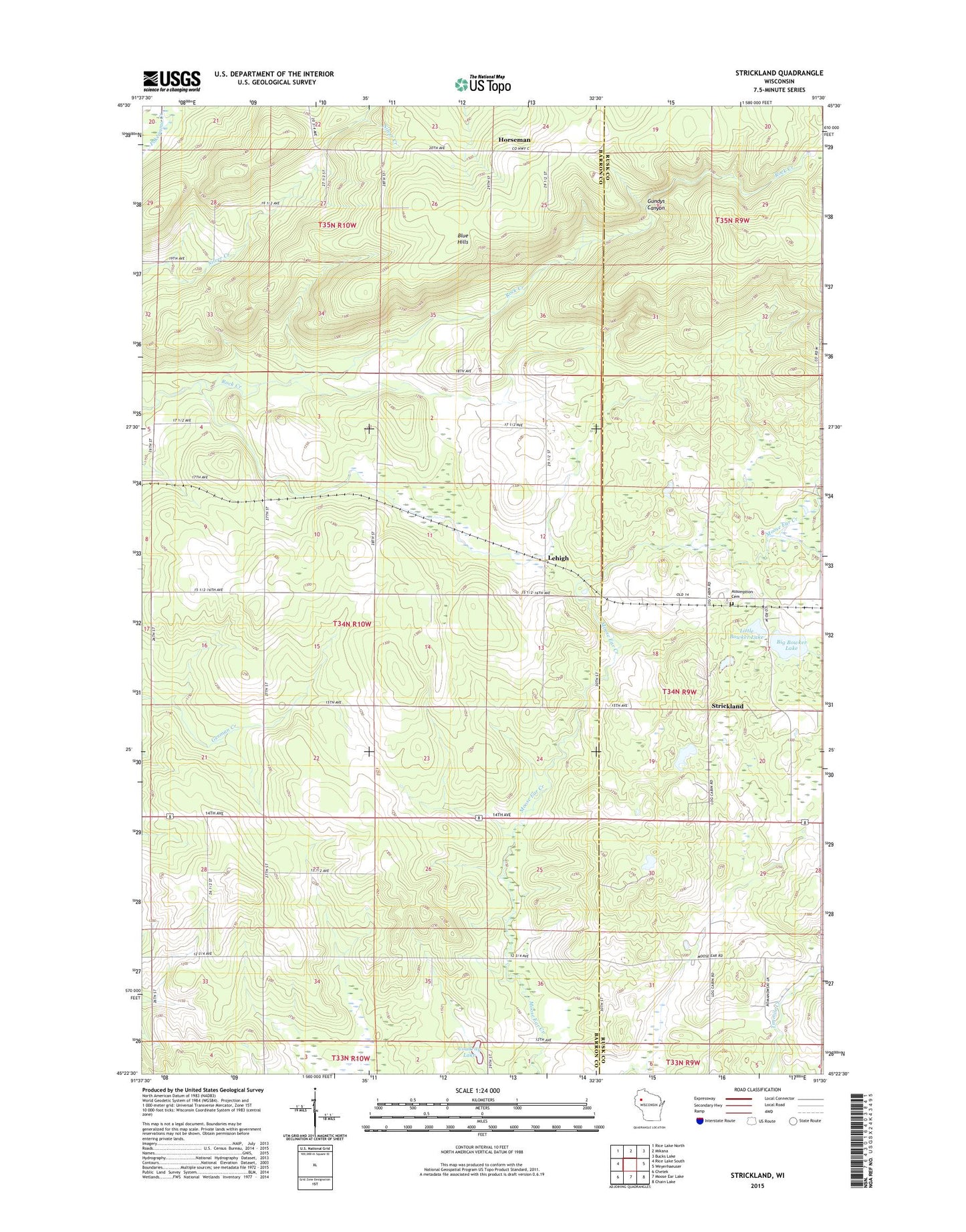
Strickland Wisconsin US Topo Map
Couldn't load pickup availability
2022 topographic map quadrangle Strickland in the state of Wisconsin. Scale: 1:24000. Based on the newly updated USGS 7.5' US Topo map series, this map is in the following counties: Barron, Rusk. The map contains contour data, water features, and other items you are used to seeing on USGS maps, but also has updated roads and other features. This is the next generation of topographic maps. Printed on high-quality waterproof paper with UV fade-resistant inks.
Quads adjacent to this one:
West: Rice Lake South
Northwest: Rice Lake North
North: Mikana
Northeast: Bucks Lake
East: Weyerhaeuser
Southeast: Chain Lake
South: Moose Ear Lake
Southwest: Chetek
This map covers the same area as the classic USGS quad with code o45091d5.
Contains the following named places: Assumption Church, Assumption of the Blessed Virgin Mary Cemetery, Big Bowker Lake, Blue Hills Felsenmeer State Natural Area, Coudray Lake, Grandview School, Greenwood School, Gundys Canyon, Horseman, Lehigh, Little Bowker Lake, Oakland School, Rock Creek Felsenmeer State Natural Area, Strickland, Town of Sumner, Victory School