MyTopo
Moose Ear Lake Wisconsin US Topo Map
Couldn't load pickup availability
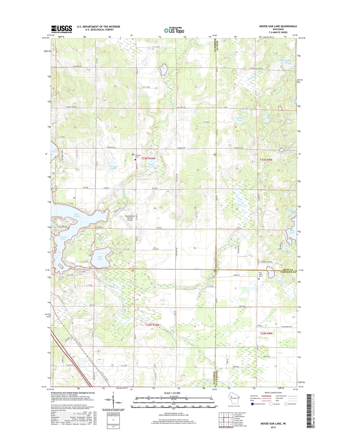
2022 topographic map quadrangle Moose Ear Lake in the state of Wisconsin. Scale: 1:24000. Based on the newly updated USGS 7.5' US Topo map series, this map is in the following counties: Barron, Rusk, Chippewa. The map contains contour data, water features, and other items you are used to seeing on USGS maps, but also has updated roads and other features. This is the next generation of topographic maps. Printed on high-quality waterproof paper with UV fade-resistant inks.
Quads adjacent to this one:
West: Chetek
Northwest: Rice Lake South
North: Strickland
Northeast: Weyerhaeuser
East: Chain Lake
Southeast: Marsh-Miller Lake
South: New Auburn
Southwest: Sand Creek
This map covers the same area as the classic USGS quad with code o45091c5.
Contains the following named places: Barron County Park, Bass Lake, Bass Lake Church, Bass Lake School, Beaver Creek, Cloud Dancer Private Airport, East Dovre School, Edgewood School, Eyk E2980 Dam, Fish Lake, Horseshoe Lake, Jacobson Lake, Jerdet Farms, Johnson Cemetery, Koehler Lake, Lake 11 2 0.3, Moose Ear Creek, Moose Ear Lake, Moose Ear School, Oakland School, Pleasant Valley School, Tenmile Creek, Tenmile Lake, Town of Chetek, Town of Dovre, Twin Lake School, Twin Lakes, Twin Lakes Cemetery, Twin Lakes Ranch