MyTopo
Dallas Wisconsin US Topo Map
Couldn't load pickup availability
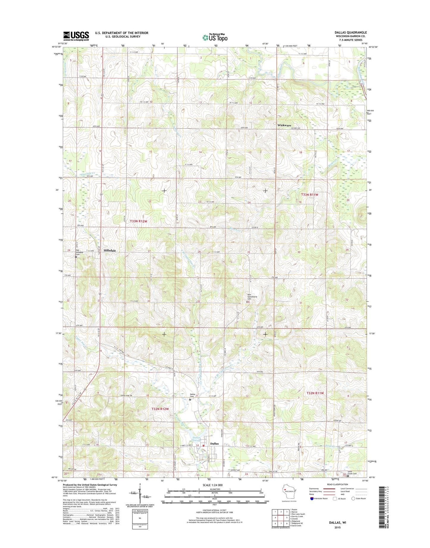
2022 topographic map quadrangle Dallas in the state of Wisconsin. Scale: 1:24000. Based on the newly updated USGS 7.5' US Topo map series, this map is in the following counties: Barron. The map contains contour data, water features, and other items you are used to seeing on USGS maps, but also has updated roads and other features. This is the next generation of topographic maps. Printed on high-quality waterproof paper with UV fade-resistant inks.
Quads adjacent to this one:
West: Dorrity Creek
Northwest: Poskin
North: Barron
Northeast: Rice Lake South
East: Chetek
Southeast: Sand Creek
South: Ridgeland NE
Southwest: Ridgeland
This map covers the same area as the classic USGS quad with code o45091c7.
Contains the following named places: Anderson Dam, Dallas, Dallas - Sioux Creek Fire Department, Dallas Cemetery, Dallas Elementary School, Dallas Flowage, Dallas Post Office, East Branch Upper Pine Creek, Gilbertson School, Hillsdale, Howard School, Irving School, Langlade School, Last Chance Dairy, Maple Grove Center School, New Scandinavia Lutheran Cemetery, North Branch Upper Pine Creek, Old Hillsdale Cemetery, Pershing School, Pine Crest Golf Course, Pleasant View Amish School, Prairie Lake Evangelical Covenant Church, Prairie Lake Heights School, Scandinavia Church, Severson Number 2 Landing Strip, Sioux Creek Cemetery, Sioux Creek School, Town of Dallas, Town of Maple Grove, Village of Dallas, Wickware, Woodside School, Yellow River, ZIP Code: 54733