MyTopo
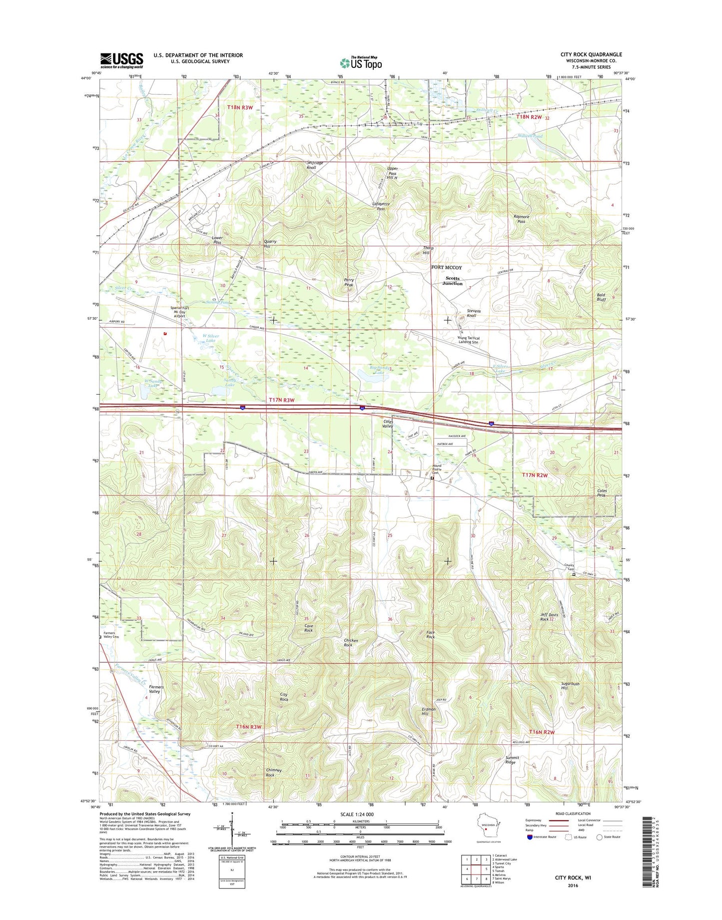
City Rock Wisconsin US Topo Map
Couldn't load pickup availability
2018 topographic map quadrangle City Rock in the state of Wisconsin. Scale: 1:24000. Based on the newly updated USGS 7.5' US Topo map series, this map is in the following counties: Monroe. The map contains contour data, water features, and other items you are used to seeing on USGS maps, but also has updated roads and other features. This is the next generation of topographic maps. Printed on high-quality waterproof paper with UV fade-resistant inks.
Quads adjacent to this one:
West: Sparta
Northwest: Cataract
North: Alderwood Lake
Northeast: Tunnel City
East: Tomah
Southeast: Wilton
South: Saint Marys
Southwest: Melvina
Contains the following named places: Bailey Creek, Bald Bluff, Big Sandy Lake, Cave Rock, Chicken Rock, Chimney Rock, City Rock, Coles Peak, Coles Valley, Coles Valley School, East Silver Lake, Erdman Hill, Face Rock, Farmers Valley, Farmers Valley Cemetery, Fort McCoy Barrens State Natural Area, Fort McCoy Fire Department South Station, Gates School, Hickory Hill School, Hill H, Jeff Davis Rock, La Crosse River State Fishery Area, Lafayette Pass, Lower Pass, Monroe County Burial Ground, Mound Prairie Cemetery, Mound Prairie School, Old Camp McCoy, Perry Peak, Quarry Hill, Raymore Pass, Sandy Lake, School Number Two, Scotts Junction, Selfridge Knoll, Sparta/Fort McCoy Airport, Stevens Knoll, Stillwell Dam, Stillwell Pond, Sugarbush Hill, Swamp Pond, Thorp Hill, Town of Angelo, Upper Pass, Welch Church, West Sandy Lake, West Silver Lake, Young Tactical Landing Site