MyTopo
Tunnel City Wisconsin US Topo Map
Couldn't load pickup availability
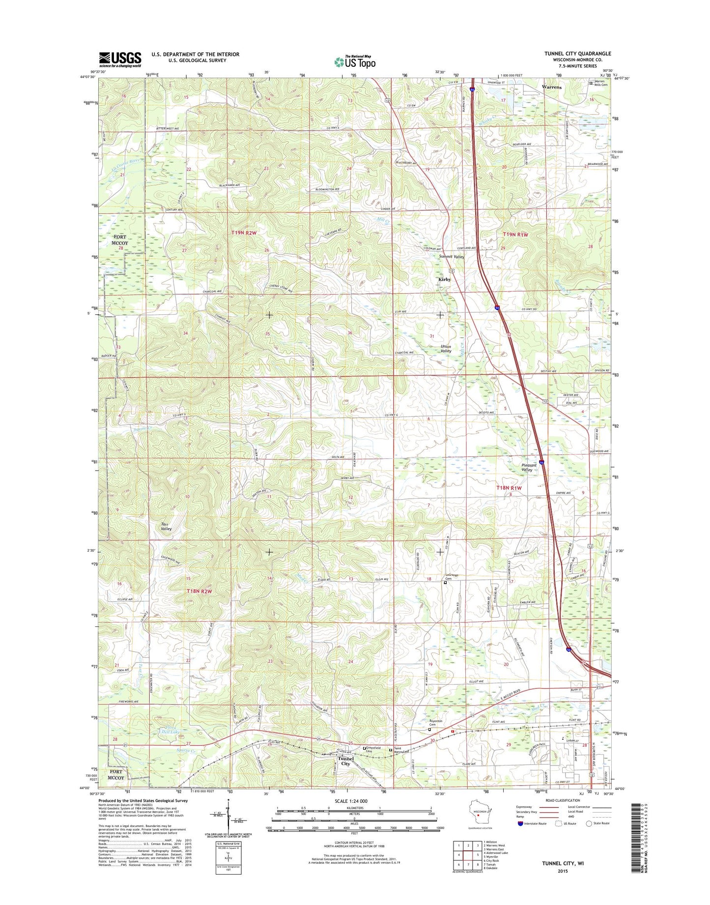
2022 topographic map quadrangle Tunnel City in the state of Wisconsin. Scale: 1:24000. Based on the newly updated USGS 7.5' US Topo map series, this map is in the following counties: Monroe. The map contains contour data, water features, and other items you are used to seeing on USGS maps, but also has updated roads and other features. This is the next generation of topographic maps. Printed on high-quality waterproof paper with UV fade-resistant inks.
Quads adjacent to this one:
West: Alderwood Lake
Northwest: Millston
North: Warrens West
Northeast: Warrens East
East: Wyeville
Southeast: Oakdale
South: Tomah
Southwest: City Rock
This map covers the same area as the classic USGS quad with code o44090a5.
Contains the following named places: Boynton Cemetery, Flora Dell Lake, Greenfield Catholic Cemetery, Greenfield Cemetery, Greenfield School, Hiawatha Golf Club, Kirby, La Grange Elementary School, LaCrosse Valley School, LaGrange Cemetery, Moseley's Fruit and Vegetable Farm, North Tomah, North Tomah School, Oakdale Area Fire Association La Grange Station, Pleasant Valley, Saint Matthews Church, Spring Bank Park, Summit Valley, Summit Valley School, Tarr Valley School, Town of Grant, Town of Greenfield, Tunnel City, Tunnel City Census Designated Place, Tunnel City Post Office, Union Valley, Warren Mills Cemetery, White School