MyTopo
Saint Marys Wisconsin US Topo Map
Couldn't load pickup availability
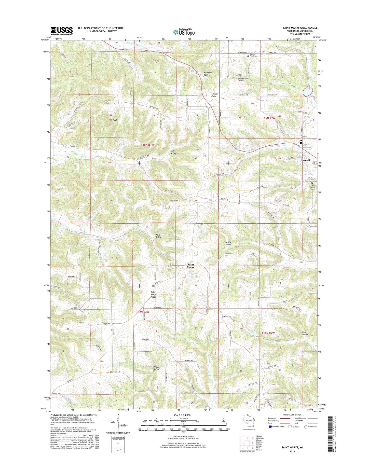
2022 topographic map quadrangle Saint Marys in the state of Wisconsin. Scale: 1:24000. Based on the newly updated USGS 7.5' US Topo map series, this map is in the following counties: Monroe. The map contains contour data, water features, and other items you are used to seeing on USGS maps, but also has updated roads and other features. This is the next generation of topographic maps. Printed on high-quality waterproof paper with UV fade-resistant inks.
Quads adjacent to this one:
West: Melvina
Northwest: Sparta
North: City Rock
Northeast: Tomah
East: Wilton
Southeast: Ontario
South: Dell
Southwest: Westby
This map covers the same area as the classic USGS quad with code o43090g6.
Contains the following named places: 0.6 Reservoir, 54648, Bohn School, Cook Valley School, Farmers Valley School, Haldeman G5500 Dam, Leon Valley School, McCrary Lake 4.61, Norwalk Catholic Cemetery, Number Three Tunnel, Oak Grove School, Pilgrims Home Cemetery, Red Rock, Saint Jacobs Cemetery, Saint Johns Church, Saint Marys, Saint Marys Ridge, Summit Ridge, Summit Ridge Cemetery, Thompson School, Town of Jefferson, Town of Wells, Tri Creek Number One 3WR1378 Dam, Village of Norwalk, Wells Town Hall