MyTopo
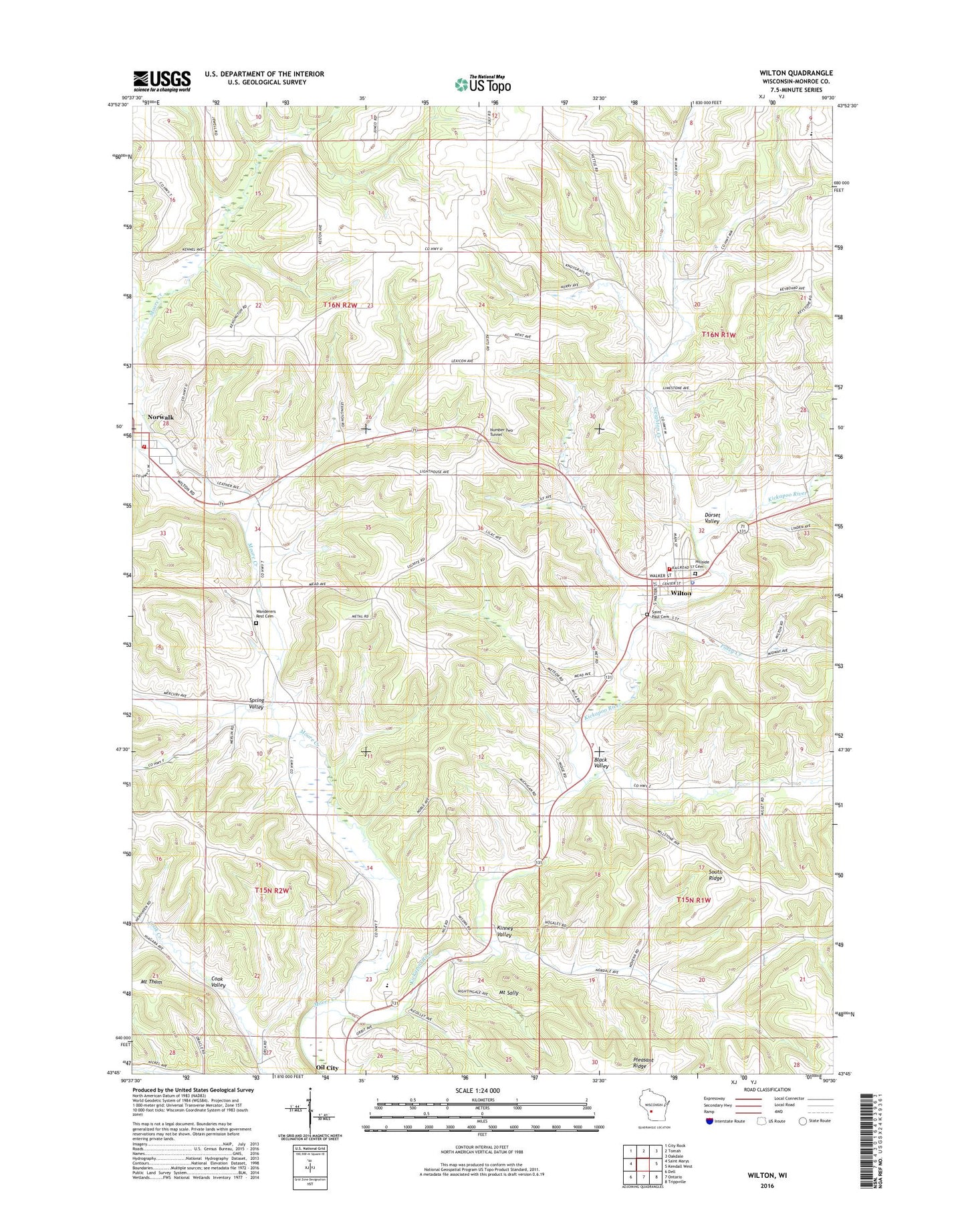
Wilton Wisconsin US Topo Map
Couldn't load pickup availability
2022 topographic map quadrangle Wilton in the state of Wisconsin. Scale: 1:24000. Based on the newly updated USGS 7.5' US Topo map series, this map is in the following counties: Monroe. The map contains contour data, water features, and other items you are used to seeing on USGS maps, but also has updated roads and other features. This is the next generation of topographic maps. Printed on high-quality waterproof paper with UV fade-resistant inks.
Quads adjacent to this one:
West: Saint Marys
Northwest: City Rock
North: Tomah
Northeast: Oakdale
East: Kendall West
Southeast: Trippville
South: Ontario
Southwest: Dell
This map covers the same area as the classic USGS quad with code o43090g5.
Contains the following named places: 0.33 Reservoir, Black Valley, Brookwood High School, Central Point School, Dorset Valley, East Ridgeville Parochial School, Enterprise School, Hillside Cemetery, Kinney Valley, Moore Creek, Mount Sally, Mount Thom, Norwalk, Norwalk - Ontario - Wilton Elementary School, Norwalk Area Fire District, Norwalk Post Office, Number Two Tunnel, Oil City, Posey Creek, Roger E McMullin 3WC80806 Dam, Saint Paul Cemetery, Salem Church, Slabtown School, Sleighton Creek, Sleighton Creek School, South Ridge, Spring Valley, Spring Valley Church, Town of Ridgeville, Town of Sheldon, Tunnel Joint School, Village of Wilton, Village of Wilton Ambulance Service, Wanderers Rest Cemetery, Wilton, Wilton Area Fire Department, Wilton Police Department, Wilton Post Office