MyTopo
Clam Falls Wisconsin US Topo Map
Couldn't load pickup availability
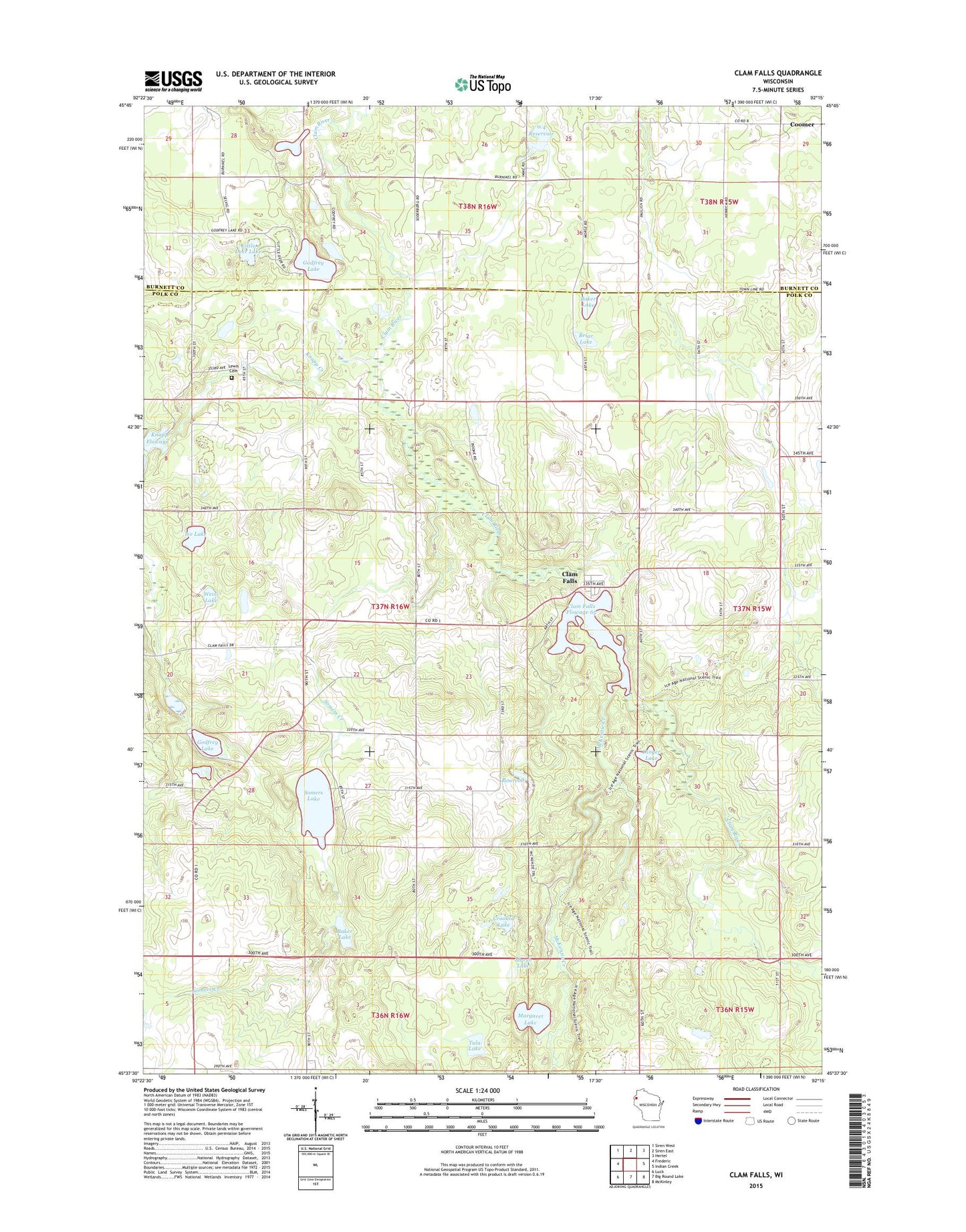
2022 topographic map quadrangle Clam Falls in the state of Wisconsin. Scale: 1:24000. Based on the newly updated USGS 7.5' US Topo map series, this map is in the following counties: Polk, Burnett. The map contains contour data, water features, and other items you are used to seeing on USGS maps, but also has updated roads and other features. This is the next generation of topographic maps. Printed on high-quality waterproof paper with UV fade-resistant inks.
Quads adjacent to this one:
West: Frederic
Northwest: Siren West
North: Siren East
Northeast: Hertel
East: Indian Creek
Southeast: McKinley
South: Big Round Lake
Southwest: Luck
This map covers the same area as the classic USGS quad with code o45092f3.
Contains the following named places: 0.4 Reservoir, 54837, Baker Lake, Bosak Lake, Briar Lake, Clam Falls, Clam Falls 2-Wd-1009 Dam, Clam Falls Flowage, Clam Falls Townhall, Coomer, Crooked Lake, Dahl G9844 Dam, Dinger Lake, Geo Jensen Airport, Godfrey Lake, Godfrey Lake 1, Godfrey Lake 2WP2230 Dam, Green Acres Farm, Ice Lake, Jensen Dam, Knapp Creek, Knapp Flowage, Lewis Cemetery, Lewis Dam, Little Deer Lake, Maple Valley School, Margaret Lake, Marsh Lake, McKenzie Creek, McKenzie Creek State Public Hunting Grounds, Pleasant Dale School, Rocky Ridge School, Somers Creek, Somers Lake, Town of Clam Falls, Tula Lake, Tula Lake State Natural Area, Weiss Lake