MyTopo
Indian Creek Wisconsin US Topo Map
Couldn't load pickup availability
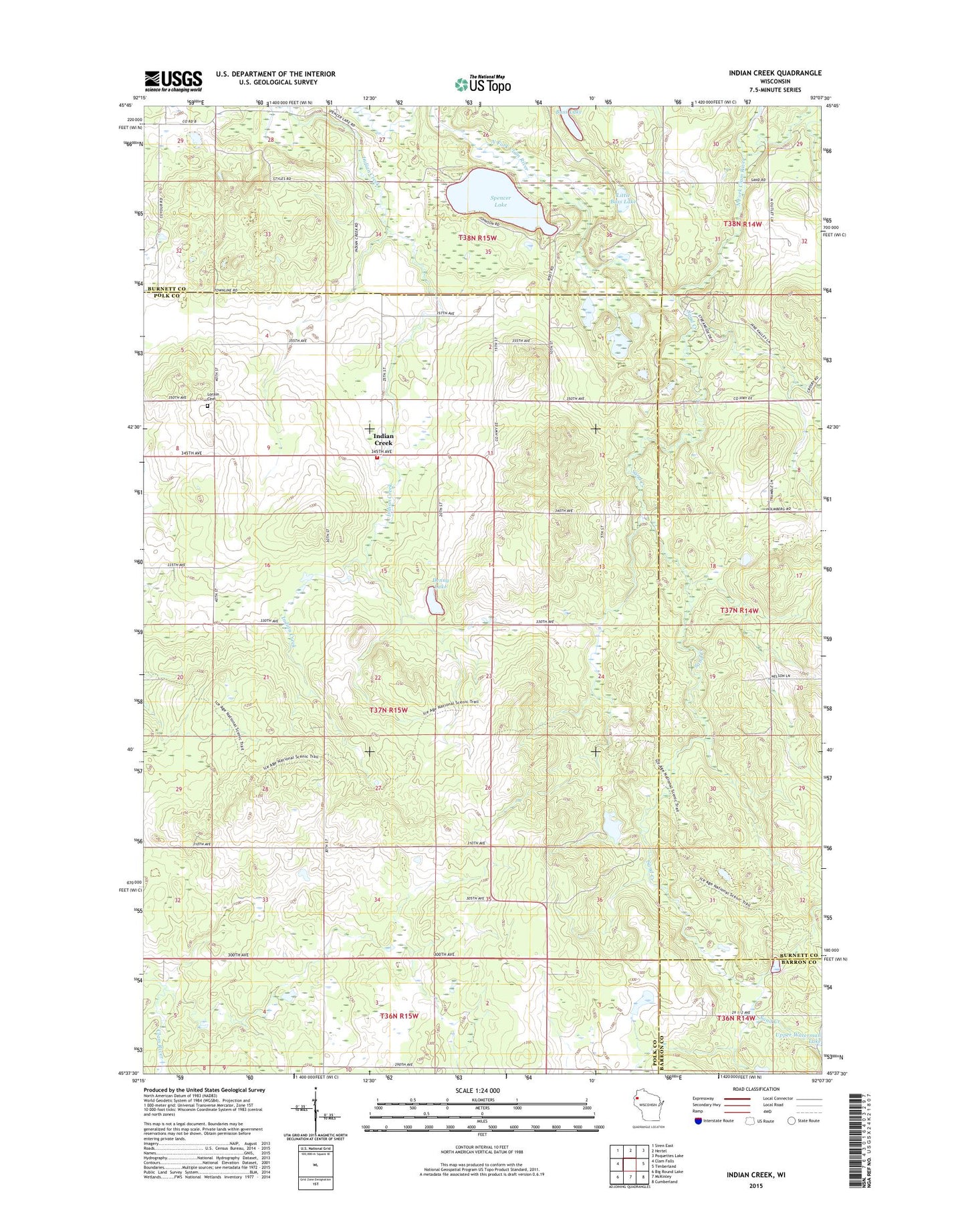
2022 topographic map quadrangle Indian Creek in the state of Wisconsin. Scale: 1:24000. Based on the newly updated USGS 7.5' US Topo map series, this map is in the following counties: Polk, Burnett, Barron. The map contains contour data, water features, and other items you are used to seeing on USGS maps, but also has updated roads and other features. This is the next generation of topographic maps. Printed on high-quality waterproof paper with UV fade-resistant inks.
Quads adjacent to this one:
West: Clam Falls
Northwest: Siren East
North: Hertel
Northeast: Poquettes Lake
East: Timberland
Southeast: Cumberland
South: McKinley
Southwest: Big Round Lake
This map covers the same area as the classic USGS quad with code o45092f2.
Contains the following named places: Bass Lake, Coomer School, Corpus Christi Church, Denny Lake, Indian Creek, Indian Creek Orchard, Little Bass Lake, Lorain Cemetery, Lorain Church, Lorain Volunteer Fire Department, Owens Farms, Sand Creek, Sand Creek State Fishery Area, Shay Mound School, Spencer Lake, Town of Lorain