MyTopo
Cornucopia Wisconsin US Topo Map
Couldn't load pickup availability
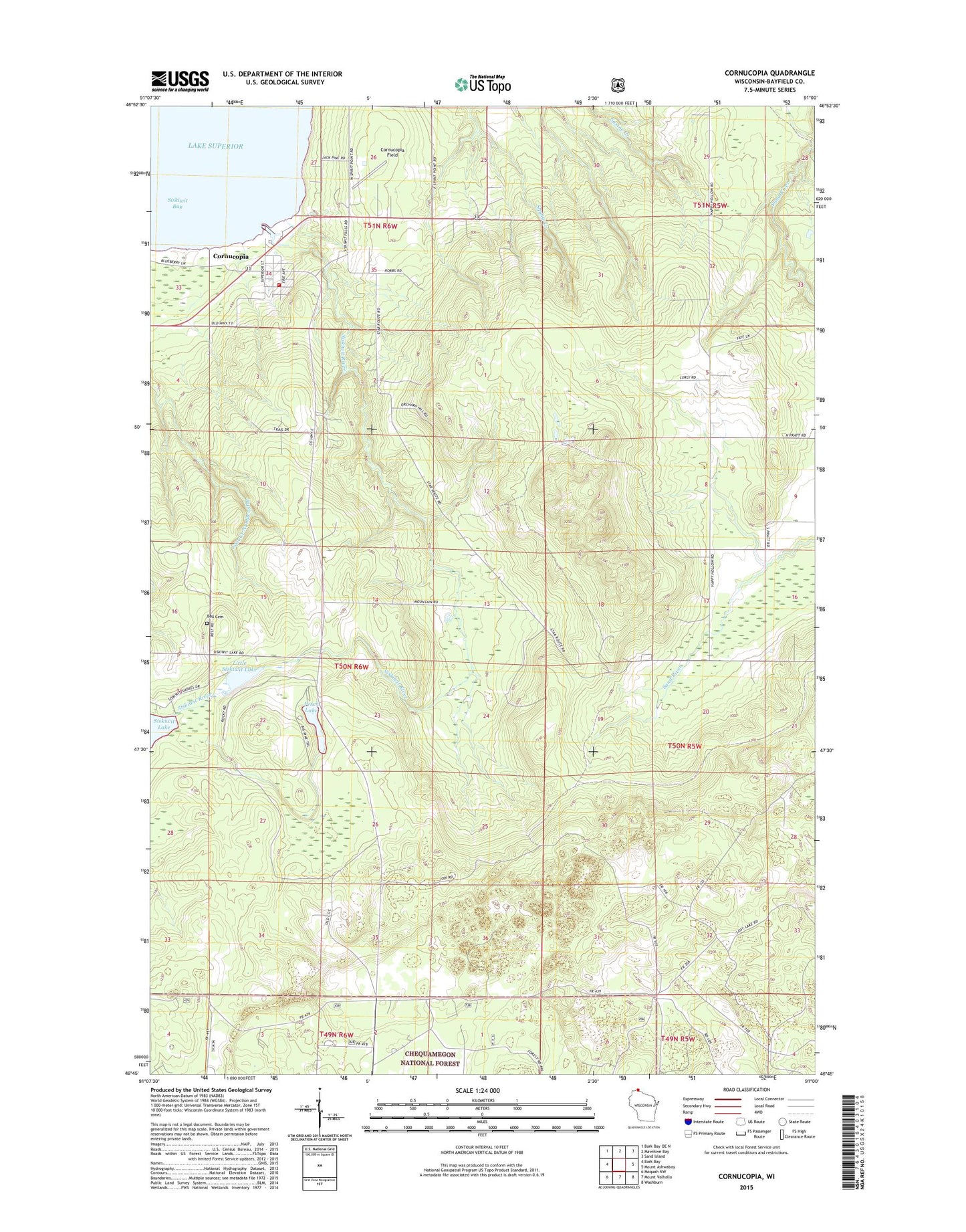
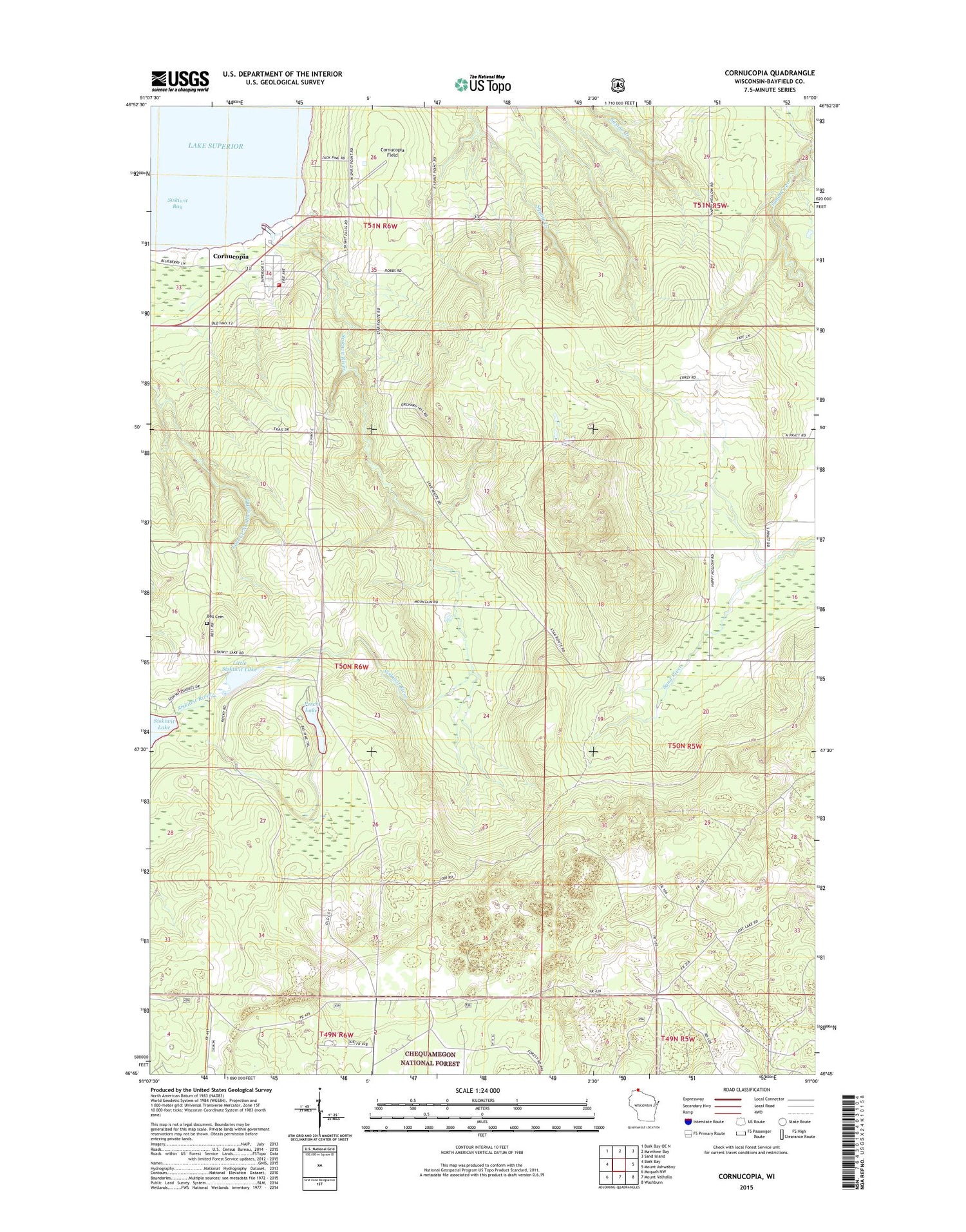
2018 topographic map quadrangle Cornucopia in the state of Wisconsin. Scale: 1:24000. Based on the newly updated USGS 7.5' US Topo map series, this map is in the following counties: Bayfield. The map contains contour data, water features, and other items you are used to seeing on USGS maps, but also has updated roads and other features. This is the next generation of topographic maps. Printed on high-quality waterproof paper with UV fade-resistant inks.
Quads adjacent to this one:
West: Bark Bay
Northwest: Bark Bay OE N
North: Mawikwe Bay
Northeast: Sand Island
East: Mount Ashwabay
Southeast: Washburn
South: Mount Valhalla
Southwest: Moquah NW
Contains the following named places: Cornucopia, Cornucopia Census Designated Place, Cornucopia Field, Cornucopia Post Office, Cornucopia Volunteer Fire Department, East Pier Light, George D Jones Junior Memorial Cemetery, Little Siskiwit Lake, Perch Lake, Saint Anthony Church, Siskiwit Bay, Siskiwit Massacre Historical Site, Siskiwit River, South Shore Marina, Town of Bell, ZIP Code: 54827