MyTopo
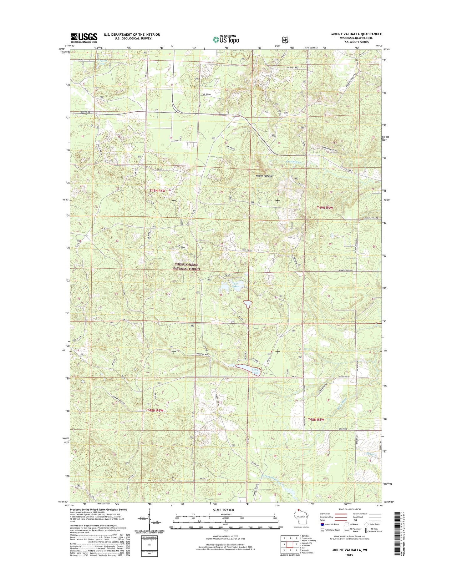
Mount Valhalla Wisconsin US Topo Map
Couldn't load pickup availability
Also explore the Mount Valhalla Forest Service Topo of this same quad for updated USFS data
2022 topographic map quadrangle Mount Valhalla in the state of Wisconsin. Scale: 1:24000. Based on the newly updated USGS 7.5' US Topo map series, this map is in the following counties: Bayfield. The map contains contour data, water features, and other items you are used to seeing on USGS maps, but also has updated roads and other features. This is the next generation of topographic maps. Printed on high-quality waterproof paper with UV fade-resistant inks.
Quads adjacent to this one:
West: Moquah NW
Northwest: Bark Bay
North: Cornucopia
Northeast: Mount Ashwabay
East: Washburn
Southeast: Ashland West
South: Moquah
Southwest: Ino
This map covers the same area as the classic USGS quad with code o46091f1.
Contains the following named places: Birch Grove Recreation Site, Crystal Lake, Long Lake, Long Lake Picnic Area, Mount Valhalla, Mount Valhalla Ski Area, Town of Washburn, Twin Lakes, Washburn Lookout Tower